Download
1 / 33
350 likes | 738 Vues
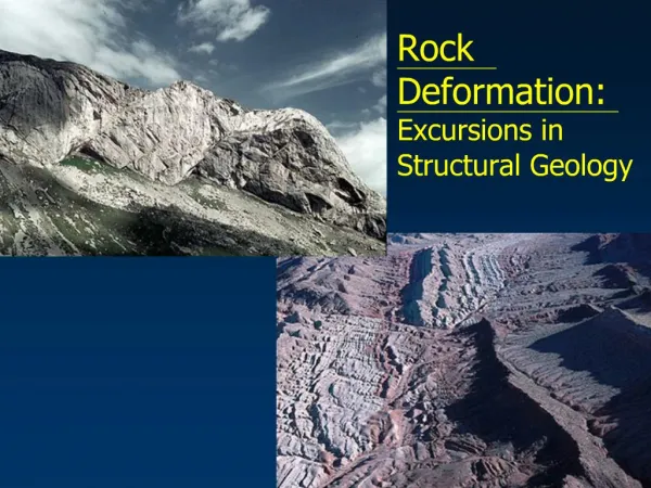
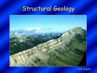
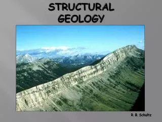
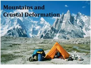
Structural Geology Crustal Deformation. Structural geology. Structural geologists study the architecture and processes responsible for deformation of Earth crust. Deformation. Deformation refers to all changes in the original form and/or size of a rock body

E N D
Structural geology • Structural geologists study the architecture and processes responsible for deformation of Earth crust
Deformation • Deformation refers to all changes in the original form and/or size of a rock body • Most crustal deformation occurs along plate margins
Deformation • Deformation involves • Force • Stress - force applied to a given area • Types of stress • Compressional stress – shortens a rock body • Tensional stress – tends to elongate or pull apart a rock unit • Shear stress – produces a relative motion between layers
Deformation • Strain – changes in the shape or size of a rock body caused by stress • How rocks deform • Rocks subjected to stresses greater than their own strength begin to deform usually by folding or fracturing
Deformation • How rocks deform • Types of rock deformation • Elastic deformation – the rock returns to nearly its original size and shape when the stress is removed • Non-elastic - Once the elastic limit (strength) of a rock is surpassed, it either flows (ductile deformation) or fractures (brittle deformation)
Deformation • How rocks deform • Factors that influence the strength of a rock and how it will deform • Temperature • Confining pressure • Rock type • Time
Mapping geologic structures • When conducting a study of a region, a geologist identifies and describes • The dominant rock structures • Outcrops (sites where bedrock is exposed at the surface) are available • Work is aided by advances in aerial photography, satellite imagery and Global Positioning Systems (GPS)
A geologic map illustrates the geologic structures of an area
Mapping geologic structures • Describing and mapping the orientation of a rock layer or fault surface involves determining the features: • Strike (trend) • The compass direction of the line produced by the intersection of an inclined rock layer or fault with a horizontal plane • Generally expressed an an angle relative to north
Mapping geologic structures • Dip (inclination) • The angle of inclination of the surface of a rock unit or fault measured from a horizontal plane • Includes both an of inclination and a direction toward which the rock is inclined
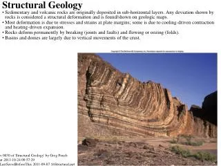
Folds • During crustal deformation rocks are often bent into a series of wave-like undulations called folds • Characteristics of folds • Most folds result from compressional stresses which shorten and thicken the crust
Folds • Characteristics of folds • Parts of a fold • Limbs – refers to the two sides of a fold • Axis – a line drawn down the points of maximum curvature of each layer • Axial plane – an imaginary surface that divides a fold symmetrically
Folds • Common types of folds • Anticline – upfolded or arched rock layers • Syncline – downfolds or troughs of rock layers • Depending on their orientation, anticlines and synclines can be described as • Symmetrical, asymmetrical, overturned, or plunging
Folds الالتواءات • Common types of folds • Monoclines – large, step-like folds in horizontal sedimentary strata • Other types of folds • Dome • Upwarped displacement of rocks • Circular or slightly elongated structure • Oldest rocks in center, younger rocks on the flanks
Monoclines are often the result of movement along buried faults
Folds • Other types of folds • Basin • Circular or slightly elongated structure • Downwarped displacement of rocks • Youngest rocks are found near the center, oldest rocks on the flanks
Circular outcrop patterns are typical for both domes and basins
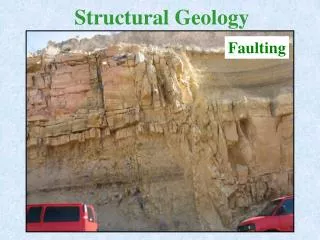
Faults انزلاقات أو انكسارات • Faults are fractures in rocks along which displacement has taken place • Sudden movements along faults are the cause of most earthquakes • Classified by their relative movement which can be • Horizontal, vertical, or oblique
Faults • Types of faults • Dip-slip faults • Movement is mainly parallel to the dip of the fault surface • Parts of a dip-slip fault include the hanging wall (rock surface above the fault) and the footwall (rock surface below the fault)
Faults • Types of dip-slip faults • Normal fault • Hanging wall block moves down relative to the footwall block • Accommodate lengthening or extension of the crust • Most are small with displacements of a meter or so
Faults • Types of dip-slip faults • Reverse and thrust faults • Hanging wall block moves up relative to the footwall block • Reverse faults have dips greater than 45o and thrust faults have dips less then 45o • Accommodate shortening of the crust • Strong compressional forces
On a reverse fault, the hanging wall moves up relative to the footwall
Faults • Strike-slip fault • Dominant displacement is horizontal and parallel to the strike of the fault • Types of strike-slip faults • Right-lateral – as you face the fault, the block on the opposite side of the fault moves to the right • Left-lateral – as you face the fault, the block on the opposite side of the fault moves to the left
A block diagram showing the features along a strike-slip fault
Fault • Strike-slip fault • Transform fault • Large strike-slip fault that cuts through the lithosphere • Accommodates motion between two large crustal plates
Joints • Joints are among the most common rock structure • Technically, a joint is a fracture with no movement • Most occur in roughly parallel groups • Significance of joints • Chemical weathering tends to be concentrated along joints
Joints • Significance of joints • Many important mineral deposits are emplaced along joint systems • Highly jointed rocks often represent a risk to construction projects