Homer Hoyt’s Sector Model: Urban Development Analysis
90 likes | 206 Vues
Explore Homer Hoyt’s sector model, focusing on sector development in US cities, transportation influence, residential patterns, ecological factors, economic rent concept, and criticisms.

Homer Hoyt’s Sector Model: Urban Development Analysis
E N D
Presentation Transcript
Background • Research conducted by economist Homer Hyot (1895-1984) in 1939 • Studied 64 widely distributed American cities • Publication: The Structure and Growth of Residential Neighbourhoods in American Cities.
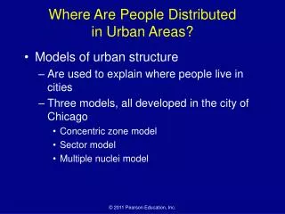
Why did he put forward another model? • He rejected the idea of concentric zones. • He suggested that residential areas took the form of a series of sectors. • Sector is a section of an urban area in the shape of a wedge, beginning at the edge of the CBD and gradually widening to the periphery.
wedge like/ sector arrangement following the axial arrangement of the transport lines diverging from the city centre. found near to railways, bordering the manufacturing / warehousing sectors (the least desirable land). occupied intermediate positions. • locate outside the CBD due to land costs and along transport routes to minimize costs of transportation. • developed along main transport routes for ease of commuting into the CBD • located away from areas of heavy polluting industry. • found on high grounds (good view), • waterfronts not used by industries and homes of community leaders. CBD remains a circular form in the centre.
How are sectors developed? • Differences in accessibility from outlying districts to the city centre • High-class housing estates were built along transport routes, e.g. suburban railway line • attract accretionary growth of similar residential housing, thus extending the zone out as a sector (ecological factor). • A high rent residential district in one sector of the city will migrate outwards by the addition of new belts of housing along its outer arc. • Similar land uses attracted other similar land uses, concentrating a function in a particular area and repelling others. This ‘attract and repel’ process led to sector development.
Significance • ecological factors + economic rent concept to explain the land use pattern • stress on the role of transport routes in affecting the spatial arrangement of the city. • both the distance and direction of growth from the city centre are considered. • Brings location of industrial and environmental amenity values as determinants in residential location • Example: sectors of high class residential areas tend to grow towards higher grounds, sites with better view, more open space, the homes of influential leaders within the community and existing outlying, smaller settlements.
Criticisms • He based his model on housing and neglected other land uses. • Areas of low cost housing do occur beside main roads near to the boundaries of most cities. • It is too concerned with residential land use and has not paid enough attention to the existence of residential and industrial suburbs in cities. • It has paid little attention to the height of buildings and the variation of land use with height.