Download
1 / 14
150 likes | 584 Vues
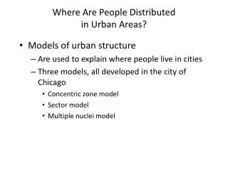
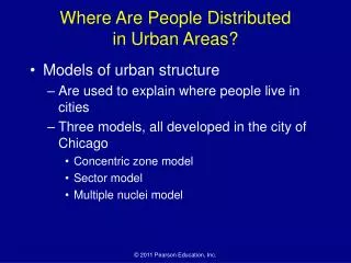
Where Are People Distributed in Urban Areas?. Models of urban structure Are used to explain where people live in cities Three models, all developed in the city of Chicago Concentric zone model Sector model Multiple nuclei model. Concentric Zone Model. Figure 13-4. Sector Model.

E N D
Where Are People Distributed in Urban Areas? • Models of urban structure • Are used to explain where people live in cities • Three models, all developed in the city of Chicago • Concentric zone model • Sector model • Multiple nuclei model
Concentric Zone Model Figure 13-4
Sector Model Figure 13-5
Multiple Nuclei Model Figure 13-6
Where Are People Distributedin Urban Areas? • Geographic application of the models • Models can be used to show where different social groups live in the cities • Census tracts • Social area analysis • Criticism of the models • Models may be too simple • Models may be outdated
Census Tracts • Census Tracts are small, relatively permanent statistical subdivisions of a county or equivalent entity that are updated by local participants prior to each decennial census as part of the Census Bureau’s Participant Statistical Areas Program. The Census Bureau delineates census tracts in situations where no local participant existed or where state, local, or tribal governments declined to participate. The primary purpose of census tracts is to provide a stable set of geographic units for the presentation of statistical data. • Census tracts generally have a population size between 1,200 and 8,000 people, with an optimum size of 4,000 people. A census tract usually covers a contiguous area; however, the spatial size of census tracts varies widely depending on the density of settlement. Census tract boundaries are delineated with the intention of being maintained over a long time so that statistical comparisons can be made from census to census. Census tracts occasionally are split due to population growth or merged as a result of substantial population decline. • Census tract boundaries generally follow visible and identifiable features. They may follow nonvisible legal boundaries, such as minor civil division (MCD) or incorporated place boundaries in some states and situations, to allow for census-tract-to-governmental-unit relationships where the governmental boundaries tend to remain unchanged between censuses. State and county boundaries always are census tract boundaries in the standard census geographic hierarchy. Tribal census tracts are a unique geographic entity defined within federally recognized American Indian reservations and off-reservation trust lands and can cross state and county boundaries. Tribal census tracts may be completely different from the census tracts and block groups defined by state and county
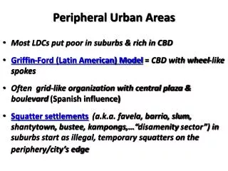
Where Are People Distributedin Urban Areas? • Applying the models outside North America • European cities • Less developed countries • Colonial cities • Cities since independence • Squatter settlements
Income Distribution in the Paris Region Figure 13-10