Background Observed meteorological conditions WRF simulation ARPS simulation
250 likes | 436 Vues
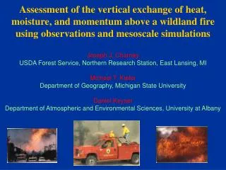
Assessment of the vertical exchange of heat, moisture, and momentum above a wildland fire using observations and mesoscale simulations Joseph J. Charney USDA Forest Service, Northern Research Station, East Lansing, MI Michael T. Kiefer Department of Geography, Michigan State University

Background Observed meteorological conditions WRF simulation ARPS simulation
E N D
Presentation Transcript
Assessment of the vertical exchange of heat, moisture, and momentum above a wildland fire using observations and mesoscale simulations Joseph J. Charney USDA Forest Service, Northern Research Station, East Lansing, MI Michael T. Kiefer Department of Geography, Michigan State University Daniel Keyser Department of Atmospheric and Environmental Sciences, University at Albany
Organization • Background • Observed meteorological conditions • WRF simulation • ARPS simulation • Discussion and synthesis
Background • Fire weather is primarily concerned with surface meteorological conditions • wind speed and direction • humidity (usually relative humidity) • temperature
Background Vertical exchanges of heat, moisture, and momentum affect and are affected by the fire At large spatial scales (~ 1–10km), mesoscale processes can be associated with variations in surface winds and humidity that affect the evolution of the fire At fine spatial scales (~ 0.1–100 m), the combustion process produces heat, moisture, super-heated gasses, and solid material (smoke) that perturb the environment in the vicinity of the fire
Background How can we use NWP models to better understand and anticipate these effects? Case studies of fire events Investigate the processes associated with the observed fire behavior and atmospheric perturbations Develop indices and diagnostics that highlight the relevant processes for fire weather forecasters and fire managers
Double Trouble State Park Wildfire • June 02, 2002 fire in south-central NJ • A campfire abandoned the night before turned into a rapidly spreading wildfire at 1800 UTC • Burned 1,300 acres • Forced the closure of the Garden State Parkway • Damaged or destroyed 36 homes and outbuildings • Directly threatened over 200 homes • Forced the evacuation of 500 homes • Caused an estimated $400,000 in property damage
Double Trouble Observations MODIS visible satellite imagery
Double Trouble Observations Meteogram from KWRI (McGuire AFB)
Double Trouble Observations New Brunswick wind profiler
Double Trouble WRF Simulation WRF3.1 model simulation of the meteorological conditions associated with the fire Examine, at the fire location, the surface and vertical distribution of: temperature moisture momentum Link the local evolution of these quantities to mesoscale processes 04km simulation, 51 vertical levels, initialized with NARR, MYJ PBL, NOAH LSM, RRTM radiation
Double Trouble WRF Simulation Simulated skew-T log-P at the fire location at 1800 UTC
Double Trouble WRF Simulation Simulated 700hPa relative humidity at 1800 UTC
Double Trouble WRF Simulation Simulated vertical cross section of relative humidity (color shaded) and vertical velocity (contours) at 1700 UTC
Double Trouble WRF Simulation Simulated vertical cross section of relative humidity (color shaded) and vertical velocity (contours) at 1800 UTC
Idealized 2-D ARPS simulation ARPS model simulation using 1800 UTC potential temperature and wind speed profiles from the WRF as a base state A prescribed 28.8 kW/m2 surface heat flux parameterizes the heat released by the fire 50m horizontal grid spacing Stretched vertical grid to 9 km with 2.5 m separation at the surface 120 minute simulation
Idealized 2-D ARPS simulation Kiefer et al. (2009) employ the ARPS model to investigate the impact of the environmental wind profile on dry convection above a prescribed heat source Identified two primary modes of convection: intense plume multi-cell
Double Trouble Fire Idealized 2-D ARPS simulation Surface wind speed (buoyancy imparted by the fire) white squares = intense plume grey squares = multi-cell Mixed-layer average wind speed (advection of updrafts away from the fire)
Idealized 2-D ARPS simulation Base state profiles wind speed potential temperature
Idealized 2-D ARPS simulation perturbation potential temperature (shaded) and vertical velocity (contours)
Idealized 2-D ARPS simulation total horizontal wind speed (shaded) and vertical velocity (contours)
Discussion and Synthesis The two models simulate fire-atmosphere interactions on different scales WRF: tongue of dry air aloft connects with dry air at the ground coincident with the time when the fire exhibited rapid growth and erratic fire behavior ARPS: the prescribed heat source induces convective perturbations within the mixed layer and across the boundary between the mixed layer and the free atmosphere
Discussion and Synthesis The simulations demonstrate how the potential for vertical exchanges of heat, moisture, and momentum above a wildland fire can be diagnosed Short-term (~0.5 to 2 hours) fluctuations in critical fire-weather ingredients are important to users of fire-weather and fire-behavior forecasts This study addresses the inherent difficulties in observing and simulating these ingredients on the fine spatial and temporal scales that are important for wildland fire management decisions