Download
1 / 16
160 likes | 179 Vues
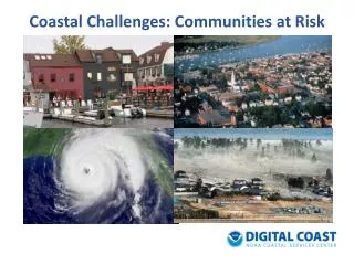
Explore wildfire risks in Oregon communities through the Wildfire Risk Explorer GIS tool. Evaluate at-risk areas, generate reports, and make informed decisions to protect natural resources. Access valuable information for decision-makers, planners, agencies, and concerned citizens.

E N D
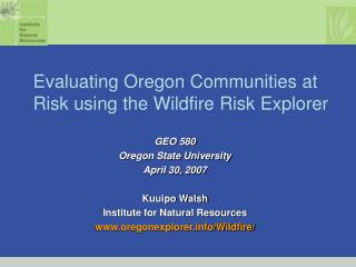
Evaluating Oregon Communities at Risk using the Wildfire Risk Explorer GIS in Action 2007 Vancouver, Washington April 18, 2007 Kuuipo Walsh Institute for Natural Resources www.oregonexplorer.info/Wildfire/
Natural Resources Digital Library Vision • Oregon Explorer™ as the “go to” place for natural resources information • Create a “purposeful” digital library • Information and map-making tools to help people learn about and make better natural resource decisions throughout the State • Address importance of “place” and access to geo-referenced information Oregon Explorer Public Release in June 2007
Wildfire Risk Explorer Released in October 2006 Funded by ODF www.oregonexplorer.info/Wildfire/
Wildfire Risk Explorer Users: • Natural resource decision-makers • Community Wildfire Protection Planners • Wildfire Protection Agencies • Land Management Agencies • At-risk communities • Homeowners • Landowners • Interested citizens
Exploring Wildfire Risk in Your Area Wildfire Risk in Your Area Select a Community …
Choose between a report on overall fire risk rating & Total acres of wildland urban interface
Choose the watersheds, counties, or communities you want to evaluate and or compare
What have we learned • We discovered that 201,584 acres were potentially at high-risk in Umatilla county. • We discovered that 106,632 acres were potentially at high-risk in Morrow county. • The Mitchel City community was rated to be at high risk
For more information, you can contact the Oregon Explorer co-managers • Janine Salwasser, OSU Libraries Janine.salwasser@oregonstate.edu • Jimmy Kagan, OSU Institute for Natural Resources Jimmy.kagan@oregonstate.edu