Download
1 / 77
770 likes | 823 Vues
Explore the political and administrative setup of the Far East Federal District in Russia, highlighting key regions, demographics, resources, and international cooperation.

E N D
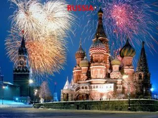
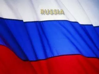
Russia Political Administrative System Contd. Presented by Elena V. Fedorova Vladivostok,VSUE, 12.07.2005.
Far Eastern Federal District • Amur Region • Chukotka Autonomous Area • Jewish Autonomous Region • Kamchatka Region • Koryak Atonomous Area • Magadan Region • Maritime Territory • Republic of Sakha (Yakutia) • Sakhalin Region • Plenipotentiary Representative Konstantin B. Pulikovsky.
The Far Eastern Federal District 10 subjects of the Russian Federation: • 2 Territories (Khabarovsk, Maritime), • 5 Regions (Amur, Kamchatka, Magadan, Sakhalin, Jewish Autonomous), • 2 Autonomous Areas (Koryak, Chukot), • The Republic of Sakha (Yakutia).
The Far Eastern Federal District Area: 6,215,000 square kilometers. Borders: • On Japan (in La Perouse Strait, Proliv Izmeny, and Sovetsky Proliv) and on China; • Washed by the East Siberian Sea and the Chukchi Sea In the North; • By the Bering Sea, Sea of Okhotsk, Sea of Japan, and the Pacific in the East; • The Siberian Federal District In the West.
The Far Eastern Federal District Population: 7,345,000, mostly urban. Ethnic composition: More than 100 ethnic groups, including Russians, Ukrainians, Yakuts, the Nanai, the Udeghe, small Northern peoples
The Far Eastern Federal District Mineral resources: • Major deposits of tin (Komsomolskiy and Khingan-Olonoyskiy ore areas), mercury, apatite ores (Dzhugdzhur and Baladensky nassifs); • Commercial reserves of noble, non-ferrous, and rare metals (gold, platinum, silver, tungsten, copper, molybdenum, polymetallic ores), chromatic and ornamental stone; • combustible minerals (coal, oil, gas), all intensely produced (coal reserves in the main fields are due to last for the next 49 to 90 years);
The Far Eastern Federal District • Raw materials for the chemical and cement industries; • Commercial reserves of building materials. • Oil and gas (Sakhalin) • Okha-Komsomolsk main pipeline is five million tons of oil a year.
The Far Eastern Federal District • Water reserves (surface and subterranean); • Fresh water reserves; • Full spectrum of the main balneological mineral water groups.
The Far Eastern Federal District • The District's biological resources are on the world scale and unique both numerically and quality-wise. • The Sakhalin-Kurile basin is one of Russia's biggest fishery areas. • The overall biomass of the local commercial fish species is more than 6.3 million tons; the authorized production rate being over 1 million tons a year, including over 800,000 tons of fish, about 285,000 tons of invertebrates, and about 300,000 tons of algae. • Prospectively, it may serve as a basis for a thriving bio-pharmaceutical industry.
The Far Eastern Federal District Favorable conditions for the District's cooperation with nations of the Asia-Pacific Region: • Border location, • Non-freezing seaports, • Rich raw material reserves, • Existing industrial and social potential
The Amur Region • Area: 361,900 sq km. • Location: • Southeastern Russia, between the Stanovoi Range and the Amur River. • Declared a constituent part of the Russian Federation on October 20, 1932.
The Amur Region Population: 997,500 - Russians (86.8%), Ukrainians (6.7%), Belarussians (1.7%), Tatars (0.9%), Azerbaijanis (0.6%), Armenians (0.3%), Bashkirs (0.3%), Mordovians, Germans, Chuvash and Evenks (0.2% each nationality), and other nationalities and ethnic groups (1.9%).The capital city is Blagoveshchensk (est. in 1858). • Blagoveshchensk – Moscow: 7,985 km.
The Amur Region The region has: • 9 cities (of them, 7 cities are under regional and 2 under district jurisdiction), • 27 urban-type settlements, • 282 village administrations, • 2 districts in cities.
The Amur Region Industry is the largest economic sector and accounts for 26% in the region's total production. Main sections: • Power engineering (50.7%), non-ferrous metal production (14.8%), coal mining (12.7%), food processing facilities (10.8%), timber and woodworking (2.9%), and industrial facilities manufacturing farm machines and mining equipment.The Amur Region is the main agricultural zone of Russia's Far East.
The Amur Region • Executive power in the region is represented by the local administration. • The supreme body of legislative power is the regional Council of People's Deputies (earlier it was legislative assembly).
Chukotka Autonomous Area • Formed December 10, 1930. • Administrative division: • 8 districts, • 3 towns under district jurisdiction, • 27 urban settlements, • 41 villages.Administrative center: Anadyr (11,900 residents).
Chukotka Autonomous Area Area: 737,700 square kilometers (4.32% of the Russian Federation).Population: • Urban: 70,000, 49,100, • Rural: 23,000. Ethnic composition: • 60 different ethnic groups, including Russians (66.1%), Ukrainians (16.8%), the Chukchi (7.3%), Byelorussians (1.9%), the Eskimos (0.9%), the Evens (0.8%), the Chuvantsy (0.6%).
Chukotka Autonomous Area Mineral resources: • gold, silver, tungsten, tin, coal,brown coal, copper. Best-known tin deposits: Valkumei, Pyrkakai; Coal fields: Anadyr, Behring. Main industries: • Power generation, coal, non-ferrous (gold mining), food, fishing.Agriculture: • Reindeer herding, fur farming, fur hunting, hothouse vegetable-growing.
Chukotka Autonomous Area Leading enterprises: • OAO "Chukotenergo," AOZT "Ruda," AO "Shakhta Ugolnaya," AO "Shakhta Nagornaya."Executive authorities: • Administration of the Chukot Autonomous Area; administration head Roman A. Abramovich.Legislature: • Duma of the Chukot Autonomous Area; Chairman Vasily N. Nazarenko.
Jewish Autonomous Region Established on May 7, 1934The region has: • 5 districts, • 2 cities, • 12 urban-type settlements • 47 villages.The administrative center is Birobidzhan (pop. 84,000).
Jewish Autonomous Region Area: • 36,300 sq km (0.21% of the territory of Russia).Population: • 199,100 (134,400 live in the urban part and 64,700 people in the rural area).
Jewish Autonomous Region Minerals: • Iron, manganese, tin, gold, graphite, brucite, magnesite, zeolite, construction materials, and also healing mineral springs. Deposits of rare metals: • Preobrazhenskoye and Diturskoye
Jewish Autonomous Region Industries: • Nonferrous metallurgy, • Mechanical engineering, • Metalworking, • Production of construction materials, • Timber, • Woodworking, • Light and food processing.
Jewish Autonomous Region Main industrial facilities: • The Khingan tin enterprise, • The Dalselmash works manufacturing farm machines, • A plant producing power transformers • The Teploozersk cement mill.
Jewish Autonomous Region • Executive power in the region is represented by Governor of the Jewish Autonomous Region Nikolai Volkov. • Legislative power is represented by Anatoly Tikhomirov, Chairman of the regional Legislative Assembly.
Kamchatka Region • Established on October 20, 1932, as part of the Khabarovsk Territory, and on January 21, 1956, it was made a region of the Russian Federation.The Kamchatka Region has: • 7 districts, • 2 cities under regional jurisdiction, • 1 city under district jurisdiction, • 2 districts in cities, • 8 urban-type settlements, • 26 rural administrations.The center of the region is the city of Petropavlovsk-Kamchatski (est. in 1740). Petropavlovsk - Moscow is 7,985 km.
Kamchatka Region Area: • 179,100 sq km (without the Koryak Autonomous Area) • 472,300 sq km. (with the Koryak Autonomous Area) Location: • The Kamchatka regionis in the northeast of Russia. This region and the Koryak Autonomous Area, its constituent part, occupy the Kamchatka peninsula, part of the mainland adjoining it and the Komandor (Commander) Islands.The population: • 353,900, 85.4%. (without the Koryak Autonomous Area) living in the urban area.
Kamchatka Region • The Kamchatka Region is unique in its geographic position and climatic resources. It boasts an unparalleled variety landscapes. Mineral resources: • Gas, • coal, • natural sulphur, • thermal water, • gold and silver.
Kamchatka Region • Kamchatka has no railways. Industries: • Shipbuilding and fishing (which accounts for 62% of all production in the region). • Crabs are caught there in big amounts and whaling is well developed.
Kamchatka Region • Industrial facilities in the region produce timber, construction materials, and coal. • Electricity is generated by the Pauzhetskaya Geothermal power station • It is the only area in which all the main balneological groups of mineral water exist.
Kamchatka Region The biggest enterprises: • Kamchatskenergo power engineering company, • The Kamchatskommunenergo enterprise, • The Kamchatrybprom fish processing facility, • The Okeanrybflot fishing fleet, • The Lenin Fishing Kolkhoz (collective farm), • The Petropavlovsk Shipyard.
Kamchatka Region • The supreme body of executive power in the region is the Regional Administration headed by Governor Vladimir Biryukov. • Legislative power in the region is exercised by the Council of People's Deputies and its Chairman is Lev Boitsov.
Koryak Autonomous Area Established on December 10, 1930.Area: 301,500 sq km.Population: 31,700.Over 30 nationalities live in the autonomous area: Koryaks (16.4 %), Russians (62%), Ukrainians (7.2%), Chukchis (3.6%), Itelmens (3%), Evens (1.8%), Tatars (1.2%), Belarussians (1%), other nationalities (3.8%).The area is subdivided into four districts.The administrative center is the Palana settlement.
Koryak Autonomous Area • Marine biological resources are the main renewable wealth of the area. Minerals and metals: • Ore and placer gold, platinum, nickel, copper, tin, zinc, mercury, gas and gas condensate, peat, natural sulphur, and a variety of construction materials. • The West-Kamchatka shelf contains potentially great deposits of oil and gas by far exceeding such resources of the peninsula.
Koryak Autonomous Area Main industries: • Fishing, woodworking, mining, ferrous metallurgy, and power engineering.Developed in the area: • Greenhouse vegetable farming, reindeer breeding and hunting. The leading facilities: • The Chaibukha mining company, • The Koryakgeoldobycha enterprise, • The Khairyuz and Korf fish processing plants.
Koryak Autonomous Area • Executive power in the area is represented by the chief of the Administration of the Koryak Autonomous Area, Vladimir Loginov. • Legislative power in the area is represented by Chairman of the Koryak Duma Vladimir Zuyev.
Magadan Region Location: • north-eastern Russia; • washed by the Arctic Ocean and the Pacific. Area: 1,199,100 square kilometers. Formed: December 3, 1953.Population: 227,200.