40 Years Mangrove Development in Kiribati
240 likes | 444 Vues
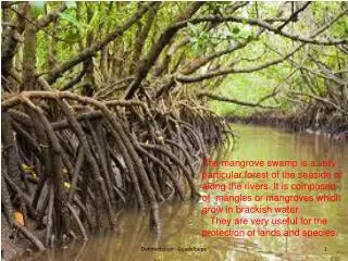
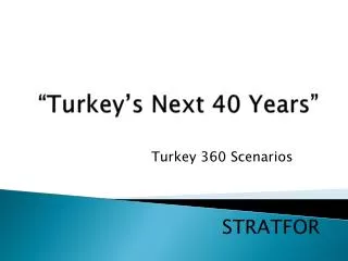
40 Years Mangrove Development in Kiribati. Pacific Islands GIS&RS User Conference 27 th to 30 th November Suva Kataebati Bataua. Laura, Majuro, Marshall Islands. 1983 = 187 hectares 2000 = 140 hectares. Green = New vegetation. Red = Loss of vegetation.

40 Years Mangrove Development in Kiribati
E N D
Presentation Transcript
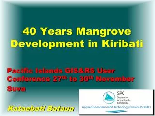
40 Years Mangrove Development in Kiribati Pacific Islands GIS&RS User Conference 27th to 30th November Suva Kataebati Bataua
Laura, Majuro, Marshall Islands 1983 = 187 hectares 2000 = 140 hectares Green = New vegetation Red = Loss of vegetation
Steps: • Scanning of map • Linear geometric rectification towards satellite image • Delineation of vegetation classes on map • Rasterising map and satellite image interpretation • Overlay analysis
Tarawa 40 Years Difference Mangroves are growing not shrinking !
Investigated Islands • 1 Makin, 2 Butaraitari, 3 Marakei, 4 Tarawa, 5 Maiana, 6 Aranuka, 7 Onotoa, 8 Tamana and 9 Arorae • Only in Makin slight decrease of vegetation
Possible Sources of Vegetation Increase • Sea level fall ? • Geometric correction wrong ? • Interpretation of black and white aerial photographs 1969 partly wrong ? • Satellite image interpretation wrong ? • Changing water flow ?
Possible Human Influence for Vegetation Increase • Environmental education ? • Coconut planting programmes after 1969 • Less need for mangrove as fire wood ? • Alternative fuel • Better drinking water • Better living conditions for mangroves ?
Kiribati’s population is growing but the vegetation is growing as well (if trend continues) Thanks