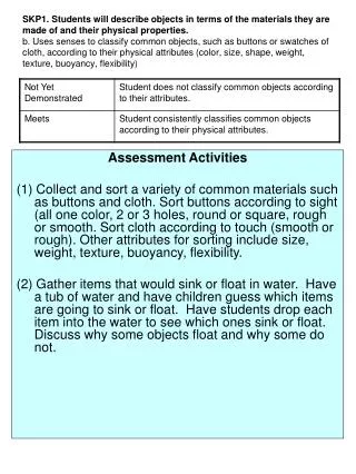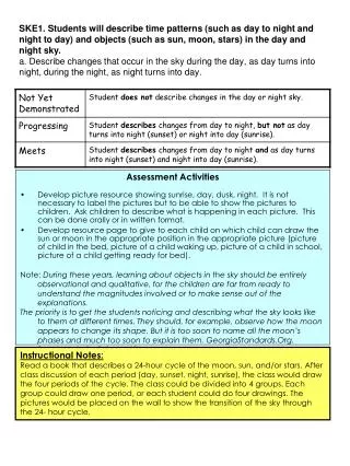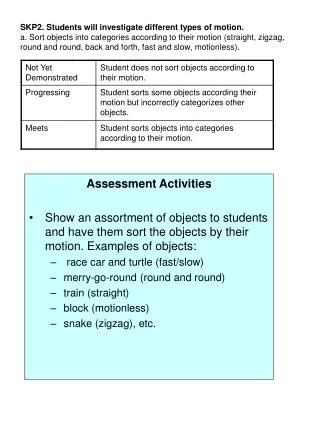
Assessment Activities
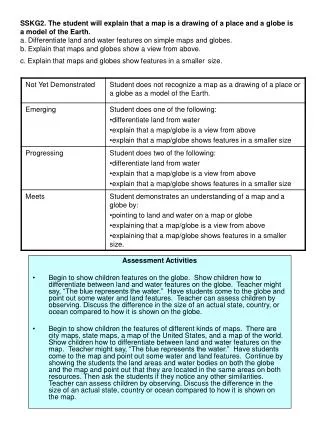
SSKG2. The student will explain that a map is a drawing of a place and a globe is a model of the Earth. a. Differentiate land and water features on simple maps and globes. b. Explain that maps and globes show a view from above. c. Explain that maps and globes show features in a smaller size.

Assessment Activities
E N D
Presentation Transcript
SSKG2. The student will explain that a map is a drawing of a place and a globe is a model of the Earth.a. Differentiate land and water features on simple maps and globes.b. Explain that maps and globes show a view from above.c. Explain that maps and globes show features in a smallersize. Assessment Activities • Begin to show children features on the globe. Show children how to differentiate between land and water features on the globe. Teacher might say, “The blue represents the water.” Have students come to the globe and point out some water and land features. Teacher can assess children by observing. Discuss the difference in the size of an actual state, country, or ocean compared to how it is shown on the globe. • Begin to show children the features of different kinds of maps. There are city maps, state maps, a map of the United States, and a map of the world. Show children how to differentiate between land and water features on the map. Teacher might say, “The blue represents the water.” Have students come to the map and point out some water and land features. Continue by showing the students the land areas and water bodies on both the globe and the map and point out that they are located in the same areas on both resources. Then ask the students if they notice any other similarities. Teacher can assess children by observing. Discuss the difference in the size of an actual state, country or ocean compared to how it is shown on the map.