Spatial Cloud Computing: Usage in Geo-Spatial Sciences
Spatial Cloud Computing: Usage in Geo-Spatial Sciences. Topics. Problem Statement Define the problem Significance in context of the course Key Concepts Cloud Computing Spatial Cloud Computing Major Contributions of the paper Most significant - Why Preserve and Revise.

Spatial Cloud Computing: Usage in Geo-Spatial Sciences
E N D
Presentation Transcript
Topics • Problem Statement • Define the problem • Significance in context of the course • Key Concepts • Cloud Computing • Spatial Cloud Computing • Major Contributions of the paper • Most significant - Why • Preserve and Revise
Problem Statement • Use of Cloud Computing to support the intensities of geospatial sciences • Reason for need of platform like Cloud Computing • What is Cloud Computing? • Spatial Cloud Computing (SCC) • SCC Scenarios/Examples • Opportunities & Challenges • Cloud computing has been one of the most advancing technologies recently. Utilizing it in the context of Geo-Spatial sciences can prove to be very useful.
Cloud Computing • Advancement of Distributed Computing • Provides ‘computer as a service’ for end users • In ‘pay-as-you-go’ model • Model: • Enables convenient, on-demand network access to a shared pool of configurable computing resources • Ex: networks, servers, storage, applications and services • Resources can be rapidly provisioned and released • With minimal management effort • Or with Service provider interaction
Services for Cloud Computing • Cloud Computing is provided through 4 services • Infrastructure as a Service (IaaS) – Amazon EC2 • Platform as a Service (PaaS) – MS Azure, Google Apps • Software as a Service (SaaS) – Salesforce.com • Data as a Service (DaaS) For Geospatial Sciences • Hadoop & Map Reduce can also be used
Uses of Cloud Services • Earth Observation (EO) Data Access: • DaaS is used for fast, secure access & utilization of EO data • DaaS also provides the needed Storage & Processing needs • Model: • IaaS gives full control of computing instances • But has network bottlenecks • Cloud computing can be used in complement to solve computing intensive problems • Knowledge & Decision Support: • Used by domain experts, managers or public • SaaS provides good support • Social Impact & Feedback: • SaaS such as Facebook & email can be best utilized
Characteristics of Cloud Computing • 5 characteristics that distinguish Cloud Computing from other distributed computing paradigms • On-Demand Self Service • For customers as needed automatically • Broad Network Access • For different types of network terminals • Resource Pooling • For consolidation of diff. types of Computing resources • Rapid Elasticity • For rapidly and elastically provisioning, allocating, and releasing computing resources • Measured Service • To support pay-as-you-go approach
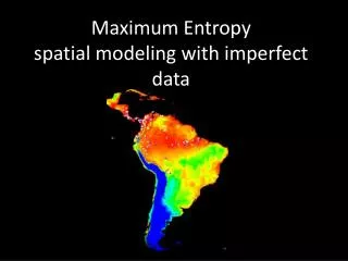
Spatial Cloud Computing • Operation of geospatial applications on cloud computing environments • Cloud computing • Helps geospatial sciences • Can be optimized with Spatiotemporal principles • Best utilize available distributed computing resources • Geospatial Science Problems • Have intensive Spatiotemporal constraints & Principles • Best enabled if we consider general spatiotemporal rules for geospatial domains
SCC Scenarios • 4 scenarios given for 4 intensity problems. An Example in the PPT. • Data Intensity Scenario: • Data Intensity issues in Geospatial sciences characterized by 3 aspects • Multi-Dimensional • Massiveness • Globally distributed-organizations with data holdings are distributed over entire earth • Large volumes of data transferred • Over fast computer networks • Or collocated with processing to minimize transmitting
Data Intensity scenario solution: • Developing DaaS • Distributed inventory and portal based on SCC • To enable discoverability, accessibility & utilizability of geospatial data • Stores millions to billions of metadata entries • With data locations & performance awareness • Developed & Tested based on Microsoft Azure, Amazon EC2 & NASA Cloud Services
Opportunities & Challenges • The grand challenges along 4 intensity problems can be solved by latest advancements in cloud computing • Opportunities: • Spatiotemporal principle mining & extracting • Important digital earth & complex geospatial science and applications • Supporting the SCC characteristics • Security • Citizen and Social Science
Major Contributions & Significant • Categorization of grand challenges of Geospatial Sciences in 21st century • Good Explanations of Cloud Computing and Spatial Cloud Computing with examples • Insight with examples into how cloud computing can solve 4 intensity problems • Most Significant • Looks ahead to see possible solutions for intensity problems
Preserve & Revise • Revise • Whole paper along recent advancements in cloud computing • Examples of SCC scenarios • Preserve • Initial different kinds of intensity definitions • Cloud Computing & SCC key concepts