Download
1 / 28
1k likes | 2.8k Vues
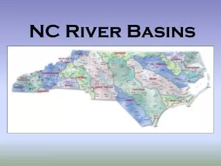
SITUATION OF RIVER BASINS IN MINDANAO. VICENTE B. TUDDAO, JR. PH.D. Executive Director River Basin Control Office Department of Environment and Natural Resources. Presented during Mindanao Economic and Environment Summit Davao City, June 4-5, 2012.

E N D
SITUATION OF RIVER BASINS IN MINDANAO VICENTE B. TUDDAO, JR. PH.D. Executive Director River Basin Control Office Department of Environment and Natural Resources Presented during Mindanao Economic and Environment Summit Davao City, June 4-5, 2012
Values of River Basins in the Philippines Land, forest, aquatic resources, minerals, Water Biodiversity, water balance Increase Quality of life, Environmental Integrity and Economic Development Ecosystem/ Environment Agriculture Food Production Commerce and industry, and utilities Economic Growth Maria Cristina Falls, Agus River Basin Domestic Water Supply Social Development
The Cabinet Cluster on Climate Change Adaptation and Mitigation Chaired by DENR Secretary has approved on May 02, 2012 a resolution “Adopting the 18 Major River Basins in the Country As Priority Areas of the Government
Abulog og River Basin 4 Abra River Basin Abra River Basin Cagayan River Basin Cagayan River Basin Agno River Basin Agno River Basin 100 0 100 Kilometers Pampanga River Basin Pampanga River Basin Pasig-Laguna River Basin Pasig-Laguna River Basin Bicol River Basin Bicol River Basin Panay River Basin Panay River Basin Jalaur River Basin Jalaur River Basin Ilog-Hilabangan River Basin Ilog-Hilabangan River Basin Agusan River Basin Agusan River Basin Tagaloan River Basin Tagaloan River Basin Cagayan de Oro River Basin Cagayan de Oro River Basin Agus River Basin Agus River Basin Mindanao River Basin Mindanao River Basin Davao River Basin Davao River Basin Tagum (Saug)-Libuganon River Basin Tagum (Saug)-Libuganon River Basin Buayan-Malungan River Basin Buayan-Malungan River Basin 18 Major and Priority River Basins in the Philippines Abulog River Basin Abulog River Basin DENR-River Basin Control Office,2012
Abulog og River Basin 4 Abra River Basin Abra River Basin Cagayan River Basin Cagayan River Basin Agno River Basin Agno River Basin 100 0 100 Kilometers Pampanga River Basin Pampanga River Basin Pasig-Laguna River Basin Pasig-Laguna River Basin Bicol River Basin Bicol River Basin Panay River Basin Panay River Basin Jalaur River Basin Jalaur River Basin Ilog-Hilabangan River Basin Ilog-Hilabangan River Basin Agusan River Basin Agusan River Basin Tagaloan River Basin Tagaloan River Basin Cagayan de Oro River Basin Cagayan de Oro River Basin Agus River Basin Agus River Basin Mindanao River Basin Mindanao River Basin Davao River Basin Davao River Basin Tagum (Saug)-Libuganon River Basin Tagum (Saug)-Libuganon River Basin Buayan-Malungan River Basin Buayan-Malungan River Basin 18 Major and Priority River Basins in the Philippines 8 Major River Basins in Mindanao Abulog River Basin Abulog River Basin % of Drainage Areas of River Basins in Mindanao to the total 18 Major River Basins In the Country . ………..41.55% (Visayas, 6.7% and Luzon, 51.75%) DENR-River Basin Control Office,2012
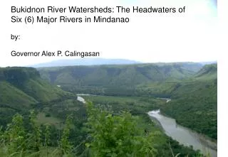
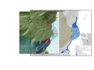
Satellite Map of Mindanao Island Showing the Major River Basins
Groundwater Resources in Mindanao (Mines and Geosciences Bureau)
THE EIGHT (8) MAJOR RIVER BASINS IN MINDANAO
Location: • Region 12 ( South Cotabato, North Cotabato, Maguindanao, Sultan Kudarat) Region X (Bukidnon) • Area: • 21,502sq. km. • No. of Principal Rivers: • Thirteen (13) • Libungan, Pulangui, Ala, Maridagao, Buluan, Mulita, Kabacan, Banga, M-lang, Dalika, Malasila, Tigua, and Kulama River • River Classification (2009): • Libungan River – Class D • Pulangui River – Class D • Ala River-Class C • M’lang River-Class C • Kulama River-Class A Quick Facts: Mindanao River Basin
Major Environmental Issues/Concerns Flooding Siltation and Sedimentation of rivers Watershed Denudation Riverbank Erosion Water Pollution from Domestic and Agricultural sources Proliferation/invasion of water hyacinth
Area: • 11,937 sq. km. • No. of Principal Rivers: • Twelve (12) • Agusan, Ojot, Wawa, Andanon, Libang, Maasam, Kasilan, Gibong, Adgaon, Simulao, Kayanan, and Haoan River • River Classification (2009): • Agusan River– Class C • Ojot River-Class A • Wawa River-Class A • Libang River-Class D Quick Facts: Agusan River Basin Location: Region 13 (Agusan Del Norte, Agusan Del Sur) Region XI (Campostela Valley)
Major Environmental and Institutional Issues/Concern Affecting Agusan River Basin FLOODING Water Pollution from Domestic and industrial sources Watershed Denudation Absence of River Basin Organization Siltation and sedimentation of rivers Soil Erosion and Landslides
TAGUM (SAUG)-LIBUGANON RIVER BASIN Quick Facts • Location: • Davao Del Norte • Area: • 2,374 sq. km. • No. of Major River: • Three (3) • Tagum, Hijo and Libuganon River • River Classification (2009): • Tagum River-Class D • Hijo River-Class D • Major Environmental Issues: • Flooding • Siltation • Deforestation • Erosion • Other related Issues: • Weak River Basin governance • Absence of River Basin organization River Basin Control Office Department of Environment and Natural Resources
DAVAO RIVER BASIN River Basin Information Brief • Major Environmental Issues: • Flooding • Improper waste disposal • Soil Erosion & sedimentation • Deforestation • Loss of aquatic flora and fauna & its biodiversity • Mangrove conversion • Weak River Basin governance • Absence of river basin organization • Location: • Northern Mindanao and Davao Region • Area: • 1,598 sq. km. • No. of Major River: • One (1) • Salug River • River Classification (2009): • Salug River (Upper and Lower Reach)-Class B and C) River Basin Control Office Department of Environment and Natural Resources
BUAYAN RIVER BASIN River Basin Information Brief • Location: • Northern portion of Sarangani Province • Area: • 1,435 sq. km. • No. of Major River: • Two(2) • Buayan, and Malungun Rivers • River Classification (2009): • Buayan River-Class B • Major Environmental Issues: • Flooding • Siltation • Illegal extraction of groundwater • Soil Erosion • Deforestation • No River Basin Organization created River Basin Control Office Department of Environment and Natural Resources
TAGOLOAN RIVER BASIN River Basin Information Brief • Location: • Malaybay City Bukidnon Northern Mindanao • Area: • 1,658 sq. km. • No. of Major River: • Seven (7) • Malitbog, Siloo, Titian, Mangima, Alulum, Amusig, and Dila River • River Classification (2009): • Malitbog River-Class A • Mangima River-Class A • Major Environmental Issues: • Watershed degradation due to loss of forest cover • Increase of river siltation due to poor farming technology • Occurrence of flooding and landslides during extreme rainfall events • River water quality deterioration due to effects of pollutants from agricultural areas, industries and communities • Increase of informal settlers along river banks • Absence of River Basin Organization
CAGAYAN DE ORO RIVER BASIN River Basin Information Brief • Location: • Northern Mindanao (CDO City, Bukidnon, part of Iligan) • Area: • 1,361 sq. km. • No. of Major River: • Eight (8) • Batang, Bulaong, Bubunauan, Mawala, Picalin, Tumalaong, Munigui, and Kalawaig River • River Classification (2009): • Cagayan River-Class A • Kalawaig River-Class A • Major Environmental Issues: • Improper solid waste disposal • Disposal of untreated wastewater from domestic and industrial /commercial sources • land use conversion • Forest denudation • soil erosion & sedimentation • Decrease river water quality due to illegal mining • Intensive agricultural • cultivation without soil erosion measures
AGUS RIVER BASIN (RANAO RIVER BASIN) River Basin Information Brief • Major Environmental Issues: • Floods • Degraded water quality due to domestic wastewater disposal • Diminishing water inflow and siltation of the lake (resulting to declining hydro-power generating capacity) • Water pollution due to improper solid waste management • soil erosion from cultivated gricultural land • Illegal logging • Presence of hyacinth growth which impede regular flow of river • Weak River Basin Governance Location: Lanao del Sur, ARMM Area: 1,918 sq. km. No. of Major River: Five (5) Linamon, Taraka, Gata, Ramain, and Malaig River
River Basin Ecosystem Dynamics, threats and Management Approaches Participatory Partnership Environmental Stress such as Climate Change, Man-made Pressures River Basin Environment Ecosystem-based RIVERS Biodiversity, Climate, Community, Land,water Forests Sustainable Management Integrated Management Ridge to reef/river basin Management Approach Risk-Based Management
In summary, the Major Environmental, Social and Institutional Issues and Concerns Affecting Mindanao River Basins
In summary, the Major Environmental, Social and Institutional Issues and Concerns Affecting Mindanao River Basins
Highly vulnerable river basins to flooding need to be Effectively Managed through: • Complete hazards vulnerability assessment by river basin/watershed • Prioritize flood mitigation measures such as watershed planting/reforestation; soil conservation measures such as check dams, water-impounding structures, and/or use of bio-eco engineering measures (e.g. coconet/cocomatting of unstable slopes, vetiver grass, bamboos etc); • Removal of barriers to natural flow of rivers such as hyacinth, solid wastes;
GOOD GROUND COVER FAIR GROUND COVER POOR GROUND COVER 60-75% of ground covered with plants and litters 37% of ground covered with plants and litters 10% of ground covered with plants and litters Surface run-off = 75% of rainfall Surface run-off = 14% of rainfall Surface run-off = 2% of rainfall Soil loss = 21.13 tons per hectare Soil loss = 1.24 tons per hectare Soil loss = 0.07 ton per hectare A simple illustration of how forests help minimize (not prevent) floods EFFECT OF FOREST COVER CONDITION ON RUN-OFF AND EROSION 6.2 cm of rain in one hour
Increase capacity of rivers through removal of sediments or temporary damming of hardened silts/sediments deposition through physical/mechanical means; • Strengthen river basin governance/creation of RBO • Review easement guideline/provisions in the Clean Water Act and strictly enforce easement regulation • Relocate informal settlers and remove illegal structures
Reclaim easement areas and establish potential linear park development projects; • Develop effective waste water sewerage and treatment systems; and integrate cooperation/partnership/collaboration among different agencies and sectors; • Need for convergent actions among national government agencies • Formulate and implement a national campaign (poverty alleviation, sustainable livelihood and entrepreneurship programs, community stakeholders empowerment) and a strong advocacy program to Save Philippine Rivers and River Basins. • Develop long term River Basin master Plan/Operational Plans