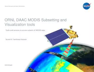
MODIS Subsetting and Visualization Tool:
National Aeronautics and Space Administration. MODIS Subsetting and Visualization Tool:. Bringing time-series satellite-based land data to the field scientist. www.nasa.gov. What is MODIS. MOD erate Resolution I maging S pectroradiometer

MODIS Subsetting and Visualization Tool:
E N D
Presentation Transcript
National Aeronautics and Space Administration MODIS Subsetting and Visualization Tool: Bringing time-series satellite-based land data to the field scientist www.nasa.gov
What is MODIS • MODerate Resolution Imaging Spectroradiometer • Hyper-Spectral sensor onboard two satellites (Terra and Aqua) • Terra MODIS and Aqua MODIS are viewing the entire Earth’s surface every 1 to 2 days, acquiring data in 36 spectral bands or groups of wavelengths • http://aqua.nasa.gov/reference/visualizations.php Tammy Walker Beaty
MODIS data is great, but • Users (Field researchers) have some inconveniences • Data Volume • Accessibility • Data Format • Processing Time • Working conditions Tammy Walker Beaty
What ORNL DAAC offers • MODIS Land Products in an easy-to-use format and size to characterize field sites • MODIS Subsets for Selected sites (1147 MODIS Collection 5) • Data formatted in ASCII (7X7 km subsets) and GeoTIFF (25X25 km subset) • Selection by Site Search, Country, Continent or Land Unit, Network, IGBP Classification • MODIS Subsetting and Visualization Tool for Any Location on the Globe • Site Selection from a pick list or by entering a site’s geographic coordinates • Area defining the site can be from 1 pixel up to 201 X 201 km • Documentation Tammy Walker Beaty
Selected Sites & Global Tool Products • Time series plots of the selected product measurement • ASCII file of the pixel values for the selected product along with quality information • Average & standard deviations for the area selected • A file that can be imported directly into GIS software • A land cover grid (IGBP classification) of the area • An estimate of heterogeneity (Shannon richness and evenness) • Documentation Tammy Walker Beaty
MODIS Global Tool • http://daac.ornl.gov/modis/modis_subsets3.cfm • Global Subsetting and Visualization Tool Tammy Walker Beaty
MODIS Global Tool, Step 1 - select Location • http://daac.ornl.gov/cgi-bin/MODIS/GLBVIZ_1_Glb/modis_subset_order_global_col5.pl Tammy Walker Beaty
MODIS Global Tool, Step 2 - select data layer and subset size (LST and 100 X 100) Tammy Walker Beaty
MODIS Global Tool, Step 3 - select temporal range, provide email address, and submit Tammy Walker Beaty
MODIS Global Tool, Step 4 – order description and subset creation Tammy Walker Beaty
MODIS Global Tool, Step 5 – order summary and verification Tammy Walker Beaty
MODIS Global Tool, Step 6 – order notification and data retrieval • Link to visualization and data • Citation Tammy Walker Beaty
MODIS Global Tool, Data Files can be downloaded • Each order page has links to the data files (on http server) • Help files explain contents and format Tammy Walker Beaty
Resulting Data • Unique URL for each order: • http://daac.ornl.gov/glb_viz_2/02Oct2008_16:28:25_348253391L35.958767L-84.287433S201L201_MOD11A2/index.html Tammy Walker Beaty
SignOffPage Tammy Walker Beaty
Available MODIS Products • Surface Reflectance • Surface Temperature • Land Cover • Vegetation Phenology (life cycle) • NDVI/EVI (Normalized Difference Vegetation Index and Enhanced Vegetation Index) • LAI / fPar (Leaf Area Index and Fraction of photo-synthetically active radiation absorbed by vegetation) • Net Photosynthesis • Annual NPP (Net Primary Production) • Calculated Albedo (ratio of diffusely reflected to incident electromagnetic radiation) • Reflectance – BRDF (bidirectional reflectance distribution function) adjusted Tammy Walker Beaty
MODIS Collection 5 – 1147 sites • http://daac.ornl.gov/cgi-bin/MODIS/GR_col5_1/mod_viz.html • By Country, Land Unit, Network, IGBP Land use Classification • 8-day, 16-day, or annual composite periods • 1 km, 50 m, or 250 m resolution • Documentation Tammy Walker Beaty