The Delaware DataMIL
The Delaware DataMIL. Maintaining the Delaware Spatial Data Framework. Delaware’s GIS Community Delaware Spatial Data Framework Delaware and The National Map DataMIL Architecture Map Production Laboratory Public Participation Future Directions. Delaware…. No central “GIS Authority”

The Delaware DataMIL
E N D
Presentation Transcript
The Delaware DataMIL Maintaining the Delaware Spatial Data Framework ESRI International Users Conference
Delaware’s GIS Community • Delaware Spatial Data Framework • Delaware and The National Map • DataMIL Architecture • Map Production Laboratory • Public Participation • Future Directions ESRI International Users Conference
Delaware… • No central “GIS Authority” • Data developed at, and shared among, all levels of government • Based on a shared Framework standard: data sets “work together” • All contribute data, all gain data ESRI International Users Conference
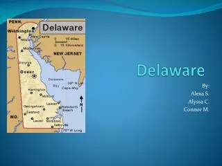
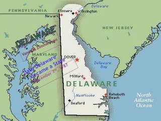
Delaware • 2,000 Square Miles (Give or Take) • 784,000 Folks • 3 Counties • 57 Municipalities ESRI International Users Conference
The Sec. of Agriculture and the State Planning Director A Close-Knit Community Levy Court Commission Brooks Banta and Governor Ruth Ann Minner ESRI International Users Conference
Our Challenge • Create and maintain useful spatial data • Accurate, up-to-date, statewide • Open to all • In a completely distributed environment • With no truly formal control ESRI International Users Conference
Coordination, Not Control • Local expertise creates better data • Two keys: • Communicate • Share Data ESRI International Users Conference
Delaware’s GIS Community • Inter-related Committees • State Mapping Advisory Committee • Delaware Geographic Data Committee • Delaware Spatial Data I-Team • Focused on Delaware’s Spatial Data Framework ESRI International Users Conference
The Spatial Data Framework • Accepted in 2000 • The “skeleton” that supports a wide variety of spatial data sets • Limited to core, skeletal data sets • Part of the National Spatial Data Infrastructure (NSDI) ESRI International Users Conference
Geographic Names Land Use Cadastral Transportation Hydrography Governmental Units Geodetic Control Hypsography Orthoimagery ESRI International Users Conference
Geographic Names Land Use Cadastral Transportation Hydrography Governmental Units Geodetic Control Hypsography Orthoimagery ESRI International Users Conference
Geographic Names Land Use Cadastral Transportation Hydrography Governmental Units Geodetic Control Hypsography Orthoimagery ESRI International Users Conference
Geographic Names Land Use Cadastral Transportation Hydrography Governmental Units Geodetic Control Hypsography Orthoimagery ESRI International Users Conference
Geographic Names Land Use Cadastral Transportation Hydrography Governmental Units Geodetic Control Hypsography Orthoimagery ESRI International Users Conference
Geographic Names Land Use Cadastral Transportation Hydrography Governmental Units Geodetic Control Hypsography Orthoimagery ESRI International Users Conference
Geographic Names Land Use Cadastral Transportation Hydrography Governmental Units Geodetic Control Hypsography Orthoimagery ESRI International Users Conference
Geographic Names Land Use Cadastral Transportation Hydrography Governmental Units Geodetic Control Hypsography Orthoimagery ESRI International Users Conference
Need for Improvement • Delaware topographic map series (DRGs/DLGs) produced in early 1990s • Updated Delaware DOQQs 1997/2002, Land Use, DelDOT Transportation Network, Municipal Boundaries, Watersheds (Delaware Framework) • Several USGS National datasets under development – GNIS, NHD, NED, Imagery, Land Cover (The National Map) ESRI International Users Conference
NSGIC, Sept. 2000, Tahoe • Discussion With USGS • We have data… • …you have data • DLG updates? ESRI International Users Conference
The National Map • Seamless • Nationwide • Current • Partnership based • Major data themes • Public domain • Online accessibility ESRI International Users Conference
Can We Have… • Somewhere on-line to combine and compare data? • A collaboratory where we can host discussions? • Mini topo maps? • Easy-to-use interface? ESRI International Users Conference
Serendipity? • Coincidence of DataMIL and The National Map • Past & Present Partnerships • Tremendous Synergy and Focus ESRI International Users Conference
What Is the DataMIL? • Delaware Data Mapping and Integration Laboratory (DataMIL) • Maintain and improve Delaware Framework through collaboration • Provide access to Delaware Framework information for all ESRI International Users Conference
DataMIL’s Components • Partnership-based; MOAs among State and Federal agencies • Spatial Data and Metadata Servers • Public Participation/Feedback Process • Web Services • Web Site ESRI International Users Conference
DGS USGS DNREC FEMA DE OSPC Census DelDOT US DOT DataMIL Distributed (G.NET) Web Services • Mapping • Feature Streaming • Metadata Publish • Metadata Browse Database Archive ESRI International Users Conference
DataMIL Technology • Web • ASP, JSP, HTML/JavaScript • iPlanet 6.0, ChiliSoft ASP 3.6.2 • Mapping & Metadata • ArcIMS 4.0, ArcGIS 8.2 • ArcSDE 8.2, Oracle 8i • Discussion Forums • Akiva WebBoard 5.0 ESRI International Users Conference
Web Server Map Server Dual PIV 1.4 GHz 2 GB RAM 40 GB Disk Dual PIV 2.0 GHz 2 GB RAM 60 GB Disk Quad PIII Xeon 700 MHz 2 MB L2 cache/proc 4 GB RAM 2-36 GB OS – RAID1 4-36 GB Data – RAID5 Data Server ESRI International Users Conference
Web Site Architecture Portal Metadata Explorer Integration Lab Standards Collaboration Integration Production Lab Forums ESRI International Users Conference
Metadata within Delaware • ArcIMS Metadata Server • Delaware Metadata Explorer (Web) • ArcCatalog (ArcGIS Desktop) • Distributed Maintenance • Each agency with unique login & folder • Edit/Publish through ArcCatalog or web ESRI International Users Conference
DemonstrationDelaware Metadata Explorer ESRI International Users Conference
DemonstrationMap Production Laboratory ESRI International Users Conference
DemonstrationDiscussion Forums ESRI International Users Conference
April 18, 2002 “Delaware was the ‘First State’ at the start of the nation; now we're ready to be the first state in the new, 21st century National Map.” -- Gov. Minner Gov. Minner at Delaware GIS 2002: Connecting Communities ESRI International Users Conference
Making It Known • Governor’s Press Release • Newspapers, TV, Radio • Web links • Extensive e-mailing ESRI International Users Conference
Real World Uses • It’s Shields, Not “Shilds” • That’s not a stream, that’s a driveway. • Selbyville Police Chief • Emergency planning • Knowing where the ditches are ESRI International Users Conference
What Next? • Mapping Partnership Office (MPO) • Cadastral Layers • Vertical Integration of Framework Layers • Develop Delaware Framework Data Model • Non-Framework Layers? ESRI International Users Conference
The Delaware DataMIL http://datamil.udel.edu ESRI International Users Conference