Download
1 / 37
370 likes | 537 Vues
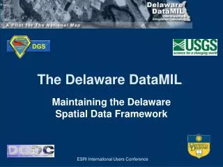
The Delaware DataMIL A Pilot Project for The National Map. July 25, 2002 State of Delaware Council of Geographic Names Authorities (COGNA). The DataMIL Team. Mike Mahaffie, OSPC, DGDC Sandy Schenck, DGS, SMAC Christina Callahan, RDMS, UD John Callahan, RDMS, UD Richard Sacher, RDMS, UD

E N D
The Delaware DataMILA Pilot Project for The National Map July 25, 2002 State of Delaware Council of Geographic Names Authorities (COGNA)
The DataMIL Team • Mike Mahaffie, OSPC, DGDC • Sandy Schenck, DGS, SMAC • Christina Callahan, RDMS, UD • John Callahan, RDMS, UD • Richard Sacher, RDMS, UD • Greg Forte, RDMS, UD • Shannon Bain, MCMC, USGS • Robert Rinehart, MCMC, USGS • William Harris, MCMC, USGS • Roger Barlow, Eastern Region, USGS
What is DataMIL? DataMIL = DataMapping and Integration Laboratory Developed from conversations between Delaware Geological Survey, Delaware Office of State Planning Coordination with USGS regarding the revision of Topographic Maps and Digital Line Graphs using Delaware data (September 2000).
DataMIL - Primary Objectives • Combine state (Delaware) and federal (USGS) geographic data to create the most up-to-date database possible • Allow online access for the general public, state and federal agencies in the form of digital GIS data, online images, hard-copy maps, and database attribute information • Optimize data storage, maintenance, accessibility, and archival procedures
The State of Delaware has no central “GIS Authority”!
Delaware Geographic Data Committee (DGDC) • House Bill 395, 1998 created the DGDC • State-wide, multi-disciplinary membership • To promote the sharing of geospatial data, information, and knowledge • Works in Coordination with State Mapping Advisory Committee (SMAC) • Coordination, not Control!
SMAC Education & Training Conference Orthophoto Metadata Geographic Names Delaware’s GIS Community I-Team Delaware Geographic Data Committee
Delaware Spatial Data Framework • Approved by SMAC and DGDC Summer of 2000 • The “skeleton” that holds together a wide variety of spatial data sets • A shared Framework standard means data sets work together • Delaware Version 1.0 complete at 1:24000 scale– Nine Layers
Delaware’s Framework • Geographic Names • Land Use • Cadastral • Transportation • Hydrography • Gov. Units • Geodetic Control • Hypsography • Orthoimagery
Delaware’s Framework • Geographic Names • Land Use • Cadastral • Transportation • Hydrography • Gov. Units • Geodetic Control • Hypsography • Orthoimagery
Delaware’s Framework • Geographic Names • Land Use • Cadastral • Transportation • Hydrography • Gov. Units • Geodetic Control • Hypsography • Orthoimagery
Delaware’s Framework • Geographic Names • Land Use • Cadastral • Transportation • Hydrography • Gov. Units • Geodetic Control • Hypsography • Orthoimagery
Delaware’s Framework • Geographic Names • Land Use • Cadastral • Transportation • Hydrography • Gov. Units • Geodetic Control • Hypsography • Orthoimagery
Delaware’s Framework • Geographic Names • Land Use • Cadastral • Transportation • Hydrography • Gov. Units • Geodetic Control • Hypsography • Orthoimagery
Delaware’s Framework • Geographic Names • Land Use • Cadastral • Transportation • Hydrography • Gov. Units • Geodetic Control • Hypsography • Orthoimagery
Delaware’s Framework • Geographic Names • Land Use • Cadastral • Transportation • Hydrography • Gov. Units • Geodetic Control • Hypsography • Orthoimagery
Delaware’s Framework • Geographic Names • Land Use • Cadastral • Transportation • Hydrography • Gov. Units • Geodetic Control • Hypsography • Orthoimagery
Need for Improvement • Delaware topographic map series (DRGs/DLGs) produced in early 1990s • Updated Delaware DOQQs 1997/2002, Land Use, DelDOT Transportation Network, Municipal Boundaries, Watersheds (Delaware Framework) • Several USGS National datasets under development – GNIS, NHD, NED, Imagery, Land Cover (The National Map)
The National Map • Seamless nationwide • Current • Partnership based • Major data themes • Public Domain • Online Accessibility • 9 Pilot Projects
The National Map Pilot Projects Washington-Idaho Pennsylvania Lake Tahoe Area Utah Missouri Delaware Florida Texas US Landsat
DataMIL Audience • State and Local Government • Federal Government • Public • Delaware Researchers • Delaware Educators
Metadata Explorer Integration Lab DataMIL Architecture Portal Standards Collaboration Integration Production Lab Forums
DataMIL Portal • Entry into the DataMIL • All components available from Portal • Project description, contact information • Help pages • Resources
Map Production Lab • Delaware Framework • The National Map (USGS DLGs) • Online Maps • Production Maps • GIS data download • Metadata • Discussion Forums
Map Lab Product Generation • Imagery • GNIS • Transportation
Map Lab Product Generation • Hillshade • Contours • Hydrography • Trails
Discussion Forums • Divided by geographic theme • Threaded discussion list • Content/Keyword, Date searchable • Online archive of all messages • Submission through the forum and Map Lab • Open to all with moderators for each theme • Feedback
Discussion Forums Mapping & Metadata Errors Comments Delaware Data Providers Delaware Geological Survey Database Resolution Federal Agencies US Geological Survey DataMIL Feedback User
Data Integration Lab • Feature Streaming • User can suggest shape/attribute edits (EditNotes) • User can modify rendering of features • User can add graphics (MapNotes) • Multiple data sources
Located at UD Oracle/ArcSDE USGS Internet DNREC Data Server DE OSPC WWW DelDOT Web/Map Server DataMIL – Data Sources
Distributed Database • Individual layers at data provider’s location (Federal and State) • Reduces duplication of efforts • Community building • Reliability and accessibility are critical • Central host for website deployment • MOAs among DGS, Delaware I-Team, USGS, and Delaware data providers