Download
1 / 28
280 likes | 452 Vues
High-Accuracy GPS for GIS: From 1ft to 4in. Why High-Accuracy?. Utilities Collecting assets/features accurately: collecting existing features or ‘as-built’ surveys Relocating assets/features Local & city government Urban asset databases Road centerlines Construction

E N D
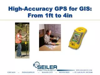
High-Accuracy GPS for GIS:From 1ft to 4in CHICAGO --- INDIANAPOLIS --- KANSAS CITY --- MILWAUKEE --- ST. LOUIS/ST. PETERS
Why High-Accuracy? • Utilities • Collecting assets/features accurately: • collecting existing features or • ‘as-built’ surveys • Relocating assets/features • Local & city government • Urban asset databases • Road centerlines • Construction • Preliminary site surveys • As-built surveys for collecting asset information • Environmental impact reports
Why Mapping-Grade? • If your applications only require 4in-12in, these systems are built for that level of accuracy. • Cost of the high-accuracy mapping systems are typically about half to a third of the cost of a survey-grade unit. • The Trimble Mapping/GIS products are designed to work well with attribute-intensive GIS data collection projects. • They integrate seamlessly with ESRI software such as ArcGIS.
Accuracy Levels • 12 inches • GeoXH’05 or GeoXH’08 or ProXH • 8 inches • GeoXH’05 /Pro XH with Zephyr Antenna • 4 inches • ProXRT / GeoXH’08 with Zephyr (close to base station)
GeoXH (2008) Handheld • <12 inch accuracy after post-processing or VRS • Typically requires 1-2 minutes at each point • 3-foot accuracy in the field with WAAS • Integrated unit can be carried in your hand. No need for cables or a pole/backpack.
GeoXH’08 with Zephyr • 4 inch accuracy after post-processing…depends on distance to base station (also 6in inch vertical) • Typically requires 1-2 minutes at each point • 3-foot accuracy in the field with WAAS. 4 inches when connected to VRS. • Designed for use on a rangepole
ProXH • <12 inch accuracy after post-processing • Typically requires 1-2 minutes at each point • 3-foot accuracy in the field with WAAS • Use with a mobile data collector, tablet, or laptop. • Communication via Bluetooth or serial cable.
ProXH with Zephyr • <8 inch accuracy after post-processing • Typically requires 1-2 minutes at each point • 3-foot accuracy in the field with WAAS • Use with a mobile data collector, tablet, or laptop
ProXRT • <4 inch accuracy after post-processing (<6in vertical) • ALSO…<4 inch accuracy in the field (<6in vertical) • Dependent on base station distance • Typically requires about 30-60 seconds at each point • 3-foot accuracy in the field with WAAS/Beacon • Omnistar/GLONASS capable • Designed for use on a rangepole
Post-Processing • Pathfinder Office • GPS Analyst for ArcGIS • Baseline Requirements: • 50 miles for subfoot • 18 miles for 4 inches (must use zephyr antenna) • 2 options for real-time decimeter (4in) data collection: • Using real-time H-Star technology (VRS) • OmniSTAR HP (ProXRT only) • Real-time data collection • Allows for in field verification...knowing that a feature has been captured to the desired accuracy level streamlines workflow and reduces the risk of recollecting data • For relocating assets accurately and efficiently
Postprocessed DGPS <10cm - 5m
Postprocessed Code Phase Differential • Corrections applied in Pathfinder Office software or GPS Analyst software
H-Star Processing • Corrections applied in GPS Pathfinder Office software or GPS Analyst • Multiple CORS used • Carrier phase float solution generated • One base station within 50 miles or three within 120 miles.
Seiler MWRTK • 60 base stations…and growing • 23 are NetR5 (GLONASS) • www.mwrtk.net
Why use VRS for GIS? • Do not need post-processing software if you are working with Shapefile format. • Increased accuracy • Better than WAAS and Beacon • Doesn’t degrade with distance from the base • All users in common, established co-ordinate frame • Best fit of GIS data with survey/cadastral framework • Integrity monitoring • QA/QC increasingly important for contractors • Availability in places where other RTCM doesn’t reach • Inner cities are well served by mobile phone networks, but don’t tend to be WAAS-friendly
VRSData Flow Reference station data streams back to server through LAN, Internet, or radio links
VRSData Flow Roving receiver sends an NMEA string back to server using cellular modem. Virtual Reference Station position is established. VRS NMEA—GGA
VRSData Flow Server uses VRS position to create corrected observables and broadcasts them to the rover VRS RTCM or CMR+
Cellular Connection • Must have cellular service in your work area • Verizon, AT&T, Sprint, T-Mobile • Data Plan is needed (differs from a voice plan) • Make sure “tethering” is enabled • Carry spare batteries or bring an external battery • A bluetooth cell phone is better • A Nomad “GX” series is best! (AT&T and T-Mobile)
VRS Conclusions • VRS is coming … • Large and recent expansion in the Midwest • The cost of using VRS is declining or is free • Cellular costs dropping; coverage improving • The benefits of VRS are significant • Data quality and consistency • Once availability and cost get to the right level, VRS is expected to be the DGPS source of choice for many applications • Particularly urban/suburban
Omnistar (ProXRT) • 4 in real-time accuracy • After typical initialization time of 20–40 minutes • OmniSTAR removes the need for cellular devices—it’s already integrated • All you need is a subscription which can be obtained conveniently over the air • The GPS Pathfinder ProXRT receiver is capable of receiving Omnistar • North America Pricing: • OmniSTAR XP (for 8in) - $1,500/year/receiver • OmniSTAR HP (for 4in) - $2,500/year/receiver
GLONASS Option (ProXRT) • The GLONASS option increases the number of satellites the receiver can track • Maintain lock on satellites when sky visibility becomes limited • Users can work for longer in tougher environments • The GLONASS option can reduce the initialization time for real-time subfoot data collection • Base stations must also support GLONASS (NetR5) • GLONASS post-processing is not supported
Datums NAD83 (CORS96) • Choosing the wrong datum can greatly shift your data! • NAD27 to NAD83 could mean 50 feet or more. • “NAD83” has different versions • NAD83 (86) • NAD83 (91) • NAD83 (97) • NAD83 (CORS 96) I’m in “NAD83”
Datum Shift • Know your correction source. • WAAS and Beacon are different! • Confirm your base station if post-processing. • Find one base station that works and stick with it. • Do a test point on a known location before starting.
Questions? CHICAGO --- INDIANAPOLIS --- KANSAS CITY --- MILWAUKEE --- ST. LOUIS/ST. PETERS