Download
1 / 90
960 likes | 1.54k Vues
SECTION 7 & 8 FORECAST & PROGNOSTIC CHARTS. FA – Area Forecasts. How many geographical areas in the CONUS? What does SFO mean? How many times a day are FA’s issued for SFO or SLC? How long is the Synopsis section normally valid for? How long is the clouds and weather section valid for

E N D
FA – Area Forecasts • How many geographical areas in the CONUS? • What does SFO mean? • How many times a day are FA’s issued for SFO or SLC? • How long is the Synopsis section normally valid for? • How long is the clouds and weather section valid for • How long is the outlook section valid for?
FA • Can be found by visiting • http://aviationweather.gov/products/fa/ • Alaska • http://aawu.arh.noaa.gov/areaforecasts.php • Contractions from FAA order 7340.2 • http://www.faa.gov/air_traffic/publications/at_orders/media/CNT.pdf
FA 7.1.6 • VFR Clouds/Weather • Gives a general description of clouds and weather which cover an area greater than 3,000 square miles and are significant to VFR flight operations. The forecasts are referenced to states or geographic areas. • Page 17-1 has a geographic area map • Review four bullets on 7-6
FA examples • http://aviationweather.gov/products/fa/
TAF Terminal Aerodrome Forecast • How long are they normally valid for? • How many times a day do they typically come out? • When are the normal start times for TAF’s • http://www.aviationweather.gov/adds/tafs/
International Aviation Route Forecasts (ROFOR) • WFO Honolulu will honor all ROFOR requests for flights within the Pacific Region beginning or ending in, or having most of the flight path within its area of responsibility, which is the Oakland Oceanic FIR south of 30N, between 140W and 130E. • Contain • Winds and temperatures aloft • Significant en-route weather • Zone Weather • Weather Synopsis
ROFOR • http://www.prh.noaa.gov/hnl/pages/aviation.php
FB, FD, … Winds and Temp Aloft Forecast • Winds Aloft, officially known as the Winds and Temperatures Aloft Forecast (These reports were known as "FD" in the US, but are becoming known as "FB", following the World Meteorological Organization (WMO) nomenclature.), • http://www.nws.noaa.gov/directives/010/pd01008012d.pdf
FB – winds and temp aloft • Bulletin Designators. Wind and temperature aloft forecasts are issued in bulletins identified by the data type designator "FB" in the World Meteorological Organization (WMO) • 6-Hour Forecast FBUS31 KWNO • 12-Hour Forecast FBUS33 KWNO • 24-Hour Forecast FBUS35 KWNO
FB • (Extracted from FBUS31 KWNO 051402) • FD1US1 DATA BASED ON 051200Z VALID 051800Z FOR USE 1400-2100Z. TEMPS NEG ABV 24000 FT • 6 hour forecast • (Extracted from FBUS33 KWNO 051402) FD3US3 DATA BASED ON 051200Z • 12-Hour Forecast
Higher winds aloft in WA • Only GEG and SEA (not YKM) • 45,000 53,000 • GEG 245657 233753 • SEA 225057 223753
FB’s • Issued four times a day • Based on data from 00Z and 12Z • Table page 7-43 (7-11) • Model run at 00Z, 06Z, 12Z, 18Z • Available 02Z, 08Z, 14Z, 20Z • Valid for 6 hour • 02Z-09Z • 08Z-15Z • 14Z-21Z • 20Z-03Z
FLIGHT FOLDER • International Flight Folder Documentation Folder http://www.aviationweather.gov/iffdp/ • Weather Depiction & Weather Radar • Volcanic Ash Forecast Guidance http://www.arl.noaa.gov/ready2-bin/ashcurrent.pl • SIGWX old style black and white http://www.aviationweather.gov/data/iffdp/2101.gif • Canadian GFA http://www.aviationweather.gov/iffdp/cacw • Winds and Temp aloft higher altitudes FL 390 to FL500 • TAFs specific routes • METAR’s specific routes • International, Oceanic, Domestic SIGMETs • AIRMET’s • Tropical Cyclones • Volcanic Eruptions • Other (National Radar Composite, International Satellite Imagery)
KMWH 052152Z 20020G28KT 10SM FEW075 14/M01 A2955 RMK AO2 PK WND 22028/2146 SLP009 T01441011 • KMWH 052052Z 21018G26KT 10SM FEW060 13/M01 A2959 RMK AO2 PK WND 21030/2040 SLP020 T01281006 58016 • KMWH 051952Z 22019G35KT 10SM CLR 13/M01 A2961 RMK AO2 PK WND 21035/1948 SLP027 T01331011 • KMWH 051852Z 23019G30KT 10SM OVC070 13/M02 A2964 RMK AO2 PK WND 22030/1850 SLP037 T01281017 • KMWH 051752Z 21014G23KT 10SM CLR 12/00 A2964 RMK AO2 PK WND 22027/1719 SLP037 T01170000 10122 20050 58021 • KMWH 051652Z 20013KT 10SM FEW110 11/01 A2966 RMK AO2 SLP046 T01060006 • KMWH 051552Z 19007KT 10SM CLR 08/00 A2969 RMK AO2 SLP053 T00830000 • KMWH 051452Z 21005KT 10SM OVC110 07/00 A2970 RMK AO2 SLP060 T00670000 56027 • KMWH 051352Z 00000KT 10SM CLR 06/M01 A2973 RMK AO2 SLP068 T00611006 • KMWH 051252Z AUTO 14006KT 10SM CLR 06/M01 A2975 RMK AO2 SLP077 T00561006 • KMWH 051152Z AUTO 16008KT 10SM CLR 06/00 A2978 RMK AO2 SLP087 T00610000 10111 20061 58026 • KMWH 051052Z AUTO 18009KT 10SM CLR 08/M01 A2981 RMK AO2 SLP095 T00831011
TAF 3-5-2012 • KMWH 051739Z 0518/0618 20013KT P6SM FEW110 FM051900 24019G28KT P6SM VCSH BKN060 OVC080 FM052130 26020G32KT P6SM SCT060 BKN100 FM060200 24017KT P6SM SCT080 SCT120 • TAF KMWH 051133Z 0512/0612 19007KT P6SM SCT090 BKN150 WS020/25045KT FM051600 19013G22KT P6SM SCT080 BKN150 FM051900 24019G28KT 5SM BLDU VCSH BKN080 OVC140 FM052300 26020G32KT 6SM BLDU SCT080 BKN120 FM060200 24017KT P6SM SCT080 SCT120
GEG • KGEG 051739Z 0518/0618 21018G24KT P6SM VCSH FEW060 BKN080 BKN200 • FM052000 22023G31KT P6SM -RA OVC035 FM060200 22019G27KT P6SM VCSH BKN040 OVC060 • FM060400 23013G22KT P6SM SCT040 FM061000 22011KT P6SM FEW060
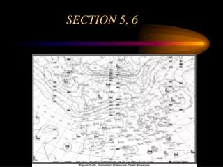
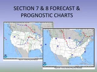
8.1 Short-Range Prognostic (Prog) Charts • Provides a forecast of surface pressure systems, fronts and precipitation for a 2-day period. • Divided into four forecast periods • 12-,24-,36-, and 48-hours.
Surface Prog Chart • Can be found at http://adds.aviationweather.noaa.gov/progs/ • Symbols
CONTENT • Fronts and Squall lines are denoted with the symbols on figure 8-2 • Pressure systems • Depicted by pressure centers, troughs, isobars, drylines, tropical waves, tropical storms, and hurricanes • Isobars are denoted by solid gray lines and labeled with the appropriate pressure in millibars.
PRECIPITATION • Areas are denoted by thick, solid, green lines. • A mix of precipitation is indicated by the use of two pertinent symbols separated by a slash. A bold dashed grey line is used to separate precip. within an outlined area with contrasting characteristics. (eg. Snow from rain)
PRECIPITATION • Shaded areas indicate the precipitation is expected to have more than 50% (broken) coverage. Unshaded areas indicate 30-50% (scattered) coverage.
USE • Short-Range Surface (prog) charts make the comprehension of weather details easier and more meaningful. For example, in figure 8-6 through 8-9, the cold front located from the eastern Great Lakes to Missouri is forecast to move southeastward and the High pressure center just north of the Minnesota/North Dakota boarder is also forecast to move southeast and weaken.
8.2 Low-Level Significant Weather (SIGWX) Charts • Provide a forecast of aviation weather hazards primarily intended to be used as guidance products for pre-flight briefings. • For altitudes 24,000 ft or 400 millibars and below • Give turbulence and freezing level. Icing is NOT specifically forecast. • Shows forecast areas of IFR and MVFR