A2 Natural Hazards
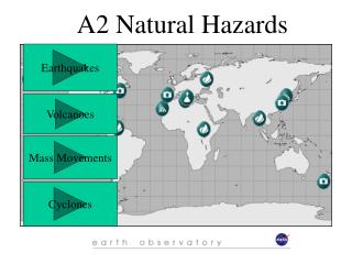
A2 Natural Hazards. Earthquakes. Volcanoes. Mass Movements. Cyclones. OCR Synoptic Paper Outline Hazards Structure Causes, Effects etc. Park Model (1991) Hazards Modules: Earthquakes 2 weeks Volcanoes 2 weeks Mass Movements 2 weeks Tropical Cyclones 2 weeks. 1. Earthquakes.

A2 Natural Hazards
E N D
Presentation Transcript
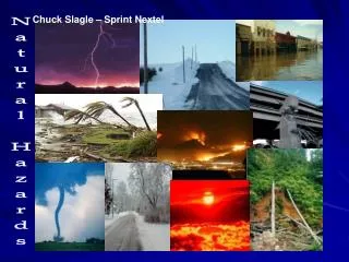
A2 Natural Hazards Earthquakes Volcanoes Mass Movements Cyclones
OCR Synoptic Paper Outline • Hazards Structure • Causes, Effects etc. • Park Model (1991) • Hazards Modules: • Earthquakes 2 weeks • Volcanoes 2 weeks • Mass Movements 2 weeks • Tropical Cyclones 2 weeks
MEDC - LEDC Earthquake Case Studies MEDC Case Studies 1. Kobe, Japan, 17 Jan 1995; RS = 7.2; Deaths = 5,500 2. Los Angeles, USA, 17 Jan 1994; RS = 6.6; Deaths = 40 3. San Fransisco, USA, 17 Oct 1989, RS = 7.1; Deaths = 63 4. Alaska, USA, 27 March 1964, RS = 9.2; Deaths = 131
MEDC - LEDC Earthquake Case Studies LEDC Case Studies 1. Izmit, Turkey: 17 August 1999; RS = 7.4; Deaths = 40,000~ 2. Khillari, India: 30 Sept 1993; RS = 6.4; Deaths = 25,000 3. Gujurat, India: 26 Jan 2001; RS = 7.4; Deaths = 60,000~ 4. Armenia: 7 Dec 1988; RS = 7.0; Deaths = 25,000 - 100,000
The seismic gap theory The part of an active fault that has experienced little or no seismic activity for a long period, indicating the build up of stresses that are useful in predicting earthquakes 1969-1989 3 weeks after 1989
Liquefaction Japan 1963
Port and wharf facilities are often located in areas susceptible to liquefaction, and many have been damaged by liquefaction in past earthquakes. Most ports and wharves have major retaining structures, or quay walls, to allow large ships to moor adjacent to flat cargo handling areas. When the soil behind and/or beneath such a wall liquefies, the pressure it exerts on the wall can increase greatly - enough to cause the wall to slide and/or tilt toward the water. Liquefaction caused major damage to port facilities in Kobe, Japan in the 1995 Hyogo-ken Nanbu earthquake.
Prince William Sound, Alaska 1964 03:36:14 UTC, 9.2 on the richter scale Landslides in Anchorage caused heavy damage. Huge slides occurred in the downtown business section, at Government Hill, and at Turnagain Heights. The largest and most devastating landslide occurred at Turnagain Heights. An area of about 130 acres was devasted by displacements that broke the ground into many deranged blocks that were collapsed and tilted at all angles. This slide destroyed about 75 private houses. Water mains and gas, sewer, telephone, and electrical systems were disrupted throughout the area. This great earthquake and ensuing tsunami took 125 lives (tsunami 110, earthquake 15), and caused about $311 million in property loss. Earthquake effects were heavy in many towns, including Anchorage, Kodiak, Portage, Seward and Valdez. Anchorage, about 120 km Northwest of the epicentre, sustained the most severe damage to property. About 30 blocks of dwellings and commercial buildings were damaged or destroyed in the downtown area. The J.C. Penny Company building was damaged beyond repair; the Four Seasons apartment building, a new six-story structure, collapsed; and many other multi-storey buildings were damaged heavily. The schools in Anchorage were almost devastated. The Government Hill Grade School, sitting astride a huge landslide, was almost a total loss. Anchorage High School and Denali Grade School were damaged severely. Duration of the shock was estimated at 3 minutes.
The earthquake was accompanied by vertical displacement over an area of about 520,00 square km. The major area of uplift trended Northeast from southern Kodiak Island to Prince William Sound and trended east-west to the east of the sound. Vertical displacements ranged from about 11.5m of uplift to 2.3m of subsidence relative to sea level. Off the Southwest end of Montague Island, there was absolute vertical displacement of about 13 - 15m. This shock generated a tsunami that devastated many towns along the Gulf of Alaska, and left serious damage at Alberni and Port Alberni, Canada, along the West Coast of the United States (15 killed), and in Hawaii. The maximum wave height recorded was 67m at Valdez Inlet. It was also recorded on tide gages in Cuba and Puerto Rico.
Close-up of Government Hill elementary school, which was destroyed by the Government Hill landslide. Anchorage, Alaska.
The waterfront at Seward a few months after the earthquake, looking north. Note the "scalloped" shoreline left by the underwater landslides that severed tracks in the railroad yard which dangle over the landslide scarp and the windrow-like heaps of railroad cars and other debris thrown up by the tsunami waves. Alaska.
Uplifted sea floor at Cape Cleare, Montague Island, Prince William Sound, in the area of greatest recorded tectonic uplift on land (33 feet). The very gently sloping flat rocky surface with the white coating which lies between the cliffs and the water is about a quarter of a mile wide. It is a wave cut surface that was below sea level before the earthquake. The white coating consists of the remains of calcareous marine organisms that were killed by desiccation when the wave cut surface was lifted above the high tide during the earthquake.
One span of the "Million Dollar" truss-bridge of the former Copper River and Northwestern Railroad was dropped into the Copper River by the earthquake, and the other truss spans were shifted on their piers.
Close-up of damaged homes at Turnagain Heights landslide, Anchorage.
The Turnagain Heights landslide in Anchorage. Its length was about 1.5 miles; its width was about .25 to .50 miles. This landslide reduced to rubble many of the finer homes of the city. Failure here, and in the "L" Street, Fourth Avenue, and Government Hill landslides in Anchorage occurred on horizontal or near horizontal slip surfaces in the Bootlegger Cove Clay, a marine silt.
A subsidence trough (or graben) formed at the head of the "L" Street landslide in Anchorage during the earthquake. The slide block, which is virtually unbroken ground to the left of the graben, moved to the left. The subsidence trough sank 7 to 10 feet in response to 11 feet of horizontal movement of the slide block. A number of houses seen in this photograph were undercut or tilted by subsidence of the graben. Note also the collapsed Four Seasons apartment building and the undamaged three story reinforced concrete frame building beside it, which are on the stable block beyond the graben. .
This truck at Lowell Point, 2 miles from Seward, was bent around a tree by the surge waves generated by the underwater landslides along the Seward waterfront. The truck was about 32 feet above water level at the time of the earthquake.
A detail illustrating the violence of the surge waves that struck Whittier: man holds mounted tire where wave has driven a piece of wood through the tire
The rails in this approach to a railroad bridge near the head of Turnagain Arm were torn from their ties and buckled laterally by channelward movement of the river banks during the earthquake .
Trees up to 24 inches in diameter and between 88 and 101 feet above sea level were broken and splintered by the surge wave generated by an underwater landslide in Port Valdez, Prince William Sound.
On Tuesday, January 17, at 5:46 a.m. local time, an earthquake of magnitude 7.2 (Mj)1 struck the region of Kobe and Osaka in south-central Japan. This region is Japan’s second-most populated and industrialized area, after Tokyo, with a total population of about 10 million. The shock occurred at a shallow depth on a fault running from Awaji Island through the city of Kobe, which in itself has a population of about 1.5 million. Strong ground shaking lasted for about 20 seconds and caused severe damage over a large area. Nearly 5,500 deaths have been confirmed, with the number of injured people reaching about 35,000. Nearly 180,000 buildings were badly damaged or destroyed, and officials estimate that more than 300,000 people were homeless on the night of the earthquake. The life loss caused by the earthquake was the worst in Japan since the 1923 Great Kanto Earthquake, when about 140,000 people were killed, mostly by the post-earthquake conflagration. The economic loss from the 1995 earthquake may be the largest ever caused by a natural disaster in modern times. The direct damage caused by the shaking is estimated at over ¥13 trillion (about U.S.$147 billion). This does not include indirect economic effects from loss of life, business interruption, and loss of production. Kobe earthquake
One of the key factors in loss of life and damage to buildings in the Kobe earthquake was the extend of the fires that resulted. • The risks are particularly high in Japan because of • high population densities; • very narrow streets and alleys, which cannot act as fire breaks; • numerous old wood-frame smaller commercial and residential buildings mixed in the commercial zones of towns; • unanchored or unprotected gas storage tanks or heaters; • and a mix of collapse-prone old buildings in all built-up areas
KFD had minimal staffing on duty at the time of the earthquake, possibly because the previous day had been a holiday. Initial actions included recalling off-duty personnel and responding to fire calls. Approximately 100 fires broke out within minutes, primarily in densely built-up, low-rise areas of the central city, which comprise mixed residential-commercial occupancies, predominantly of wood construction. Within 1 to 2 hours, several large conflagrations had developed. There were a total of 142 fires reported in Kobe on January 17. Fire response was hampered by extreme traffic congestion, and collapsed houses, buildings, and rubble in the streets. Because of the numerous collapses, many areas were inaccessible to vehicles. Water for fire-fighting purposes was available for 2 to 3 hours, including the use of underground cisterns. Subsequently, water was available only from tanker trucks. KFD attempted to supply water with a fireboat and relay system, but this was unsuccessful due to the relatively small hose used by KFD. An EQE engineer overflew the area at about 5:00 p.m. on January 17 and was able to observe all of the larger fires (about eight in all) from an altitude of less than 300 meters. No fire streams were observed, and all fires were burning freely—several with flames 6 meters or more in height. No fire apparatus were observed in the vicinity of the large fires, although fire apparatus could be seen at other locations (their activities were unclear from the air). Some residents formed bucket brigades (with sewer water) to try to control the flames.
. A typical street scene in a residential and light commercial area of Kobe. A house has collapsed, blocking the very narrow street and preventing access to the area by the fire department. Thousands of narrow streets were blocked like this. In other areas, many of the collapses were traditional buildings with ground-floor stores or shops and second-floor residential units.
Aftershock Maps from Kandilli Observatory and Research Institute
This picture is on the far east end of the rupture. The fault went directly through the school - the chalkboard read something like: "We're all happy because school is out".
This is where 6 large apartments buildings all were completely flattened. Luckily they were uninhabitated. Residents were supposed to have moved in during June, but were delayed. The fault is seen in the foreground. Aykut Barka has a photo taken of this area from a helicopter.