Potomac Ridge Stormwater Management Project Overview - Public Meeting Highlights
300 likes | 444 Vues
This document outlines the Potomac Ridge Stormwater Management Project, as presented during a public meeting by the Montgomery County Department of Environmental Protection on October 7, 2013. The agenda included introductions, background information on the need for the project, objectives, costs, benefits, and a timeline for design and permitting. The meeting addressed crucial topics like stormwater runoff, watershed management, and strategies to improve water quality and protect local streams. It emphasized the importance of community engagement and regulatory compliance to enhance stormwater management in Montgomery County.

Potomac Ridge Stormwater Management Project Overview - Public Meeting Highlights
E N D
Presentation Transcript
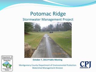
Potomac RidgeStormwater Management Project October 7, 2013 Public Meeting Montgomery County Department of Environmental Protection Watershed Management Division
Today’s Agenda • Introductions • Paul Bogle – Senior Engineer, Montgomery County DEP • Darian Copiz – Watershed Planner; Montgomery County DEP • Doug Streaker – Project Engineer; Biohabitats • Jeff Blass – Project Designer; Charles P. Johnson Engineering • Background Information – Why County is Doing This • Potomac Ridge Stormwater Management Overview • Project Objectives • Project Costs and Benefits • Design and Permitting Timeline • What to Expect During Construction
Sources of Water • About 97% is salt water • About 2% is frozen • Only 1% is available for drinking water • 95% from groundwater across the Country • 32% from groundwater, 68% from surface water in Maryland • Potential for greater impacts from runoff in Maryland
Montgomery County, MD • 500 sq. miles • 1,000,000 people • Second only to Baltimore City within Maryland in average people per square mile • 184 languages spoken • About 12% impervious surface overall • About the size of Washington DC • Over 1,500 miles of streams • Two major river basins: • Potomac • Patuxent • Eight local watersheds District of Columbia Impervious: Not allowing water to soak through the ground.
What is a Watershed? • A watershed is an area from which the water above and below ground drains to the same place. • Different scales of watersheds: • Chesapeake Bay • Eight local watersheds • Neighborhood (to a storm drain)
What is Runoff? • Water that does not soak into the ground becomes surface runoff. This runoff flows over hard surfaces like rooftops, driveways and parking lots collecting potential contaminants and flows: • Directly into streams • Into storm drain pipes, eventually leading to streams • Into stormwater management facilities, then streams Two Major Issues: Volume/Timing of Runoff Water Quality
What is the County doing to protect our Streams? • Must meet regulatory requirements • Federal Clean Water Act permit program • MS4 = Municipal Separate Storm Sewer System • Applies to all large and medium Maryland jurisdictions • County programs • Restore our streams and watersheds • Add runoff management • Meet water quality protection goals • Reduce pollutants getting into our streams • Educate and engage all stakeholders • Individual actions make a difference • Focus on watersheds showing greatest impacts
MS4 permit, what is it? • Montgomery County is responsible for: • What goes into our storm drain pipes • What comes out of them • What flows into the streams • Requires additional stormwater management for 20 percent of impervious surfaces (4,292 acres = 6.7 square miles). That’s about three times the size of Takoma Park. That’s equivalent to 3,307 football fields!
Project Selection • Ponds constructed in early 1980s • Located in a key watersheds (Muddy Branch, Watts Branch) for pond retrofits • Ponds are at or near the end of service life • Meet current safety and design standards • Opportunity for water quality treatment and ecological benefits
Project Location Potomac Ridge
Potomac Ridge 10876 Rich Branch (Muddy Branch) 10887 10891 10847 Sandy Branch (Watts Branch)
Project Objectives • STORMWATER MANAGEMENT • Add permanent pool for water quality where feasible • STREAM PROTECTION • Modify outlet works to better regulate pond discharge and protect Sandy Branch and Rich Branch streams • MAINTENANCE • Replace existing risers with water-tight structures • Replace dam embankment or install impervious liner • Install internal drain in downstream embankments • AESTHETICS/ENVIRONMENT • Landscape the pond to improve aquatic habitat and aesthetics • Augment existing environmental features such as forest and wetlands where possible
Stormwater Pond Drainage Areas • Pond 10847 • 60.4 Acres • 25% Impervious • Pond 10876 • 7.9 Acres • 22% Impervious • Pond 10887 • 58.8 Acres • 16% Impervious • Pond 10891 • 47.3 Acres • 20% Impervious
Pond 10847 • Stormwater Management Dry Pond • 8’ High Earth Embankment Dam • Adjacent residential properties • Does not meet current SWM requirements to achieve any MS4 credit. • Long drainage swale inflow to north end. Existing Metal Outlet Structures Large Outlet Control Orifice Embankment Dam Concrete Inflow Channels
Pond 10847 Proposed Pond Access Re-build Existing Embankment Improve Existing Swale
Pond 10876 Metal riser structure is not in compliance with current standards • Stormwater Management Dry Pond • 7’ High Earth Embankment Dam • Adjacent to County Road • Does not meet current SWM requirements to achieve any MS4 credit. Erosion at Outfall Facility is undersized for drainage area
Pond 10876 Install Infiltration Basin Re-build Embankment Access from Dufief Mill Road
Pond 10887 Metal riser structure is not in compliance with current standards • Stormwater Management Dry Pond • 10’ High Earth Embankment Dam • Existing Pedestrian Path Across Embankment • Does not meet current SWM requirements to achieve any MS4 credit. Concrete Channels Prevent Facility from Operating Properly per Current Standards Access from Grey Colt Drive
Pond 10887 Remove Existing Inlet/Outlet Structure and Provide Additional SWM Treatment Access from Grey Colt Drive Convert Downstream End of Facility to Wet Pond Re-build Embankment
Pond 10891 Metal riser structure is not in compliance with current standards • Stormwater Management Dry Pond • 8’ High Earth Embankment Dam • Does not meet current SWM requirements to achieve any MS4 credit. • Available room for wet pond and potential bioretention terraces Concrete Channels Prevent Facility from Operating Properly per Current Standards
Pond 10891 Potential for Terraced Bioretention along sides of facility Access from Appaloosa Way Re-build Embankment Convert Downstream End of Facility to Wet Pond
Project Objectives - SWM • All ponds - 24-hour detention for stream channel protection • Ponds 10887, 10891 - Permanent Wet Pool • Pond 10847 – Dry Pond • Pond 10876 - Convert to Infiltration area/Dry Pond Combination • Pond 10887 – Install bioswale in-lieu of inlet/outlet structure at Northeast inflow point. • Pond 10891 – Potential bioretention terraces
Project Objectives - Streams • Stream protection • Modify outlet works to better regulate pond discharge and protect Rich Branch and Sandy Branch • Achieve partial to full channel protection volume requirement (depending on pond)
Project Objectives - Maintenance • Maintenance • Replace existing risers with water-tight structures • Install impervious liner on dam embankments • Install internal drain in downstream embankments
Project Objectives - Aesthetics • Landscape all facilities with native vegetation to improve aquatic habitat and aesthetics
Project Costs • Financial – estimated cost of $2.3M financed through MCDEP CIP Program using funds generated through the Water Quality Protection Charge • Recreational – temporary construction impacts to pedestrian path on top of embankments at Pond 10887. • Forest – tree clearing for to comply with state dam safety laws along the downstream toe of the dam. • Traffic – construction traffic enter and exit roadways Monday – Friday, 7AM to 4PM • Neighborhood – construction traffic and noise will typically occur Monday – Friday, 7AM to 4PM
Project Benefits • Water – improved water quality and stream water temperature through better management of runoff • Environmental – reduced downstream discharge allows for natural self-repair of stream channel. Increased aquatic and riparian habitat through landscaping and reforestation. • Recreational – increased aesthetic appeal of ponds • Maintenance – safer operating structure that will require minimal structural maintenance in future.
Estimated Design and Permitting Timeline • Design – September 2013 – March 2014 • Approvals – March/April 2014 • Permits – April 2014 • Bidding –May 2014 • Construction – June - August2014
What to expect during construction • Duration • Approximately 3 months • Construction Hours • Monday through Friday, 7AM – 4PM • Safety • Open sides of site will be fenced with orange construction safety fence to separate construction from residents. • Traffic • Minor impacts to traffic from entering and exiting construction traffic and contractor parking during the day. • Noise • Contractor is required to comply with Montgomery County Noise Ordinance – site elevation will help alleviate noise pollution. • Sediment • Contractor will be required to comply with Montgomery County Sediment Control Permit and not track dirt onto roads
Questions? For more information: • Doug Streaker, 240-499-8531, doug.streaker@montgomerycountymd.gov