Download
1 / 69
700 likes | 718 Vues
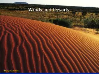
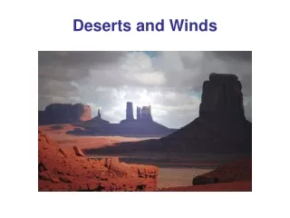
Deserts and Winds. Deserts. Deserts cover about 30% of the Earth’s land surface (42 million square kilometers) No other land climate type covers such a large area. Semiarid, Arid and Deserts.

E N D
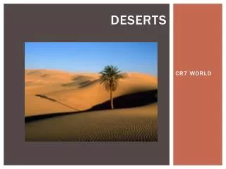
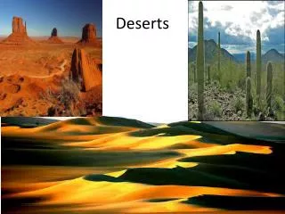
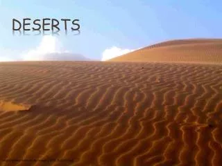
Deserts Deserts cover about 30% of the Earth’s land surface (42 million square kilometers) No other land climate type covers such a large area
Semiarid, Arid and Deserts Semiarid lands, also called steppes, typically receives 250 to 500 millimeters (10 to 20 inches) of rain per year Arid lands receive less than 250 millimeters (10 inches) of rain per year Deserts are formally defined as regions that rarely receive precipitation, typically less than 100 millimeters (4 inches) per year
Deserts True deserts are characterized by having little or no vegetation
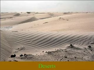
Are All Deserts Sandy? A common misconception is that deserts are only composed of mile after mile of drifting sand dunes For example, only 10% of the Sahara Desert is covered with sand The sandiest desert is the Arabian Desert, which is still only 33% sand
Polar Deserts Many polar regions are technically deserts because they receive little precipitation Polar deserts on Earth cover nearly 5 million square kilometers and range from bedrock to gravel plains to ice sheets
The Sahara Desert The Sahara Desert in North Africa is considered to be the largest desert on Earth In fact it is just part of an even greater desert environment, the low-latitude deserts
The Low-latitude Deserts The low-latitude deserts are a virtually unbroken desert environment stretching for more than 9300 kilometers (5800 miles) from the Atlantic coast of North Africa across the Middle East and into India
The Low-latitude Deserts What created this extensive desert environment?
The Low-latitude Deserts Most desert regions are created by the pattern of the Earth’s air circulation and the topography of the land
The Low-latitude Deserts Along the equator, in the region referred to as the equatorial low, heated air rises 15-20 kilometers up into the atmosphere and then spreads out to the north and south reaching to 20o and 30o latitude
The Low-latitude Deserts Air that rises through the atmosphere, expands and cools, a process that creates clouds and rain For this reason, the areas under the influenced of the equatorial low is among the rainiest on Earth
The Low-latitude Deserts Just the opposite is true at 20o-30o north and south latitudes, where high pressure predominates Here in the zone known as the subtropical high, the dry air from the equatorial low sinks towards the ground
The Low-latitude Deserts When air sinks, it is compressed and warmed This is just the opposite of what is needed to create clouds and rain So the air is very dry
The Sahara Desert The Sahara Desert occurs where the very dry air from the subtropical high sinks downward With no clouds and no rain, the Sahara is dry
The Sahara Desert The world record high temperature of 137o F (57.8o C) was record in El Azizia, Libya, in North Africa’s Sahara Desert on September 13, 1922 This was the air temperature 5 feet above the ground as measured at a French colonial meteorology station
Australia’s Desert In the Southern Hemisphere, dry air sinking down between 20o-30o south latitudes creates the desert in central Australia (and in Southwest Africa) 20o 30o
Rainshadow Deserts Most of the interior of the Western United States is an arid to semiarid environment These dry lands exist because they are in the interior of a land mass, far removed from the ocean
Rainshadow Deserts Many deserts in the middle latitudes, such as in the Western U.S., are rainshadow deserts Moisture laden clouds blowing in from the Pacific Ocean encounter the Coast Range and the Sierra Nevada
Rainshadow Deserts The mountains force the wind and clouds upward in elevation into a region of lower atmospheric pressure and cooler temperatures, where the clouds cannot continue to contain their moisture The clouds drop their rain onto the windward side of the mountains
Rainshadow Deserts Air descending on the leeward side of the mountains is much drier The mountains have effectively cut off the rain from the interior of the U.S., creating a rainshadow desert region
Death Valley Death Valley is a deep valley on the leeward side of the Sierra Nevada Mountains in California During the late Pleistocene, the valley was inundated by prehistoric Lake Manly, but the lake dried up thousands of years ago
Death Valley Badwater Basin, located within Death Valley, is the lowest point in North America with a depth of -282 feet (87 meters) below sea level Surprisingly, just 76 miles (123 km) west of Death Valley, Mount Whitney rises to a height of 14,505 feet (4,421 meters)
Death Valley The highest temperature ever recorded in the Western Hemisphere, 57oC (134oF), occurred on July 10, 1913 in Death Valley
Atacama Desert The Atacama Desert in South America is in the rainshadow of the Andes Mountains and is the driest desert on Earth (some areas may not have had rain for 400 years)
Atacama Desert The Atacama Desert is so dry and lifeless, that it is used by researchers at UTK and Carnegie Melon to test Mars rovers for NASA
Desert Water In most dry environments, it does occasionally rain, such as this thunderstorm over Tucson, Arizona
Ephemeral Streams Most desert streambeds are dry most of the time Deserts have ephemeral streams, which means that they only carry water in response to specific episodes of rainfall
Ephemeral Streams A typical ephemeral stream might flow only for a few days or perhaps just a few hours during the year (or it may stay dry all year)
Ephemeral Streams A basic characteristic of desert streams is that they are small and die out before reaching the sea (which is referred to as interior drainage) Without a steady supply of water, the combination of evaporation and infiltration quickly depletes the stream
Desert Rivers The few permanent rivers that cross arid regions, such as the Colorado River in the western U.S. and the Nile River in Africa, originate outside the desert, often in well-watered mountains The Colorado River starts in the Rocky Mountains
Desert Rivers After the Nile River leaves the its headwaters in the lakes and mountains of central Africa, it traverses 3,000 kilometers (2,000 miles) through the desert without a single tributary
Wind Blown Sediments Wind, like moving water, is turbulent and able to pick up sand and dust, and transport it to another location However, wind is not confined to a stream channel like water, therefore wind can spread sediment over a larger area
Wind Blown Dust Small particles of dust can be swept high into the atmosphere by the wind and can be kept suspended in the air for long periods of time Dust storm North of Stanton, Texas June 13, 2002
Wind Blown Dust The wind can blow fine dust (silt-size) particles over great distances, even around the world This dust storm blew off of the Sahara Desert in North Africa on February 26, 2000 and reached South America 7 days later
Dust Bowl “Now the wind grew strong and hard, it worked at the rain crust in the corn fields. Little by little the sky was darkened by the mixing dust, and the wind fell over the earth, loosened the dust and carried it away.” - John Steinbeck “The Grapes of Wrath”
Dust Bowl The “Dust Bowl” era refers to a series of dust storms in the central U.S. and Canada from 1931 to 1939, caused by decades of inappropriate farming techniques
Dust Bowl The fertile soil of the Great Plains was exposed through removal of grass during plowing
Dust Bowl Then a major, prolonged drought occurred The soil dried out, became dust, and blew away eastwards, mostly in large black clouds
Dust Bowl A month of especially vicious dust storms destroyed 5 million acres of wheat in March of 1935 An economic blow that was felt around the entire nation
Dust Bowl The “Black Sunday” dust storm of April 14, 1935 was so bad that day was turned into pitch black night and most people thought they would die as the storm raged on and on
Dust Bowl During the Dust Bowl, the economy of the Great Plains was nearly destroyed
Dust Bowl "And then the dispossessed were drawn west- from Kansas, Oklahoma, Texas, New Mexico; from Nevada and Arkansas, families, tribes, dusted out, tractored out. Car-loads, caravans, homeless and hungry; twenty thousand and fifty thousand and a hundred thousand and two hundred thousand.” - John Steinbeck “The Grapes of Wrath”
Dust Bowl Economically ruined, perhaps as many as two million people fled from the Great Plains
Desert Pavement In portions of many deserts, the surface is a closely packed layer of coarse pebbles and cobbles too large to be moved by wind This stony veneer is called desert pavement
Desert Pavement Desert pavement is formed when deflation lowers the surface by removing the silt and sand, until only a continuous cover of coarse particles remains
Desert Pavement Once desert pavement is establish, a process that can take hundreds of years, the pavement prevents any further wind deflation However, because the pavement is only a couple of stones thick, disruption by animals, people or vehicles and dislodge the stones and expose fine-grained material below to more deflation
Wind Deposits As with the case for running water, wind drops its load of sediment when its velocity falls and the energy available for transport diminishes So windblown silt and sand can accumulate, forming distinctive geologic features
Loess A deposit of windblown dust is called loess The fine dust in loess is typically only 0.01 to 0.06 millimeter (0.0004 to 0.0024 inch) in diameter There are two primary sources for loess deposits: Deserts Glacial outwash deposits
Loess When breached by road cuts or streams, loess deposits tend to maintain vertical cliffs and lacks any visible layering