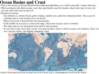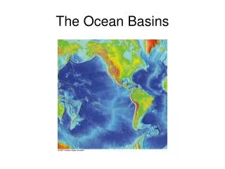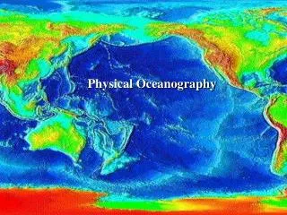
Ocean Basins
Ocean Basins. When early exploration of the oceans began, most scientists believed that the ocean floor was completely flat and featureless Furthermore, scientists believed that the deepest parts of the oceans were located in their center

Ocean Basins
E N D
Presentation Transcript
Ocean Basins • When early exploration of the oceans began, most scientists believed that the ocean floor was completely flat and featureless • Furthermore, scientists believed that the deepest parts of the oceans were located in their center • Soon, however, scientific exploration (and modern technology) unraveled the mysteries of the ocean floor
Ocean Basins • As scientists mapped the ocean floor, they found that the terrain of the sea floor was in fact, highly variable and included deep troughs, ancient volcanoes, submarine canyons, and tremendous mountain ranges • Moreover, they discovered that some of the deepest parts of the oceans are actually close to land, and NOT in the middle!
The ocean floor is mapped by bathymetry • The discovery and study of the ocean floor contours is called bathymetry (“bathy” = deep; “meter” = measure) • Early bathymetric studies involved using a rope and stone, or piano wire and an anchor • The Challenger expedition of the 19th century made 492 bathymetric recordings alone!; but the process is long and tedious
From great tragedy came great innovation • The sinking of the Titanic in 1912 stimulated research that finally ended the slow, laborious weight-on-a-line efforts • By 1914, a former employee of Thomas Edison invented the “Iceberg Detector and Echo Depth Sounder” • Emitted a powerful underwater sound pulse ahead of the ship, and listened for the return echo from a submerged portion of the iceberg
Echo sounders bounce sound off the seabed • In 1922, an echo sounder based on this design was used aboard the USS Stewart, a US Navy vessel which made the first continuous profile across an ocean basin (Atlantic Ocean) • By the late 1920’s, the German research vessel Meteor – using an improved echo sounder – made 14 profiles across the Atlantic Ocean • Revealed the mid-Atlantic Ridge and the obvious coincidence with coastlines on both sides of the Atlantic stimulated discussions of plate tectonics!
An echo sounder record To Land
Multibeam Echo Sounding Fig. 4-3a, p. 79
Satellites Can Also Be Used to Map Seabed Contours • Seafloor features directly influence Earth’s gravitational field • Deep areas such as trenches correspond to a lower gravitational attraction, while large undersea objects such as seamounts exert a stronger gravitational pull, causing the ocean surface to bulge upward • Satellites use microwave beams to measure sea level to within 4cm (1.5 in) of accuracy!
multibeam sounding • Satellite mapping of the ocean floor is more accurate and provides greater resolution than multi-beam sounding satellite
(raised up because hot = buoyant) • The transition between the thick granitic rock of the continents and the relatively thin basalt of the deep sea floor marks the boundary between continental margin and ocean basin
(raised up because hot = buoyant) Continental Margins • Continental margins are shallow water areas close to the continents; they literally are the submerged outer edges of a continent
(raised up because hot = buoyant) Ocean Basins • Ocean basins are deep-water areas farther from land, beyond the continental margin
Continental margins may be active or passive • Continental margins are classified as being either active or passive depending on their proximity to plate boundaries • Continental margins facing the edges of diverging plates are passive because relatively little earthquake or volcanic activity is associated with them • Continental margins near the edges of converging plates are active because of their greater earthquake and volcanic activity
Passive margins • Passive margins are not located on plate boundaries; rather, they are imbedded within the interior of a lithospheric plate, and therefore are not in close proximity to a plate boundary • Why they lack tectonic activity • Usually produced the rifting of continental landmasses and continued sea floor spreading • Also called “Atlantic-type”; e.g., east coast of US
Passive margins Continental and oceanic crust are located on the same lithospheric plate
Active Margins • Active margins are associated with plate boundaries, and are marked by a high degree of tectonic activity • “Pacific-type”; e.g., west coast of US • Two types: convergent and transform depending on whether the margins are associated with convergent (oceanic and continental) plate boundaries, or transform plate boundaries, respectively
Active margins Continental crust distinct (separate) from oceanic crust
Continental shelves are seaward extensions of the continents • The shallow, submerged extension of a continent is called the continental shelf • Continental shelves are underlain by granitic continental crust • Much more like the continent in composition than the ocean floor; continental shelves contain hills, depressions, sedimentary rocks and mineral and/or oil deposits that are similar to those found on nearby dry land
Continental shelves • Taken together, continental shelves make up 7.4% of Earth’s ocean area • The width of any given continental shelf is determined by: • Its proximity to a plate boundary • Shelves at passive margins are wide, while shelves at active margins are quite narrow • Localized water current speed • Fast-moving ocean currents prevent sediment from accumulating • Sea level; determines exposure or submersion
Continental slopes connect continental shelves to the deep ocean floor • The continental shelf extends from the continent to the shelf break, an abrupt transition between the continental shelf and the continental slope • The depth of water at the shelf break is surprisingly constant; 140 meters (460 feet) • The continental slope is steeper than the shelf, and end at the deep ocean basin
The continental slope is composed of sediments transported from the continent
Features of the continental margin • At passive margins (only), a continental rise can also be found at the base of the continental slope • Covered by a blanket of accumulated sediment
Submarine canyons • The continental slope and the continental shelf may exhibit submarine canyons; V-shaped canyons carved by rivers that often terminate in a fan-shaped wedge of sediment
>100 submarine canyons nick the edge of nearly all continental shelves • Hudson Canyon, off the coast of NY and NJ, is a prime example; located off the Hudson River
Turbidity Currents • Submarine canyons are primarily caused by erosion of sediments • Scientists believe that submarine canyons originate from turbidity currents; underwater avalanches of muddy water mixed with rocks and other debris • Strong, erosive currents that move down-slope under the force of gravity (denser than water)
Ocean Basins • The structure of the ocean floor is quite different than that of the continental margins • Here, the seafloor is blanketed with up to 5km (3 miles) of sediment overlying basaltic rocks • Deep-ocean basins constitute more than half of the Earth’s surface • If the oceans evaporated, the oceanic ridges would be the Earth’s most remarkable features
Oceanic ridges • The deep-ocean floor consists of oceanic ridge systems and adjacent sediment-covered plains. In addition, deep ocean basins may be rimmed by trenches or masses of sediment • Flat expanses are interrupted by islands, hills, active and extinct volcanoes • Oceanic ridges are mountainous chains of young, basaltic rock at the active spreading center of an ocean
Oceanic ridges • Ocean ridges girdle the globe like seams surrounding a softball
Oceanic ridges • Oceanic ridges literally cover 40,000 miles of Earth (that’s more than 1.5x the circumference of the Earth) • In some places, these ridges actually project upward to the surface to form islands, such as Iceland, the Azores, and Easter Island
Hydrothermal Vents: The ‘What’ • Some of the most exciting features of the ocean basins are hydrothermal vents • Hydrothermal vents are fissures (volcanic vents) from which geothermally-heated water rise • First discovered in 1977 near the Galapagos Islands near the East Pacific Rise; now believed to be relatively common along mid-oceanic ridges
Hydrothermal Vents: The ‘How’ • Seawater descending through cracks in the ridge floor comes into contact with the very hot rocks associated with active seafloor spreading; the superheated water dissolves minerals and escapes upward through the vents • This superheated water should be released as steam, but exists in liquid form because of the tremendous pressures exerted at this depth!
Hydrothermal Vents: The ‘Who’ • The temperature of water rushing out of a particular hydrothermal vent determines its appearance: • Warm-water vents: <30°C (86°F); emit clear water • White smokers: 30-350°C (86-662°F)!!!; emit white water because of the presence of light-colored compounds such as Barium, Calcium, and Silicon • Black smokers: >350° (662°F)!!!; emit black water because of the presence of dark-colored metal sulfides, such as Iron, Nickel, Copper, and Zinc
The average temperature in the vicinity of hydrothermal vent activity is ~8-16°C (46-61°F), much warmer than usual for ocean-bottom water (~3-4°C)
Hydrothermal Vents • In Iceland, hydrothermal vents exist on dry land • Iceland rests on a mid-oceanic ridge (Mid-Atlantic Ridge) that has lifted above sea level • Underwater, hydrothermal vents host a unique assembly of organisms, fueled by the chemicals dissolved in the vent fluids • Chemosynthetic Archaea form the base of the food chain