Download

1 / 1
10 likes | 118 Vues
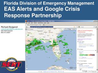
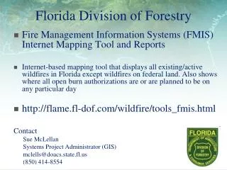
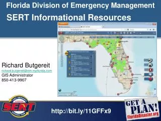
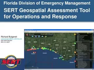
The Florida Division of Forestry provides an Internet-based mapping tool through its Fire Management Information System (FMIS) that allows users to view all active wildfires in Florida, excluding those on federal land. Additionally, the tool displays the areas where open burn authorizations are in effect or planned on any given day. This resource is essential for monitoring wildfires and understanding burn regulations in the state. For more information, visit [FMIS](http://flame.fl-dof.com/wildfire/tools_fmis.html) or contact Sue McLellan at mclells@doacs.state.fl.us or (850) 414-8554.

E N D
Florida Division of Forestry • Fire Management Information Systems (FMIS) Internet Mapping Tool and Reports • Internet-based mapping tool that displays all existing/active wildfires in Florida except wildfires on federal land. Also shows where all open burn authorizations are or are planned to be on any particular day • http://flame.fl-dof.com/wildfire/tools_fmis.html Contact Sue McLellan Systems Project Administrator (GIS) mclells@doacs.state.fl.us (850) 414-8554