Local Decision Maker: Comprehensive Planning for Sustainable Development
260 likes | 355 Vues
Our mission is to assist Indiana communities in making informed, integrated natural resource and economic development decisions. The Local Decision Maker (LDM) program provides tools for comprehensive planning, integrating university research, outreach, and GIS into the process. The program enhances economic development planning through economic diversification indexes, transportation and mobility analyses, and utilizing GIS-based regional data. The LDM foundation offers valuable resources for decision-makers, as affirmed by testimonials from planning professionals. The program is easily transferable and customizable for other regions and countries, supporting data integration from various agencies. Continued phases will focus on regional and national implementation, with potential spinoffs using the program's framework.

Local Decision Maker: Comprehensive Planning for Sustainable Development
E N D
Presentation Transcript
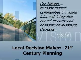
Our Mission ... to assist Indiana communities in making informed, integrated natural resource and economic development decisions. Local Decision Maker: 21st Century Planning
Outline • Background • Overview of LDM • Transferability • Next Steps
Background • Current planning and unintended consequences: • Natural resources/environment. • Urbanization – costs greater than revenues. • 2003 Workgroup (ABE, FNR, AgEcon): • Comprehensive approach. • On-line. • GIS component. • C4E Seed Grant – LDM
LDM Foundation Others Ag. Econ. Ext. AgIT FNR ABE
Objectives • Improve the development and implementation of comprehensive planning (Outcomes). • Integrate university’s research and outreach into plan development. • Incorporate GIS into this planning process. • Employ a 3-5 click framework.
Demonstration http://purdue.edu/ldm
Inventory & Analysis Inventory in one location (value-added)
Open space Value-added analysis
Customized Map Imperviousness Streams Aerial photos Imported subwatershed
Economic Development • Many comprehensive plans include economic development • LDM provides tools for benchmarking • Snapshot of GIS-based local & regional economic data • An opportunity to study economies at a regional scale
Transportation & Mobility • NTAD- National Transportation Atlas Database • FAF2 .2- Freight Analysis Framework Database, FHWA • HPMS- Highway Performance Monitoring System • BTS- Bureau of Transportation Statistics
Using spatial filter Transportation and Mobility Zip codes with employment >=10,000
Rails to Trails • 82 counties in Indiana have certain length of abandoned railroads • ¼ mile buffer • 36% museums, 33% libraries, 43% county courthouses, & 22% schools • Linkages to existing trails
Aviation Infrastructure • 650 airports in Indiana • 65.4% between 0 and 5 miles of CBD • 15% between 0 and 1.5 miles • Public & private use, sea plane, heliports, STOLports
Impacts • A private consultant: “…I am conducting a Brown-Bag for our local office in Indianapolis regarding the tool in a few weeks. This is really an outstanding resource for planners….” • County planning director: “…As planning director for a rural county in Indiana, I can attest to the importance of having access to a tool such as this program to easily access important information related to our community. Without this tool our community would most likely be required to spend several thousand dollars in order to obtain similar information through the use of a consultant….”
Transferability • Program is easily transferable to other states, regions, and nations. • Concept can be customized to fit economic regions (e.g., manufacturing). • Concept supports integration of data and analyses directly from agencies. • Our integration of Phase 1 (Inventory/Analysis) and the map service is well underway. • Other parts of the decision system planned over the next 2 to 3 years. • Regional/National LDM
Next Steps • Completion of Phase 1 (Inventory/Analysis). • Progress on phases 2-4 over the next 2 to 3 years. • Regional/National LDM. • Spinoffs using the underlying concept and framework.
Questions & Answers Sponsors Center for the Environment Purdue Center for Regional Development Illinois-Indiana Sea Grant College Program Purdue Extension Partnering for Land Use Sustainability Thank You! • Richard L. Farnsworth, Associate Professor, Forestry & Natural Resources, Purdue University, rlfarnsw@purdue.edu • Christine Nolan, Senior Associate, Purdue Center for Regional Development, Purdue University, cenolan@purdue.edu • Indraneel Kumar, AICP, Regional Planner: GIS and Spatial Analyst, Purdue Center for Regional Development, Purdue University, ikumar@purdue.edu