Download
1 / 35
350 likes | 504 Vues
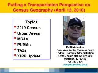
Putting a Transportation Perspective on Census Geography (April 12, 2010). Topics 2010 Census Urban Areas MSAs PUMAs TAZs CTPP Update. Ed Christopher Resource Center Planning Team Federal Highway Administration 4749 Lincoln Mall Dr. Rm 600 Matteson, IL 60443 708-283-3534

E N D
Putting a Transportation Perspective on Census Geography (April 12, 2010) • Topics • 2010 Census • Urban Areas • MSAs • PUMAs • TAZs • CTPP Update Ed Christopher Resource CenterPlanning Team Federal Highway Administration 4749 Lincoln Mall Dr. Rm 600 Matteson, IL 60443 708-283-3534 edc@EdtheFed.com
2010 Census Day - APRIL 1st Short Form Population count Age, Race, Sex, Owner/Renter
What is your Local Response Rate? http://2010.census.gov/2010census/take10map/
Urban Boundaries Census Defined Urban Area (UA) Adjusted Urbanized Area (UZA) Metropolitan Planning Area (MPA) Non-Attainment Area http://www.fhwa.dot.gov/planning/census/faqa2cdt.htm
Boundaries - the Important thing Census Defined Urban Area (UA) - Population + $$$ Adjusted Urbanized Area (UZA) - Functional Class Metropolitan Planning Area (MPA) - MPO Jurisdiction Non-Attainment Area The Letters UZA and UA often get mixed up http://www.fhwa.dot.gov/planning/census/faqa2cdt.htm
Boundaries - some names people use Census Defined Urban Area (UA) Census Urbanized Area (UZA) Adjusted Urbanized Area (UZA) Federal Aid Urban Area (FAUA) FHWA Adjusted Boundary Adjusted Urban(ized) Area Metropolitan Planning Area (MPA) Planning Area MPO Boundary
What’s an MPO? NARC- Status Quo AASHTO -Somewhat Vague FHWA - Internal House - T+I Committee, HR ____ Senate - 100K - Threshold Grandfathering 200K - Project Selection Authority 1 Million+ Special Funding and Requirements http://www.ampo.org/assets/685_finalampopdfoverviewappro.pdf
2000 density based, automated process, identified urban clusters (2,500 pop), ignored place boundaries and built from Census Blocks 2010 Census Bureau still deciding process Investigating use of place of work data via ACS, reviewing land use covers and digital elevation maps and satellite imagery, thinking about using household densities and building from Census Tracts. Look for criteria for defining urbanized areas and clusters in Spring 2010 in Federal Register Census Defined Urban Area (UA) http://www.edthefed.com/uza/UA_Update.pdf feb. 2009
Webinar and other Materials Q/As from Webinar http://ctpp.transportation.org/
Some Final Words on UAs http://www.fhwa.dot.gov/planning/census/faqa2cdt.htm
Metropolitan Statistical Areas Metropolitan and Micropolitan Statistical Areas, Metropolitan Divisions, Combined Statistical Areas Mega Regions
PUMAs? -- What are they? Public Use Microdata Sample PUMSdata is based on individual census records and is available only at large geographic areas. Think of the PUMS dataset as the raw, disaggregate census sample data, at a large enough geographic level necessary to protect the confidentiality of the census respondent. Standard Tabs ACS Sample PUMS Records PUMAs are the zones used from PUMS data
Chicago Why are PUMAs Important? NE Illinois (2008 pop estimate) Tabulation Area for ACS • Annual Data • 65K+ • Note the areas in gray • We call this Swiss Cheese
Why are PUMAs Important? NE Illinois (PUMAs) Tabulation Area for ACS • Represent 100K • Complete Coverage • Smaller than Counties • NO Swiss Cheese
PUMA Geography City of Chicago 2000 PUMAs Why are PUMAs Important? - Defines areas for analysis - Tabulation Area for ACS Who Defines Them? - The Community - Led by State Data Center When are They Defined? - Summer 2011 - Criteria out Spring 2010 2,896,016 (2000 Pop) http://www.census.gov/geo/www/maps/puma5pct.htm
What is the CTPP? CTPP is an umbrella program of data products, custom tabulations, training, technical assistance, and research for the transportation community. CTPP uses data from U.S. Census Bureau, including American Community Survey (ACS). Census Transportation Planning Products
CTPP Program lAll States + DC lAASHTO Led lOversight Board lFive Year period ~ 2011 (2012) Federal Technical Advisory Group TRB Subcommittee -- List Serve (830 strong) Quarterly Newsletter -- Outreach Several Websites
AASHTO CTPP Oversight Board (ACOB) MPOs Kuo-Ann Chiao, NYMTC Steven Gayle, BMTS Mell Henderson, MARC Arash Mirzaei, NCTCOG Guy Rousseau, ARC Clara Reschovsky,MWCOG Pete Swensson, TRPC Vacant Chair: Jennifer Finch, CO(Region IV)Vice Chair: Jonette Kreideweis, MN (Region III) AASHTO Liaison:Penelope Weinberger 17 voting members: 9 states and 8 MPOs Consensus Decision Making Ex Officio Members Ed Christopher, FHWA Melissa Chiu, Census Bureau Alison Fields, Census Bureau Rich Denbow, AMPO Elaine Murakami, FHWA Robert Padgette, APTA Alan Pisarski, Consultant Steven Polzin, USF. CUTR Nanda Srinivasan, TRB John Sprowls, FTA States Laine Heltebridle, PA (Region I) Nathan Erlbaum, NY (Region I) Hui Wei Shen, FL (Region II) Paul Agnello, VA (Region II) Phillip Mescher, IA (Region III) Ahmad Jaber, UT (Region IV) Ayalew Adamu, CA (Region IV)
Special Staff Penelope Weinberger CTPP Program Manager, AASHTO 444 North Capitol Street NE Suite 249 Washington, DC 20001 202-624-3556 pweinberger@aashto.org http://ctpp.transportation.org Melissa Chiu CTPP Program Manager Censu Bureau 301-763-2421, 2454 melissa.c.chiu@census.gov
Data Products 3-Year Data Profiles lUses 2005-2007 ACS lCompares to 2000 lFocused on Transportation lIncludes Significance Tests http://download.ctpp.transportation.org/profiles_2005-2007/ctpp_profiles.html
Coming in September CTPP 3-Year Main Product September 2010 2006, 2007, 2008 20,000 Pop. Areas (County, Place, PUMAs) Actual Flows http://trbcensus.com/products/
2000 Geography Product Structure 3-Parts Part 1-Place of Residence Part 2-Place of Work Part 3-Flows between Home and Work with On-Line Extraction Software Nation (US Total) State State-County State-County-MCD State-Place State-PUMA State-POW PUMA Metropolitan Statistical Area MSA – EACH Principal City The 3-year Product Design http://trbcensus.com/products/3-year_ACS/ctpptables-09apr01-rev2.xls
CTPP 5-year data product CTPP 5-Year Main Product Fall 2012 2006, 07, 08, 09, 2010 Small Areas (Tract, TAZ, Block Group) New TAZs Synthetic Data and Flows
“NEW” TAZs Traffic Analysis Zones • Developed in Summer 2011 • TAZs will nest with TADs • GIS equivalency process • Funded under Consolidated Purchase • FHWA is contacting state DOTs to set up contacts Subcommittee working on TAZs Guy Rousseau-chairing http://trbcensus.com/notes/ACSTAZs.pdf
Building the 5-year data Key product to the whole CTPP effort Hinges on some key research NCHRP Project 8-79($550K) Producing Transportation Data Products from the American Community Survey that Comply with Disclosure Rules Contractor selected Nov 2009 Westat Inc. (signed contact January) http://www.trb.org/TRBNet/ProjectDisplay.asp?ProjectID=2708
CTPP List Serve http://trbcensus.com
“Status Report” newsletter http://www.fhwa.dot.gov/ctpp/status.htm http://www.trbcensus.com/newsletters.html
ACS Data Profiles http://ctpp.transportation.org
Training and Technical Assistance Report 588 A Guidebook for Using ACS Data for Transportation Planning Trend Analysis How to recalculate Margins of Error 275 pages http://onlinepubs.trb.org/onlinepubs/nchrp/nchrp_rpt_588.pdf
Working with ACS A Compass for Understanding And Using ACS Data l Set of user-specific handbooks l Train-the trainer materials l E-learning ACS Tutorial http://www.census.gov/acs/www/UseData/Compass/compass_series.html
Getting Data - Census Standard Products FactFinder http://factfinder.census.gov
What is on your mind? http://www.dot.gov/ctpp http://www.TRBcensus.com http://ctpp.transportation.org For a free copy of these slides go to http://www.edthefed.com/presentations/GIS-T(04-12-2010).ppt