Census Geography
Census Geography. Montana SDC Affiliate meeting Helena November 6, 2013. Geospatial Foundation at Census. Topologically Integrated Geographic Encoding Referencing. TIGER. Classes of Census Geography. Political Geography:


Census Geography
E N D
Presentation Transcript
Census Geography Montana SDC Affiliate meeting Helena November 6, 2013
Geospatial Foundation at Census • Topologically • Integrated • Geographic • Encoding • Referencing TIGER
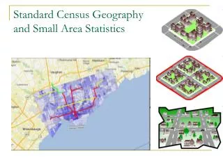
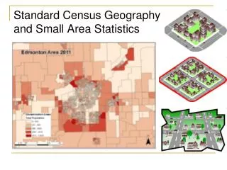
Classes of Census Geography • Political Geography: • States, Counties, Cities, American Indian Reservations, Minor Civil Divisions, etc… • These boundaries may change between censuses • Statistical Geography: • Census Tracts, Census Blocks, Voter Districts, Traffic Analysis Zones, etc… • Designed to display Census data for research and analysis in the public and private sector and most do not change between censuses
Geographic Hierarchy • County • Census Tract • Relatively homogeneous population characteristics • Population ~ 1200-8000 • Block Group • Lowest level for ACS data • Block • Bounded on all sides by visible and nonvisible features • A city block in urban areas
History of the Census Tract 1790 First census First delineation of small geographic areas called sanitary districts 1890 Dr. Walter Laidlaw suggested the delineation of permanent, small geographic areas that would retain their boundary census to census 1906 Dr. Laidlaw divided NYC into “districts” and asked Census to do the same for seven other cities 1910 1920 Dr. Laidlaw published data by district for NYC Howard Wipple became chairman of the Committee on Census Enumeration Areas and promoted the use of census tracts 1930
History of the Census Tract 1940 The census tract became an official geographic entity for which the Census Bureau would publish data. Census tracts covered major cities and block number areas (BNAs) covered many other cities The number of BNAs increased and the criteria of the BNA matched the census tract 1980 1990 Census tracts orBNAs covered the entire nation (and so do blocks) 2000 The BNA concept was retired and census tracts were defined nationwide. 2010 100th anniversary of the census tract!!
Where can you get TIGER data? www.census.gov/geo
Sources of Census Geography • TIGER/Line®Shapefiles • http://www.census.gov/geo/www/tiger/ • Download files by county • Get all levels of geography available for a county or state • TIGERweb • http://tigerweb.geo.census.gov/tigerwebmain/TIGERweb_main.html • Interactive and WMS access to roads, streams and various boundaries that are found in TIGER data. • Shapefiles with Demographic Data • Select Geographic areas with SF1 data pre-joined • Shapefiles or Geodatabases
What About Updates? • How does the Census Bureau keep the geography current?
Some Geographic Participant Programs • Boundary and Annexation Survey (BAS) • Updates all legal boundaries and names • Boundaries used to tabulate data in: • American Community Survey, Decennial Census, Population Estimates Program • Redistricting Data Program • Public Law 94-171 • Participant Statistical Areas Program(PSAP)
Public Law 94-171 • Enacted in 1975, directs the U.S. Census Bureau to provide redistricting data needed by the 50 states. • Specifies that within a year following Census Day (by April 1), the Census Bureau must send the governor and legislature in each state the data they need to redraw districts for the United States Congress and state legislature.
Statistical Areas Program • Involves local governments • Conducted once each decade • Includes; • Tracts • Block Groups • Census Designated Places (CDP)
Summary • TIGER® holds all Census Geography • The public can access the data through TIGER/Line® or via TIGERWeb • Each piece of geography has a unique identifier that is needed to link it to the demographic data