LANDFORMS
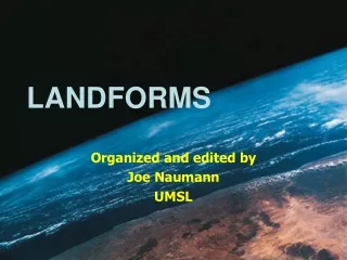
LANDFORMS. Organized and edited by Joe Naumann UMSL. Four Major Categories. Mountains Hills Plateaus Plains. Mountains. Hills. Plateau. Plain. Formation of Landforms. Endogenous forces Resulting from dynamic processes operating beneath the crust of the Earth.

LANDFORMS
E N D
Presentation Transcript
LANDFORMS Organized and edited by Joe Naumann UMSL
Four Major Categories • Mountains • Hills • Plateaus • Plains Mountains Hills Plateau Plain
Formation of Landforms • Endogenous forces • Resulting from dynamic processes operating beneath the crust of the Earth. • Diastrophism: Lifting of a large part of the crust in elevation • Orogeny: Folding, warping, faulting in the crust which may occur as a result of diastrophism. • Volcanism: a process whereby molten rock material from beneath the crust pushes through the crust and builds up the surface of the earth.
Formation of Landforms • Endogenous forces • Landforms (often plains or minor landforms) created from forces outside the earth which act upon the surface and change it. • Weathering: the breaking down of rock by chemical and/or mechanical means into smaller particles in preparation for the next two forces. • Erosion: the removal of weathered materials from higher elevations by moving water, wind, moving ice, and/or gravity. • Deposition: the build up of weathered materials at lower elevations once the force of gravity cannot be overcome by an agent of erosion.
Major Landforms Defined And illustrated
Mountain • landform that rises prominently above its surroundings, generally exhibiting steep slopes, a relatively confined summit area, and considerable local relief. Mountains generally are understood to be larger than hills, but the term has no standardized geological meaning. Very rarely do mountains occur individually. In most cases, they are found in elongated ranges or chains.
Hill • a usually rounded natural elevation of land lower than a mountain – lower in altitude and having less local relief. It has very little level land surface; however, it is usually much less steep than a mountain.
Plateau • a usually extensive land area having a relatively level surface raised sharply above adjacent land on at least one side sometimes referred to as a tableland. The steep surface where it rises sharply above the adjacent land is called an escarpment.
Plateau in the background Plain in the foreground
Plateau surface above & the escarpment Escarpment
Plain • any relatively level area of the Earth's surface exhibiting gentle slopes and small local relief. Plains vary widely in size. The smallest occupy only a few hectares, whereas the largest cover hundreds of thousands of square kilometers. • The majority of the world's most extensive plains were formed as a result of the dominance of erosional and depositional processes over tectonic activity—e.g., uplift or subsidence of the Earth's crust.
The Rock Cycle How Earth materials are formed, altered, destroyed and regenerated
Key points about the rock cycle • Diastrophism and orogeny result from the forces involved in plate tectonics. • These endogenous forces are largely responsible for the creation of mountains, hills, and plateaus. • Once the endogenous forces transform (uplift) the earth’s surface, then exogenous forces begin to further alter the surface.
Rock cycle continued . . . • Weathering begins breaking down rock material into smaller, more easily transported pieces. • Gravity plus moving water, air, and ice remove weathered particles from the higher elevations. • When conditions are such that the power of gravity can overcome the carrying power of moving water, air, or ice, the weathered material settles to the surface at a lower elevation. • The high places are reshaped and lowered, and the lower places are filled in, reshaped & raised.
Some minor landforms created by exogenous forces. For a more complete treatment of all landform types, consult a geology or earth science textbook.
Karst topography • Karst topography is a three-dimensional landscape shaped by the dissolution of a soluble layer or layers of bedrock, usually carbonate rock such as limestone or dolomite. These landscapes display distinctive surface features and underground drainages, and in some examples there may be little or no surface drainage. Some areas of karst topography, such as southern Missouri and northern Arkansas in the USA, are underlain by thousands of caves.
Karst surface features • The karstification of a landscape may result in a variety of large or small scale features both on the surface and beneath. On exposed surfaces, small features may include flutes, runnels, clients and grikes, collectively called karren or lapiez. Medium-sized surface features may include sinkholes or dolines (closed basins), vertical shafts, disappearing streams, and reappearing springs.