Download
1 / 12
120 likes | 140 Vues
Explore the crucial role of Landsat in carbon assessments for climate change mitigation and global sustainability. Learn how Landsat data aids in monitoring carbon cycle dynamics and ecosystem services.

E N D
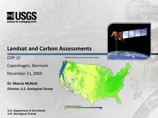
Landsat and Carbon AssessmentsCOP-15Copenhagen, DenmarkDecember 11, 2009 Dr. Marcia McNutt Director, U.S. Geological Survey U.S. Department of the Interior U.S. Geological Survey
Landsat and Carbon Assessments Outline • U.S. Geological Survey (USGS) • A Federal science agency in the U.S. Department of the Interior • Landsat • Provides globally consistent data • A vital tool for carbon assessments • Biological Carbon Studies • Terrestrial carbon sequestration to mitigate climate change • Conclusion Landsat 7: Lena DeltaImage taken 7/27/2000 The Lena River, some 2,800 miles (4,400 km) long, is one of the largest rivers in the world. The Lena Delta Reserve is the most extensive protected wilderness area in Russia. It is an important refuge and breeding grounds for many species of Siberian wildlife. 2
When we try to pick out anything by itself, we find it hitched to everything else in the universe. John Muir The Earth behaves as a system in which oceans, atmosphere and land, and the living and non-living parts therein, are all connected. Global Change and the Earth System Steffen et al. 2005 USGS Science Strategy: A Systems Approach
Landsat: A Global Imagery Archive of Land Features • Land Use/Land Cover • Famine Early Warning • Drought Monitoring • Insurance Risk Management • International Treaty Management • Diverse uses of Landsat data include: • Agriculture • Mapping • Fire/Disaster Management • Carbon Inventory/Credits • Land Use Planning • Deforestation • Global Change • Flood Management • National Security • Ecosystem Management Landsat - a multispectral land remote sensing program dating back to 1972. Landsat satellites 5 & 7 presently operating well beyond their design lives. Landsat Data Continuity Mission (LDCM) is in development.Scheduled to launch in December 2012 – it then becomes Landsat 8. Landsat data continuity required by U.S. law (Land Remote Sensing Policy Act, 1992) USGS has over 2.4 million Landsat images that are the world’s only global, continual, radiometrically accurate record of land cover over the last 37 years. 5
Worldwide Usage of Landsat Imagery Total Landsat Scenes Delivered Since October 1, 2008 • Over 2.4 million images available today • Seven fold increase in scientific and educational users • Data delivered to 180 countries • Exceeded 1 Million scenes delivered on August 17, 2009 1M Daily Average = 3,125 scenes of web-enabled data delivered Cumulative Scenes Delivered (Web-enabled)
Landsat Remote Sensing of Global Change Role in Global Change Research • Climate studies • Human dimensions of global change • Land-atmosphere interactions • Land use modifications of weather and climate • Monitoring climate-driven land dynamics • Changes in snow and ice extent, e.g., glaciers • Changes in fire frequency and severity • Drought cycles • Impacts of land use and land cover change • Carbon cycle dynamics • Changes in ecosystem services, e.g., deforestation • Carbon inventory • Carbon credit verification Landsat Image with Ice and Water Classifications, Baffin Bay Region, June 27, 2000
Landsat: Carbon Sequestration • USGS is mandated by law to assess capacities of ecosystems for carbon sequestration.This is a high priority for the US government. • Remote sensing systems such as Landsat are a critical component of the assessment methodology Land cover and disturbance year Persisting Nonforest 1995 Persisting Forest 1996 Water 1997 Pre-1985 1998 1985 • Remote sensing offers large geographic coverage that is consistent and accurate • Landsat global coverage ensures the assessment can be done for many different global ecosystems • Landsat can detect and characterize major carbon flux drivers: land cover and land use changes as well as major ecosystem disturbances such as fires 1999 1986 2000 1987 2001 1988 2002 1989 2003 1990 2004 1991 2005 1992 2006 1993 2007 1994 • This figure shows all major land use changes and ecosystem disturbances between 1985 and present. Detected and mapped using Landsat imagery.
Carbon Sequestration: Overview • USGS activities • Working with other Federal partners to assess capacities of ecosystems for carbon sequestration and greenhouse gas fluxes under baseline and potential climate, policy, and land management scenarios. • Address land use changes and the effects of disturbances such as wildland fires and drought. • Provide science data to inform development of ecosystem mitigation and adaptation strategies including restoration opportunities and effects of other ecosystem services • USGS objectives • USGS is to provide science data and tools that can be summarized to various scales to understand the future potential behavior of carbon stocks and sequestration by ecosystems, and to support decision-making for future policies as well as alternative land management strategies • Scientific importance, relevance • Stakeholders such as policy makers or land managers require urgent and credible information about the impacts of climate change and the responses of forests, wetlands, and watersheds. • Information needs (such as would be used for a future cap and trade market) are frequently at variable scales, e.g. forests, watersheds, regional or national scales
Carbon Sequestration: USGS Approach Future scenarios: assess past, present and future capacities of ecosystems given climate, policy, and management scenarios Data driven: enhancing wall-to-wall data availability in areas of land use change, ecosystem disturbances, and soil content Comprehensive: address all carbon pools, flux types, ecosystem functions (such as fire) and drivers (such as land changes) Model based: integrate data with land use model, ecosystem disturbance model, and biogeochemical ensemble models Mitigation strategies: data/maps packaged to support development of various mitigation or adaptation strategies Scenarios, input data, model parameters Land use change modeling Policy and land management analysis Integrated modeling & analysis approach Ecosystem disturbance modeling Carbon and GHG flux modeling • User-driven GIS maps, reports, tables, charts • User-derived mitigation and adaptation strategies
Conclusions, Implications • Landsat is a vital tool in supporting evidence-based decisions concerning the mitigation of the impacts of climate change. • Biosequestration is not a silver bullet (a single answer), but an important mitigation tool – domestically and internationally. • Carbon cannot be managed in isolation from other resources; sequestration can and will affect other ecological services. • Carbon sequestration capacities (and rates) are very sensitive to our understanding of ecosystem management, disturbance and response. • In the United States, the Department of the Interior can contribute significantly to America’s carbon reduction goals through restoration and carbon sequestration projects that require significant scientific and managerial expertise.
Science is more essential for our prosperity, our security, our health, our environment, and our quality of life than it has ever been. President Obama At the National Academy of Sciences April 27, 2009