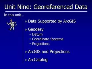
Unit Nine: Georeferenced Data
This unit focuses on the principles of georeferenced data within ArcGIS, including various data types such as shapefiles, geodatabases, and CAD formats. It explains the importance of models, referencing systems, and methods for resolving spatial references. Key topics include the definition of datum, projection types, and coordinate systems. Additionally, it covers essential tools for managing spatial data in ArcGIS, including defining spatial references and metadata handling, ensuring the integrity of mapped information, and facilitating effective data management in geographic information systems.

Unit Nine: Georeferenced Data
E N D
Presentation Transcript
Unit Nine: Georeferenced Data Data Supported by ArcGIS Geodesy Datum Coordinate Systems Projections ArcGIS and Projections ArcCatalog In this unit…
Review • GIS’ depict realityonly approximately! • Required: • Reality • A model • A referencing system • Methods for referencing data within the referencing system
Data Supported by ArcGIS • Several types of data are supported by ArcGIS • Shapefile • ArcInfo Coverage • Geodatabase • CAD • GRID & TIN • ArcGIS uses icons to differentiate.
Data Supported by ArcGIS • Some data is of a complex structure: • Coverages ‘expand’ Layers are ‘inside’
Data Supported by ArcGIS …or a really complex structure • Geodatabases can: • Store all other types of data • Have “Rules” • Support Data models • Be stored in MS Access • Create hierarchical structure of relationships (data sets and data classes) geodatabase coverage shapefile
Spatial Reference • DATUM • PROJECTION • COORDINATE SYSTEM • MAP UNITS
DatumA “Model” Starting Place Datum is defined by... Ellipsoid Size Ellipsoid Shape Location of ellipsoid(relative to Earth)
Ellipse Lumpy Potato DatumHistory Sphere Our idea of the earth’s shape evolved…
DatumCommon Datum(s?) NAD - 83 (North American Datum - 1983) based on GRS-80 ellipsoid NAD - 27 based on Clarke 1866 ellipsoid WGS -84 (World Geodetic System - 1984) based on ellipsoid very similar to GRS-80 USGS GPS
. Map Projections
Projection Transverse Mercator
Spherical Coordinates Planar Coordinates Coordinates & Map Units: A Reference Grid coordinates are NH State Plane map units are US Survey Feet Lat-Lon, aka: “decimal degrees”
Mapping VariablesRecap • The model of the earth on which the data is based?GRANIT DATUM = NAD83 • The manner in which the data from the model is projected?GRANIT PROJECTION = TRANSVERSE MERCATOR • The reference system in which a point is identified/located? GRANIT COORDINATE SYSTEM = NH STATE PLANE • The units used in the coordinate systemGRANIT MAP UNITS = US SURVEY FEET
Projections in ArcGIS fyi: Launch components Tabs – important! Projection Tools ArcCatalog ArcToolbox
Projections in ArcGIS On-the-Fly Projection • Projection for new layers: • Defaults to that of Data Frame • Data Frame defaults to projection of 1st Layer added • On-the-fly DOESN’T change Layer’s original projection • To change original projection, use ArcToolbox Use multiple Data Frames for multiple projections
Projections in ArcGIS • Projected Data? • ArcGIS still has to know about it • Requires “Defining the Spatial Reference” • Projection information is stored differently for different types of data • Shapefile .prj file • ArcInfo Coverage .prj file • Geodatabase RDBMS/internal • CAD world file
Projection Info: from Metadata Metadata: “Data about data” • Documents the data – e.g. all the “variables” • Not always included • Viewable in ArcCatalog • “importable” • Metadata Tab for Datum-Projection-Coordinate System Info • If it’s projected data, does ArcGIS know it?
Metadata Check Out Metadata examples in appendix • FGDC metadata – wicked ugly • But has a ton of useful info: • County codes • HYA=0 is quadlines
clik! Projection Info: from Properties View projection info for different files in different ways coverage • Can’t define spatial reference for coverages from here – need ArcToolbox X ?
clik! Defining Spatial Reference: ArcCatalog View projection info for different files in different ways shapefile • May define spatial reference from here • Select “shape” field • Click elipsis button 1 2
Defining Spatial Reference: ArcCatalog • View projection info for different files in different ways shapefile • Two methods for defining: • Selecting predefined • Importing from other Layer
Defining Spatial Reference: ArcToolbox • Several flavors of Projection Tools • Creating or changing • Defining • Use if data is un-projected, or needs to be re-projected • ACTUALLY CHANGES THE DATA! X • Tells ArcGIS about the projection • Doesn’t change data: creates a new file! Some tools are a little confusing…
One more thing… • You can simplify your world! • “Connecting” to a folder gives you a shortcut • “Connecting” to a web resource or server lets you share data with others
Your turn… Chapter 9: Step 1 through END