Download
1 / 24
250 likes | 437 Vues
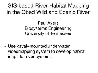
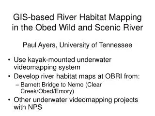
GIS-based River Habitat Mapping in the Obed Wild and Scenic River Paul Ayers, University of Tennessee. Use kayak-mounted underwater videomapping system Develop river habitat maps at OBRI from: Barnett Bridge to Nemo (Clear Creek/Obed/Emory) Other underwater videomapping projects with NPS.

E N D
GIS-based River Habitat Mapping in the Obed Wild and Scenic RiverPaul Ayers, University of Tennessee • Use kayak-mounted underwater videomapping system • Develop river habitat maps at OBRI from: • Barnett Bridge to Nemo (Clear Creek/Obed/Emory) • Other underwater videomapping projects with NPS
GPS-Instrumented KayakAcquires Georeferenced above and below water video and depth sonar
GPS Media-Mapper Front Rear Audio output (GPS output) Audio Input (GPS input) Splash Cam Video input Geo-referenced Image Recording GPS NMEA Data (ASCII) DVD Recorder
Using underwater lasers to determine depth and scale (dot spacing is 7.75 inches) 1.5 to 2.5 ft < 1.5 ft
River Characteristics Pool Riffle Run
Full Extent: River Characteristics Clear Creek (Lily to Canoe Hole)
Full Extent: Substrate Determinations Clear Creek (Lily to Canoe Hole)
Endangered Species Habitat Maps • Spotfin Chub • Dusktail Darter • Cumberland Elktoe • Cumberland Bean • Cumberlandian Combshell • Tan Riffleshell • Littlewing Pearlymussel
Ideal Habitat: Spotfin Chub (Erimonax Monachus) • River Characteristic: Run • Depth: <1.5 ft • Substrate: Bedrock/fines & Boulder
Other Projects: BISO River Habitat Mapping (Canoe and Kayak) Endangered Mussel Habitat
T&E Species Habitat Mapping • Duskytail Darter (endangered) • Smoky Madtom (endangered) • Yellowfin Madtom (threatened) • Spotfin Chub (threatened)
Biscayne NP (BISC)Motorized Reel Underwater Video Coral Reef Mapping and Monitoring
Underwater Camera and Sensors Boat and Equipment Console Depth Sensor GPS Receiver
That’s Enough • Thanks! • Questions? • Lunch? • Projects?