Diarizos River Watershed Management Case Study
150 likes | 201 Vues
Explore the Diarizos river watershed case study in Cyprus covering data collection, geographic domain, communities, land use, geology, water balance, questionnaires, and preliminary results on physical conditions, water management, and water demand.

Diarizos River Watershed Management Case Study
E N D
Presentation Transcript
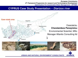
CYPRUS Case Study Presentation – Diarizos river • Presented by: • Charalambos Panayiotou • Environmental Scientist, MSc • Manager Atlantis Consulting ltd Case study area
– PROGRESS – TASKS ACHIEVED TO THE PRESENT TIME
DATA COLLECTION • GIS data of the following: elevation, river network, CORINE land use, groundwater [main aquifer(s), extent, volume, prorosity, conductivity, head changes, springs, wells and well fields, pumping], monitoring stations, water works, communities [population], main industrial units. • hydrographic yearbooks • Mean Daily stream flow 1965/66 to 2000 for Filousa stream gauging weir and for Kouklia stream gauging weir; Mean Daily inflow to Arminou Dam, Daily diversion to Kouris Dam, Diversions outside the watershed • Monthly and 6 monthly water level measurements • Standard chemical analyses for ground and surface waters • Population and population trends • Annual total/average precipitation and temperature; min/max/average, monthly total/average of precipitation (mm/day), temperature (degC), humidity (%), radiation/cloud cover (1/8), wind speed (m/s), potential evapotranspiration (mm/day) [daily?]
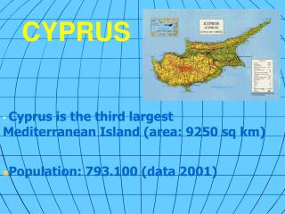
GEOGRAPHIC DOMAIN • The Diarizos river valley covers about 260 km2 in SW Cyprus and extends along approx. 33 km from headquarters to sea • Minimum elevation is 0 m and maximum elevation is 1800 m. • Bunding box [lat/long of upper left (lat: 458,978.47, long: 3,872,690.42) and lower right (lat: 488,606.67, long: 3,838,161.32) corner minimally
COMMUNITIES • Arminou dam • Number of communities in the watershed: 28 • 18 communities downstream of Arminou Dam and 10 communities upstream • Total Population: 3,550 inhabitats • mostly farmers
LANDUSE • Cultivated crops in watershed: DECARS • (1000 m2) • Citrus: 880 • Deciduous : 1460 • Olives: 250 • Vines: 130 • Fodder: 80 • Potatoes: 30 • Vegetables: 30 • TOTAL 2860
GEOLOGY • IGNEOUS ROCKS 43% • ( All are upstream of Arminou Dam ) • MAMONIA (MELANGE) 13% • CHALKS 19% • CHALKS AND MARLS 24% • ALLUVIUM 1%
WATER BALANCE • Dhiarizos Watershed Area up to Kouklia stream gauging weir: • Total area: 260 km² • Precipitation: 680 mm • Mean Annual Runoff (1965-1998) : 25 Million m³ (MCM) or 96mm • Median Annual Runoff (1965-1998) : 19.3 Million m³ (MCM) or 75mm
QUESTIONNAIRES to Stakeholders The questionnaires together with a cover letter translated in Greek were sent to the following stakeholders • Several departments/services of the Ministry of Agriculture, Natural Resources and Environment (Water Development Department, Environment Service, Forest Department, Department of Fisheries & Marine Research) • Ministry of Interior • Cyprus Tourism Organisation • Pancyprian Farmers Union • Agricultural Organisation • Federation of environmental & ecological organisations of Cyprus • Friends of the earth One questionnaire was filled in and returned via a personal interview.
QUESTIONNAIRES – Preliminary results Physical conditions • Only the upper reaches of the river has continuous (all year round) flow (until Arminou dam). The rest of the stream flows during and soon after the raining season (December-April). During summer most part of the watershed is dry. • Floods are very rare and they do not constitute an issue. The only damage that can cause is to cover some fields and damage some minor water works. On the contrary, droughts are an important issue. They tend to occur in series of 2-3 consecutive years. During 1990-2000, for example only 2 years were wet years. • The most significant factor affecting both the quality and quantity of groundwater is the overpumping. This creates sea intrusion and intrusion of water of lower quality from lower groundwater levels.
QUESTIONNAIRES – Preliminary results Water Management • Absence of a River Basin Management Plan (is expected by the stakeholders to be prepared by 2009, according to the requirements of the Directive 2000/60/EC) • There is fragmentation of competences among different institutions and it is not clearly defined. The main stakeholders in relation to the application of the regulatory framework are the Water Development Department & the Ministry of Interior. • The water management is Governmental task; the private sector is not involved • The regulatory framework is based on legislation that is old and that is focused on social and not environmental and ecological factors. (e.g. promotion of the agricultural sector). Not taking into account long term sustainability • Unclear allocation of water use rights • Water pricing is sectoral. Only water that is used from governmental works (dams, storage basins) is charged. Water from boreholes and river diversions if free. No incentives for efficient water use.
QUESTIONNAIRES – Preliminary results Water Demand • On one hand, there is increasing stress on water resources due to unsustainable consumption pattern and uncontrolled uses, but on the other hand, the population growth is limited because the rural population is decreasing. • The sectors that the most water demand is attributed are the household and agricultural sectors. • The water demand due to tourism in the watershed is limited; mainly agrotouristic developments. The temporal distribution is usually unfavourable, with the peak demand coinciding with the periods of minimal water availability (summer). • The industrial units in the watershed are mainly livestock units and small industries. Thus, there is not large water demand from industries.
QUESTIONNAIRES – Preliminary results Water Supply • Surface water from Arminou dam is used for irrigational purposes in the watershed, but also water is diverted to Kourris dam (inter-basin transfer) • For agricultural purposes water from the Arminou dam can be supplied in agreed agricultural areas, where many fields can be supplied with water. The pressure of the water supply is strong enough to permit the use of efficient irrigation systems. • In times of drought, there is decrease of irrigation (40%). Plants are irrigated only for survival. • Water distribution networks (canal & pipes) do not suffer many losses. • In addition, ecological flow (around 40l/sec) from Arminou dam is released and this is also important for the enrichment of the groundwater aquifer. • There are also storage basins (around 100m2), that are used for water supply in time of water shortage • Groundwater is used mainly for household needs and for agricultural purposes. • Groundwater from the southern part of the watershed in used by communities outside the watershed and by Pafos Water Board. • Waste water discharges do not constitute an important issue