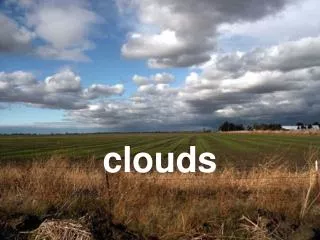
Clouds
Clouds. 6 th Grade Science. Clouds. Water from the earth’s surface moves into the air by EVAPORATION and becomes WATER VAPOR. Clouds are formed when rising air is cooled and the water vapor condenses on particles in the air and forms tiny water droplets.

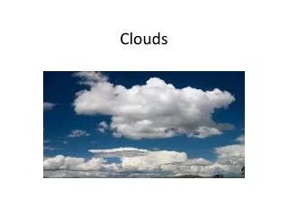
Clouds
E N D
Presentation Transcript
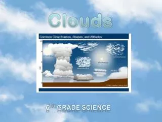
Clouds 6th Grade Science
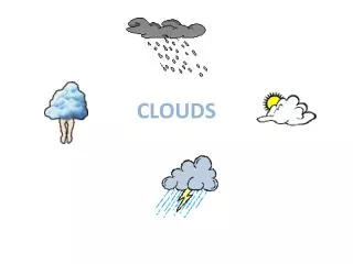
Clouds • Water from the earth’s surface moves into the air by EVAPORATION and becomes WATER VAPOR. • Clouds are formed when rising air is cooled and the water vapor condenses on particles in the air and forms tiny water droplets. • The temperature at which condensation occurs is called dew point. • Sunlight reflected on the water droplets allow us to see the clouds • What is in the clouds:1. Salt: ocean water2. Dust: rock particles, meteor dust3. Smoke: burning fossil fuels, volcanic activity4. Pollution Brainpop: clouds
How Clouds Form • Clouds form when warm, moist air rises and cools. Water vapor condenses on tiny particles to form liquid water or ice crystals.
How Air Rises • Sunshine – heat from the sun or warm ground warms the air and makes it lighter. • The terrain – air may rise as it is forced upwards due to changes in the terrain (landscape). • A front – air can also rise at a weather front. At cold fronts, cold air is pushed under warm air, forcing it upwards and at a warm front, warm moist air is forced up and over the cold air.
Thunderstorm Formation Moisture - to form clouds and rain. Unstable Air - relatively warm air that can rise rapidly. Lift - fronts, sea breezes and mountains are capable of lifting air to help form thunderstorms.
Water Droplets • Droplets come in many sizes. A raindrop has about one million times as much water in it as a cloud droplet.
Clouds are classified by shape and by altitude (how high they are)
Clouds are formed by the condensation of water in the atmosphere. • Certain types of clouds are associated with specific weather conditions. • Air movement causes clouds to take different shapes, forms, and designs.
Cloud Types • The speed and direction of movement of clouds are determined by the wind. • Large fluffy clouds are formed when air moves vertically. • Layered cloud shapes are formed when air moves horizontally.
Notes • Title your notebook page CLOUDS. • Enter the page into your Table of Contents. • On a piece of notebook paper copy down anything that is in purple. • Also copy the cloud symbol • You will use these notes for an assignment so pay attention!!
Cumulus (vertical forming) • Cumulo (means "heap“ or “pile”) refers to piled-up clouds. • Fair-weather clouds • Common on sunny days
Cumulonimbus (thunderhead)vertically forming • Nimbo (means "rain") indicates that the cloud can produce precipitation (rain, snow, or other forms of falling water). • Cumulo (means "heap“ or “pile”) refers to piled-up clouds. • Dark storm clouds, produce rain • Anvil, column- shaped • Associated with thunderstorms
Stratus (low) • Strato (meaning "layer“ or “spread out”) refers to flat, wide, layered clouds. • Smooth layers of low clouds. • They are the light grey clouds that give winter skies a dull grey color. • Usually associated with moist weather- drizzle, rain, snow, or small ice particles • Low, flat, & grey • Called fog when it touches the ground
FOG A stratus cloud in contact with the ground.
Nimbostratus (low) • Nimbo (means "rain") indicates that the cloud can produce precipitation (rain, snow, or other forms of falling water). • Strato (meaning "layer“ or “spread out”) refers to flat, wide, layered clouds. • Smooth layers of dark, grey clouds • Usually bring steady continuous rain or snow. • These clouds are thick enough to blot out the sunlight. • They are shapeless with irregular edges.
Stratocumulus (low) • Strato (meaning "layer“ or “spread out”) refers to flat, wide, layered clouds. • Cumulo (means "heap“ or “pile”) refers to piled-up clouds. • Piles of clouds in layers • Associated with a chance of drizzle or snow. • Sheets of low, lumpy, and grey clouds
Altocumulus (middle) • Alto (means "high") is a prefix given to mid-altitude clouds (between 6,000 and 20,000 feet). • Cumulo (means "heap“ or “pile”) refers to piled-up clouds. • Piles of clouds in waves • Mid-level fluffy • Usually associated with rain or snow.
Altostratus (middle) • Alto (means "high") is a prefix given to mid-altitude clouds (between 6,000 and 20,000 feet). • Strato (meaning "layer“ or “spread out”) refers to flat, wide, layered clouds. • Thick sheets of grey or blue clouds • Usually associated with rain or snow.
Cirrus (high) • Cirro (means "wisp or curl of hair") is a prefix given to high-altitude clouds (above 20,000 feet). • High-level, wispy • Feather-like clouds made of ice crystals • Formed by ice crystals which give the cloud a thin, wispy, or feathery appearance • Usually associated with fair weather
Cirrocumulus (high) • Cirro (means "wisp or curl of hair") is a prefix given to high-altitude clouds (above 20,000 feet). • Cumulo (means "heap“ or “pile”) refers to piled-up clouds. • Cottony clouds in waves • Usually associated with fair weather
Cirrostratus (high) • Cirro (means "wisp or curl of hair") is a prefix given to high-altitude clouds (above 20,000 feet). • Strato (meaning "layer“ or “spread out”) refers to flat, wide, layered clouds. • Sheet-like, high-level layers of ice crystals • Thin sheets of clouds. • Sometimes looks like a halo around the sun or moon. • Usually associated with rain or snow within 24 hours.
Cold Front Cold Front: The zone where cold air is replacing warmer air Creates tall thunderstorm clouds
Warm Front Warm Front: The zone where warm air is replacing colder air Creates many types of clouds
Stationary Front Stationary Front: When either a cold or warm front stops moving Creates thin clouds the cover a lot of sky
Cloud Notes • Strato (meaning "layer“ or “spread out”) • Nimbo (means "rain") • Cumulo (means "heap“ or “pile”) • Alto (means "high") • Cirro (means "wisp or curl of hair")
Making Your Cloud Diagram You will need 1 sheet of 8 ½” x 11” of paper and a pencil
thunderhead HIGH CLOUDS Feathery crystals Cirrus Cirrocumulus Cirrostratus MEDIUM CLOUDS Cumulonimbus altocumulus Altostratus Fair weather Fluffy & puffy VERTICALLY FORMING CLOUDS rain thunderhead Flat & gray LOW CLOUDS Stratocumulus Stratus Nimbostratus Cumulus