MIM Systematic Procedure
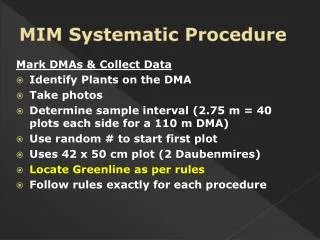
MIM Systematic Procedure. Mark DMAs & Collect Data Identify Plants on the DMA Take photos Determine sample interval (2.75 m = 40 plots each side for a 110 m DMA) Use random # to start first plot Uses 42 x 50 cm plot (2 Daubenmires) Locate Greenline as per rules

MIM Systematic Procedure
E N D
Presentation Transcript
MIM Systematic Procedure Mark DMAs & Collect Data • Identify Plants on the DMA • Take photos • Determine sample interval (2.75 m = 40 plots each side for a 110 m DMA) • Use random # to start first plot • Uses 42 x 50 cm plot (2 Daubenmires) • Locate Greenline as per rules • Follow rules exactly for each procedure
Located by pacing ▲ ▲ Flow Systematic Procedure • Monitoring the DMA (the turn-around) • Sample entire length of DMA, Both sides • At the top of the DMA, measure the distance from last plot to marker, cross to the other side measure the remaining part of the plot interval& place the frame for the next plot. Continue downstream to the lower marker.
Greenline Rules Important for precision - repeatability
The Greenline is identified by: • A. Perennial Herbaceous Vegetation, Shrub/Tree Seedlings, Embedded Rock, Anchored Wood (or any combination) • …the length & width of 1 quadrat (20 by 50 cm) with no patches of bare ground, litter, or nonvascular plants greater than 10 percent of the plot (10 by 10 cm - 4”) & that meet all rules.Rocks<15 cm = bare ground. • OR • B. Overstory of Young and/or Mature Shrubs or Trees
The greenline is approximately parallel with the stream flow. Adjust the frame to until it meets the criteria or exceeds 75° from parallel
A. Perennial Herbaceous Vegetation, Shrub/Tree Seedlings, Embedded Rock, Anchored Wood 1. Perennial Herbaceous Vegetation, Shrub/Tree Seedlings: 25% live foliar cover rooted in plot (Shrub & Tree Seedlings = less than .5 m tall)
Foliar cover equals the shadow cast if the sun was directly overhead. Here, at least 25% of the plot is shaded/covered, and uncovered patches do not exceed 10 cm or 4 inches – thus this is the greenline. YES
2. Embedded Rock:Must be greater than 15 cm (6”) diameter w/ no erosion and above the scour line (cannot be in the active channel)
3. Anchored wood:Cannot exhibit erosion and must be above the scour line (cannot be in the active channel) Log (Wood) Rock
B. Overstory of Young and/or Mature Shrubs or Trees: • Young/mature shrubs or trees (at least .5 m tall): Greenline is at base of young or mature shrubs/trees (foliar cover not considered)
B. Overstory of Young and/or Mature Shrubs or Trees with no understory:Woody overstory,no understory & canopy over plot, place frame on simulated line connecting the rooted base parallel to the stream. Canopy not over plot, continue moving perpendicular to stream until rule is met. NO YES
C. Exposed Roots: Exposed live shrub or tree roots above the scour line of the stream are part of the greenline
D. Flooded Greenline:Avoid sampling when the greenline is flooded during high streamflow
E. Perennial Vegetation Growing in Water: Some perennial vegetation, e.g., spike rush, sedges, rushes, or willows, may grow in the margins of the stream in slow backwaters or even inside the wetted channel at seasonal low flow. When this occurs, the greenline is at the edge of the water
F. Plants Occupying the Entire Wetted Channel: For dewatered channels and channels with very low flows, if the vegetation occupies the entire width of the channel, the greenline is at the deepest part of the channel
G. Floating Plant Species:Are NOT part of the greenline (rooted brookgrass is greenline) BROOKGRASS (Catabrosia aquatica) American Speedwell (Veronica Americana)
H. Detached Blocks of Vegetation: “Slump blocks” not attached to the terrace wall are NOT part of the greenline Block detached from streambank Fracture
I. Islands:Islands are not included in greenline (Island = areas surrounded by water at low flow or bounded by a scoured channel lacking perennial vegetation) Active Channel Islands
J: No Greenline Present:When the greenline is not present within 6 m from the water’s edge, the greenline is considered absent at that plot & bank monitoring is done at edge of 1st bench