Download
1 / 20
200 likes | 360 Vues
Global Monitoring for Food Security. UN International Workshop on the Use of Space Technology for Disaster Management Mirko Gregor, GIM Munich, 20 October 2004. GMFS Project - Context. GMES G lobal M onitoring for E nvironment and S ecurity Joint EC and ESA initiative

E N D
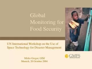
Global Monitoring for Food Security UN International Workshop on the Use of Space Technology for Disaster Management Mirko Gregor, GIM Munich, 20 October 2004
GMFS Project - Context • GMES • Global Monitoring for Environment and Security • Joint EC and ESA initiative • unites research, development and operational communities • operational capacity by 2008 for monitoring the environment and security of our planet • responds to user needs • GMFS • Global Monitoring for Food Security • is one of 12 projects in GMES Service Element program of ESA • shows what Earth Observation can do for improving food security
GMES Service element (GSE) - Schedule 2003 – 2004: consolidation phase .. identify a portfolio of services that can offer a cost-effective response to already established long-term needs for global monitoring information and can serve the public interest in specific environmental & security policy domains.. 2005 - 2008: implementation phase .. Implementation of the services as proposed in the consolidation phase.. > 2008 .. Operational (& sustainable) service..
Famines around the world in 2003 • Main reasons: • Poverty • Inadequate governmental management and policies • Inadequate management of natural resources and environment • Population dynamics, diseases • Racial and gender discrimination • Episodic climatic events and climate changes
Facts & Figures 2003 - 2004 Sudan: 3.6 Mi need Food assistance Eritrea: 1.4 Mi vulnerable people Ethiopia: 7.2 Mi require assistance 13.2 Mi in 2003 Malawi: 0.5 Mi in 2003/2004 Mozambique: 950,000 drought affected vulnerable people Angola/Zimbabwe: 1.4 Mi / 4.4 Mi
Policies – GSE GMFS • Transnational institutions involved in FS (FAO, WFP, JRC) • Universal declaration of Human rights (1948) • World Food summits (1996, 2002) • UN millennium declaration (2000) • World Food Summit on Sustainable Development (2002) • Council Regulation (EC) No 1292/96 on food aid policy • Regional Institutions involved in FS • CILSS (1973: 9 countries) • SADC (1980: 14 countries) • IGAD (1996: 7 countries) • National Institutes involved in FS (Senegal, Malawi, ..) • Monitor the food/agricultural situation and propose corrective measures
User needs • Need for accurate and timely agricultural statistics • EO based vegetation indices have demonstrated value in agricultural monitoring. Currently available agricultural models do not meet the required accuracy. The GMFS services reveal the potential to meet our needs. I look forward to planned enhancements, especially with regard to MSG. • Papa Boubacar Soumare, CSE, responsible agricultural monitoring • Need for transparent information on agricultural production • EO has made a unique and critical contribution to our awareness of environmental trends, especially when time series have been presented as evidence of environmental degradation. This information is essential to those who are trying to model the consequences of these trends for policy analysis and advocacy. • Henri Josserand, Chief GIEWS, FAO (Comments on the GMFS Strategic Orientations)
Existing precursor systems • FEWS Net- USAID Famine Early Warning System • GIEWS - FAO Global Information and Early Warning System • VAM - WFP Vulnerability Analysis and Mapping • MARS FOOD - Monitoring Agriculture with Remote Sensing (EC/JRC) • EARS - Environmental Analysis and Remote Sensing • AP3A - Alerte Précoce et Prévision des Productions Agricoles (CILSS/Agrhymet - Sahel) • SADC - Regional Early Warning System for Food Security • DMC - Drought Monitoring Centers (SADC/IGAD)
GMFS Objectives • To improve the provision of operational and sustainable information services • To consolidate and complement existing early warning systems (national and transnational precursor systems) for food security and famine • To provide crop information (yield, acreage and production) derived from earth observation (EO) data of low-, medium- and high-resolution (multi-scalarity) in combination with agrometeorological models • To assist food security decision makers from a local to a global level
What & Where 2003-2004 “Crop Monitoring system” • Areas under cultivation • Yield forecasting and historical trends • Production forecasting and trend analysis Geographic coverage • Sub-Saharan Africa • Selected sites (Senegal, Malawi)
Which multi-scale information is generated? Continental & Regional Scale Low resolution sensors Rainfall, Relative Evapotranspiration, Relative Crop Yield, Vegetation Indices and corresponding trends Crop Acreage Growth Status and Acreage Crop Acreage Major Land Cover Map & Changes National Scale Medium resolution sensors & models Field Data Yield Forecast and Estimated Harvest Time Crop Acreage Growth Status and Acreage Major Land Cover Map & Changes Crop Acreage Subnational Scale High resolution sensors Acreage at Planting Time Production during the Crop Season Land Cover Information Production at Harvest Time Season Development Status Indexand Impact Index on Food Security Socio-Economic Data Time Begin Crop Season End Crop Season
TRENDS AND FORECAST FIGURES Dry Matter Productivity Relative ET Land Cover Map Regional Yield Forecast Maize Yield Forecast CROP FIGURES National Acreage Land Cover Map Yield Sub-national Production Acreage Map Global/Continental Dry Matter Productivity
Continental productSPOT-VGT DMP Dry Matter Productivity proxy for the crop/pasture/vegetation yield (quantitative estimation)
Regional products - METEOSAT multi-temporal yield estimation Yield estimation for Maize during dry period in 2002 in Southern Africa
Malawi - Zomba test zone: ENVISAT ASAR acreages preliminary results (validation ongoing) cumulative from 7 Dec 2003 to 30 Jan 2004 Cropped area Forest
User/collaboration scheme • SADC-RRSU • CILSS-Agrhymet • CSE, Senegal • DAPS, Senegal • MoAIFS Malawi • FAO-GIEWS • WFP-VAM • MARS-FOOD Affected populations
Partners & alliances • FAO-GIEWS • FAO Global Information and Early Warning System • EC-JRC MARS-FOOD • WFP/VAM • WFP Vulnerability Analysis and Mapping • IBIMET AP3A (CILSS) • Alerte Précoce et Prévision des Productions Agricoles • FEWS Net • ESA TIGER initiative - GMFS demonstrator project
Information dissemination • GMFS Service Portal • establishment of a FAO Geonetwork node in 2005 • on national/sub-national level dissemination via existing networks (WorldSpace community radio network in 2005)
Capacity Building and Institutional Development5 groups of synchronized activities • Evaluation of the efficiency of the national FSIEWS and identification of training needs • Sensibilisation activities aiming at the decision makers • Information dissemination activities about the new EO technologies • Training activities for the assurance of adequate technology transfer • Technical courses on the use of EO • Technical courses on collection, management and dissemination of data relevant for food security • Advanced training for trainers – « the champions of GMFS » • GMFS: use of existing networks for technology transfer and CB • monitoring and evaluation of the process
More information? • Contact • project co-ordinator – Dirk Van Speybroeck dirk.vanspeybroeck@vito.be • Project manager – Lieven Bydekerke lieven.bydekerke@vito.be • Read more on: • http://www.gmfs.info