Download
1 / 58
580 likes | 603 Vues
EPSRC Infrastructure & Environment Programme. D ispersion of A ir P ollutants & their P enetration into the L ocal E nvironment. Background Activities to date Results - tracer & wind tunnel Future plans. Consortium. University of Surrey Alan Robins

E N D
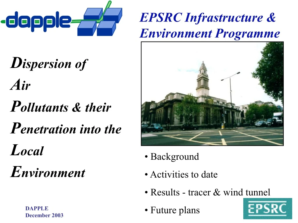
EPSRC Infrastructure & Environment Programme Dispersion of Air Pollutants & their Penetration into the Local Environment • Background • Activities to date • Results - tracer & wind tunnel • Future plans
Consortium • University of Surrey Alan Robins • Imperial College Roy Colvile • University of Bristol Dudley Shallcross • University of Cambridge Rex Britter • University of Leeds Margaret Bell • University of Reading Stephen Belcher A 4 year EPSRC funded project, supported by: • London -> ALG/APRIL/EA/Local Government/TfL • DEFRA, AEQ Division • DSTL (Porton Down), HSE • Meteorological Office
Background “… We do not yet have the understanding needed to answer fundamental questions about pollution behaviour over short distances in the urban environment. …” • DAPPLE aims: • to enhance understanding of pollutant dispersion and individual exposure to pollutants in urban areas • to improve predictive ability • to enable better planning and management of urban air quality and ‘incidents’
Output • The basic understanding gained will be used: • in the evaluation and development of appropriate decision support tools and risk assessment methodologies • in the evaluation and development of best practice guidelines for their application • in assessing the inherent uncertainty in their use • in assessing their contribution to the sustainable development of safer, more pleasant cities. • As far as possible, DAPPLE deliverables will be of generic value and applicable both within UK urban areas and others overseas.
Street intersections - the urban environment 100 Relative flow rates at the intersection; off-set 0.6H 49 56 100
LDA mean velocity measurements within canyons Block size: 4H x 6H x H 1:1 Orientation 10degs Highly unsteady exchanges C predicted C measured Intersection modelling Regulatory models (ADMS) don’t model intersections - CFD does a reasonable job for a simple 4 block geometry.
300 degs receptor Classic street canyons N Measured Street Canyon Pollution Levels in Jagtvej
In an urban setting: • How do we predict the movement of pollutants in & over a street network? • What are best practices in the urban context? • How much detail is necessary? • What area needs to be modelled and to what resolution? • How do we best go about managing & improving local urban air quality? • What tools are needed to deal with these matters? • How should these be developed for incident management?
Activities • Vehicle movement analysis • Emissions modelling • Tracer experiments • Individual dose measurement • Air quality monitoring • Wind tunnel studies • Model evaluation & development Marylebone Rd - Gloucester Place intersection
Key times 2002 April: project start 2003 Spring: initial field trials Monitoring studies: 28 April to 23 May Tracer study: 15th May Summer: results analysis, interim output & workshop 2004 Spring: main field trials 19th April to 28th May 2005 Continued analysis; results, workshop, dissemination 2006 March - project end; final reports and workshops
First field trials 28/4/03 - 23/5/03 Instrumentation installed courtesy of TfL
Schematic site plan SITE 3 SITE 6 SITE 1 SITE 2 SITE 7 Marylebone Road Marylebone Road SITE 4 Super-site WCC SITE 8 SITE 5 • WCC INDOORS • VOC - basement, reception & 4th floor rooms • particles - basement & first floor room Bickenhall Mansions WU roof not accessible due to pair of nesting falcons! Library Bickenhall St. Baker Street Thornton Place Gloucester Place York Street EXTERNAL EQUIP lamp post direction of bracket street boxes AWS sonics
Weather stations AWS at 15m AWS at 64m
Schematic site plan Marylebone Road Marylebone Road Super-site Bickenhall Mansions Library Bickenhall St. Baker Street WCC Thornton Place Gloucester Place x York Street EXTERNAL EQUIP X tracer release tracer samplers (10) street boxes AWS sonics
Trial achievements • Meteorology - 7 Sonic anemometers • - at 4 and 8m on lamp posts • - 4, 12 and 15m on WCC Hall) • - logged at 20Hz or 5Hz • - 3 Automatic Weather Stations • - 30 secs wind, temperature and humidity • - synoptic - forecasts & back trajectories (Met Office) • - meso-scale model output, data for tracer release • Pollution - 10 Street boxes (CO & NO2) • - 4 & 7m giving 5 minute averages; along • Marylebone Rd between Super-site & WCC Hall • - ITS instrumented vehicle
Ultrasonic anemometers Lamp post and building mounted
Trial achievements • AURN Super-site - CO, PM10, PM2.5, NO2, O3, SO2, Wind, etc. • WCC Hall Site - NO, NO2, PM10 + Opsis • Traffic - SCOOT data (TfL) • - Leeds instrumented vehicle and traffic counts • Tracer - SW winds from York Street (15TH May) • - 10 sampling boxes deployed within 2-3 blocks • Exposure - 4 people, 3 times a day (particulates & CO) • - different routes & modes of transport, 40 minute exposure • - indoor/outdoor VOC & particles (MSc students)
WCC Rooftop AWS Tracer exp. started at 5pm Example day - 15 May AWS mean 30s data for wind speed, direction, temp & humidity
Operator traffic detectors Online traffic model Optimiser Signal timings I/O progs 2 way data network signal controllers SCOOT DAPPLE 5 mins, hourly & daily average traffic flows Verification by manual counts Emission estimates Traffic flow modelling
CO box data - 15 May Circulation: high CO to S ---- low CO to N
SSW winds Site 1 Site 2 Site 3 Wind field - SSW winds Typical 10Hz wind direction data for SSW winds
Wind field Generally: Wind channelling and direction switching: e.g. Gloucester Place wind direction changes by 180 degrees depending on above roof wind having north or south component. Marylebone - Rd Gloucester Place intersection Street wind conditions ‘roof’ level wind from SSW
Wind channelling dominates horizontal motion Weak vortex-like motion driven by cross-flow only apparent in time averaged results. Vertical mixing - other processes Analysis continues
OBJECTIVES • a) CAMPAIGN1 – Collect co-ordinated data-set of traffic flow (SCOOT data and manual counts for verification purposes) and air quality data (Learian streetboxes); • b) Verify the SCOOT data using manual count data and automatic count site data; • c) Process and average the SCOOT data into 5, 15 and 60 minute time intervals; • d) Calculate Emissions using NAEI factors; • e) Implement ETEM (Enhanced Traffic Emission Model – uses SCOOT data, congestion algorithm and ADMS-Urban to predict roadside concentrations); • f) Implement microscopic traffic simulation model in the study area using as demand input, the raw SCOOT detector data. The simulations will predict emissions using the transient CMEM emission factor database; working with TfL staff • Conduct an integrated analysis of traffic activity, emission prediction, meteorology and ambient concentrations.
We have developed, and attempted to justify a “simple correlation” for dispersion in urban areas for use on the neighbourhood and city scales ( see DAPPLE web site). This was used in the design of the first field tracer experiment. • We have compared the “simple correlation” with the experimental data from the first field tracer experiment (only PMCH tracer). The correlation overpredicts by about a factor of two. • We have comparedthe baseline dispersion model for urban areas developed in Hanna, Britter and Franzese (2004) with the experimental data from the first field tracer experiment (only PMCH tracer). The correlation overpredicts by about a factor of two.
We have worked with Bristol to review the tracer experimental data collected in the first DAPPLE study to quality assure them and then to archive them on the DAPPLE web site. • This has been completed for the PMCH tracer release and the data should appear in an archived for on the DAPPLE web site imminently. • A problem was found with the SF6 data, ascribable to an unsuspected non-linear response at high concentrations. The results are currently being recalculated.
The PM2.5 and ultra-fine particle count personal exposure databases are now complete and are undergoing final post-processing checks. They have been constructed by Surbjit Kaur in MS Excel and will be available to the consortium via the ftp site at the beginning of February 2004. Accompanying transcripts for the real-time data will also be made available. The construction of the CO database has started; estimated date for availability of the preliminary database is end of February 2004. Statistical analysis in progress. Currently, pollutant concentration fluctuations at a fixed receptor have been modelled for these steady emissions from a single point source. This indicates that much of the short-term exposure variability (on a timescale of seconds to minutes) is attributable to the unsteadiness of the flow field under constant meteorological conditions, provided real traffic sources are not so homogeneous as to remove much of the variability by spatial averaging. Regulatory and exposure use of ADMS etc Exposure modelling - empirical
good data capture levels throughout SCOOT calibration needs further attention to allow for loops that cross two lanes which can give ambiguous data when heavily congested - statistical methods being developed
Personal exposure 5 modes of transport: bus, taxi, car, cycle, foot 3 x 40 minute ‘trips’ per day measuring: CO, Fine particles & PM2.5 plus video & voice records
Equipment CO T15 Langan Measures carbon monoxide every 10 seconds Casella Ultraflow Pump + Filter Measures average PM2.5 concentration for the route TSI P-Trak Measures ultra-fine particles every second
Personal exposure Walkers Cyclists
Tracer study Sample intake Source outlet
Tracer study Tracers: PMCH, SF6 15 minute release SF6 1.5 minute offset 10 sampling units 10x5L tedlar bags per unit 3 min samples NICI mass spectrometry perfluorocarbon negative ion chemical ionisation
Tracer study - I Three minute averaged concentration values
Tracer study CUHH2/Q Distance ~ 125m Time of flight ~ 4.5min Travel speed ~ 0.5m/s 0.06 9 0.07 0.14 Marylebone Road 8 6 7 5 Westminster Council House Bickenhall Mansions Library 4 ~ 0 0.02 Bickenhall Street 3 2 0.24 10 0.16 Thornton Place 0.11 failed Baker Street x ~ 0 Source 1 YorkStreet 114 mg release Gloucester Place Reference wind, 3m/s
Tracer study - II R/H=12.5 R/H=3.4 C ~ 1/R2 Travel speed = 0.10 to 0.35U(H)
Tracer study • Conclusions from an ensemble of one • For R/H between 3.4 and 20: • Maximum concentration, CmaxUH/Q ~ 5/R2 • Travel time, TUH/H ~ 30 to 41 - 3.6 to 5 minutes • Travel speed, U/UH ~ 1/10 to 1/3
Tracer study Enhancements for next trials: Capability for releasing three different perfluorocarbon tracers from three locations Development of 1 minute real time instrumentation Ditto for SF6 Improved logistics Greater freedom in choice of source locations (limited by traffic and other concerns) and sampler deployment
Wind tunnel study EnFlo wind tunnel 20x3.5x1.5m working section, 0-3.5m/s
Wind tunnel study Scale 1:200 Reference wind speed 2.5m/s, direction SW Source in York Street Ground level concentration data
Wind tunnel study Upper bound: CUref/Q = 50/R2
Wind tunnel study Upper bound: CUref/Q = 50/R2
Salt Lake City Upper bound: CUH/Q = 50/R2


