Download
1 / 19
190 likes | 380 Vues
Synthesis of Top-Down and Bottom-Up Scaling of Regional Terrestrial Carbon Dioxide Fluxes: An Overview of the Chequamegon Ecosystem-Atmosphere Study (ChEAS). K.J. Davis 1 and A.R. Desai 1

E N D
Synthesis of Top-Down and Bottom-Up Scaling of Regional Terrestrial Carbon Dioxide Fluxes:An Overview of the Chequamegon Ecosystem-Atmosphere Study (ChEAS) K.J. Davis1 and A.R. Desai1 A. Andrews2, J.A. Berry3, P.V. Bolstad4, M.P. Butler1, J. Chen5, B.D. Cook4, A.S. Denning6, B.R. Helliker7, N.L. Miles1, A. Noormets5, D.M. Ricciuto1, S.J. Richardson1, M. Uliasz6, W. Wang1 1Dept. of Meteorology, The Pennsylvania State University, University Park, PA 16802 2Climate Monitoring and Diagnostics Laboratory, NOAA, Boulder, CO 80305 3Department of Global Ecology, Carnegie Institution of Washington, Stanford, CA 94305 4Dept. of Forest Resources, University of Minnesota, St. Paul, MN 55108 5Dept. of Earth, Ecological and Environmental Sci, The University of Toledo, Toledo, OH 43606 6Dept. of Atmospheric Science, The Colorado State University, Fort Collins, CO 80523 7Department of Biology, University of Pennsylvania, Philadelphia, PA 19104 Correspondance: davis@met.psu.edu or adesai@psu.edu
RELATED POSTERS • Desai et al, Synthesis of top-down and bottom-up scaling of regional terrestrial carbon dioxide fluxes. (LU-302) • “part II” of this poster – overview of results from the ChEAS • Uliasz et al, Estimation of regional sources and sinks of CO2 using mixing ratio data from the ring of towers in northern Wisconsin (FF-369) • Focus on regional atmospheric inversions in the ChEAS - the “ring of towers.” • Butler et al, Using continental, continuous CO2 observations in a time-dependent global inversion to infer regional fluxes in North America (FF-147) • Application of ChEAS micrometeorological results to continental-scale inverse analyses • Chen et al, Estimating landscape-level carbon fluxes from tower CO2 mixing ratio measurements (LU-272). Oral presentation, Wednesday, 11:15 • Derivation of fluxes from the diurnal cycle of CO2 mixing ratios measured at the WLEF tower • Schuh et al, A case study in regional inverse carbon modeling (FF-316) • Tang et al, Carbon allocation in an old-growth forest in the Great Lakes region of the United States (LU-154) • Wang et al, The signals from synoptic CO2 variability and local ecosystems – a case study (FF-380)
Goals of the ChEAS • Determine the processes controlling forest-atmosphere exchange of carbon dioxide and water, • at a regional spatial scale and hourly to interannual time scales. • Determine the response of these processes to climate and land-use change, • at a regional spatial scale and hourly to interannual time scales. • Characterization of fluxes at regional scalesrequires fundamental advances in methodology. The development of regional flux measurement methodology is a central focus of our study.
Joint top-down and bottom-up approaches to bridging the gap in regional flux measurement methodology
Hypotheses Bottom-up, or regional upscaling, hypotheses: • Stand age, soil moisture status and species composition govern spatial variability in carbon fluxes across sites within the ChEAS region. Thus, characterization of ecosystem properties, in combination with plot- and stand-level flux measurements, will enable ecosystem models to accurately estimate regional fluxes. • Weather and climate drive temporal variability of carbon fluxes. The coherence of climate within the study area causes temporal variability to be coherent across multiple sites. Thus, a single flux tower can be used to capture a large fraction of the temporal variability for the entire region. • We can determine the ecological input data and ecosystem model complexity necessary to estimate up-scaled regional fluxes to within 0.2 gC m-2 d-1 (10%) on monthly time scales. Top-down, or regional inversion, hypotheses: • A regional network of tower-based atmospheric CO2 mixing ratio data, periodic aircraft profiles, and regional analyses of atmospheric transport will enable regional net carbon fluxes to be determined to within 0.2 gC m-2 d-1 on monthly time scales using atmospheric budget techniques.
Hypotheses Synthesis of methods hypotheses: • Simultaneous application of multiple top-down (atmospheric inversion) and bottom-up (ecological modeling with flux tower, remote sensing, forest inventory and other biophysical inputs) methods will converge upon net CO2 fluxes for the region that are consistent to within 0.2 gC m-2 d-1 on monthly time scales. • The simultaneous application of plot, stand and regional flux measurements will reveal the dominant processes governing regional fluxes and the temporal variability of those fluxes. This will enable the development of models that can predict the responses of the regional carbon budget to future climate and land-use change. Implications beyond the ChEAS: • These regional flux measurement methods will be exportable to other terrestrial regions. • The ability to make accurate regional carbon flux estimates will prove necessary for describing and understanding • processes responsible for the global terrestrial carbon balance, • interannual variability of the terrestrial carbon balance, and • predicting how global terrestrial carbon fluxes will change with future climate and land use change.
Complementary nature of atmospheric inversions and flux upscaling Atmospheric inversionFlux upscaling Excellent spatial Intrinsically local integration measurements. Strong constraint on Difficult to upscale flux flux magnitude magnitudes due to ecosystem complexity. Poor temporal Excellent temporal resolution resolution Limited process Strong process understanding. understanding
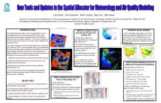
What is the ChEAS? • A long-term, BYOF (bring-your-own-funding) collective of investigators studying the carbon and water cycles of the forests of the upper Midwest, USA. • Elements: • WLEF tall tower – flux and mixing ratio measurement profiles • a cluster of stand-level eddy-covariance flux towers • chamber, biometric and sap flux measurements • a ring of atmospheric CO2 mixing ratio sensors • multi-scale airborne and satellite remote sensing of vegetation cover • atmospheric profiling via radar and lidar and; • atmospheric and ecological modeling efforts. • Domain: See map. Multiple scales, from plot to region. Hourly to multi-year temporal scales.
WLEF flux and mixing ratio observatory Photo credit: UND Citation crew, COBRA WLEF tall tower (447m) CO2 and H2O flux measurements at: 30, 122 and 396 m CO2 mixing ratio measurements at: 11, 30, 76, 122, 244 and 396 m
Regional flux estimate methods: ABL budget approaches • Traditional budget: Diurnal rate of change of CO2 in fair weather used to find hourly fluxes, day and night. Fluxes fitted to T, PAR to fill poor weather conditions. WLEF data only. • Scale ~ 1 hour*mean wind ~ few tens of km fetch. • Wang et al, in preparation A and B. Wang, Ph.D. dissertation. • Free troposphere-ABL difference method: Vertical mixing at monthly time scales estimated using H2O and meteorological reanalyses. ABL-FT mixing ratio difference is proportional to the monthly-mean surface flux. WLEF data only. • Scale uncertain. Tens to 100 km fetch? • Helliker et al, 2004; Bakwin et al, 2004; Helliker et al, in review. • Ring of towers: Regional ABL budget constrained by a ring of mixing ratio measurements at 150 km radius around WLEF. Simple budget or full regional inversion to derive fluxes. • Scale ~ 200x200 km2. • Results still in preparation. See poster by Uliasz.
Regional flux estimate methods: Up-scaling eddy-covariance flux data • Tall tower flux measurements: WLEF tower flux footprint is large. This alone may represent a regional flux. • Few to several km fetch. • Davis et al, 2003; Ricciuto et al, in review. • Tall tower footprint decomposition: Use footprint modeling and land-use maps to decompose fluxes from WLEF into contributions from six different land classes. Develop flux vs. T, PAR models for each class. Aggregate fluxes to the region using these models. Compare to stand-level flux towers. • 40x40 km2 region • Wang et al, in review, A and B. Wang Ph.D. dissertation. • Stand-level flux tower regional aggregation: Use 12 stand-level flux tower data sets, and regional land cover maps to aggregate up to region. Independent of WLEF. • 40x40 km2 region • Desai et al, in review.
Publications BACKGROUND. Mackay, D.S., D.E. Ahl, B.E. Ewers, S.T. Gower, S.N. Burrows, S. Samanta, and K.J. Davis, 2002. Effects of aggregated classifications of forest composition on estimates of evapotranspiration in a northern Wisconsin forest, Global Change Biology, 8 (12), 1253-1265. Davis, K.J., P.S. Bakwin, C. Yi, B.W. Berger, C. Zhao, R.M. Teclaw, and J.G. Isebrands, 2003. The annual cycles of CO2 and H2O exchange over a northern mixed forest as observed from a very tall tower, Global Change Biology, 9 (9), 1278-1293. Cook, B.D., K.J. Davis, W. Wang, A.R. Desai, B.W. Berger, R.M. Teclaw, J.M. Martin, P. Bolstad, P. Bakwin, C. Yi, and W. Heilman, 2004. Carbon exchange and venting anomalies in an upland deciduous forest in northern Wisconsin, USA, Agricultural and Forest Meteorology, 126 (3-4), 271-295 (doi:10.1016/j.agrformet.2004.06.008). Desai, A.R., P. Bolstad, B.D. Cook, K.J. Davis, and E.V. Carey, 2005. Comparing net ecosystem exchange of carbon dioxide between an old-growth and mature forest in the upper Midwest, USA, Agricultural and Forest Meteorology, 128 (1-2), 33-55 (doi: 10.1016/j.agrformet.2004.09.005). REGIONAL MODELING EFFORTS Baker, I., A.S. Denning, N. Hanan, L. Prihodko, M. Uliasz, P.L. Vidale, K. Davis, and P. Bakwin, 2003. Simulated and observed fluxes of sensible and latent heat and CO2 at the WLEF-TV tower using SiB2.5, Global Change Biology, 9 (9), 1262-1277. Heinsch, F.A., M. Zhao, S.W. Running, J.S. Kimball, R.R. Nemani, K.J. Davis, P.V. Bolstad, B.D. Cook, A.R. Desai, D.M. Ricciuto, B.E. Law, W.C. Oechel, H. Kwon, H. Luo, S.C. Wofsy, A.L. Dunn, J.W. Munger, D.D. Baldocchi, L. Xu, D.Y. Hollinger, A.D. Richardson, P.C. Stoy, M.B.S. Siqeira, R.K. Monson, S. Burns, and L.B. Flanagan, in press. Evaluation of remote sensing based terrestrial producitivity from MODIS using regional tower eddy flux network observations, IEEE Transactions on Geosciences and Remote Sensing. REGIONAL TOWER UPSCALING and ABL BUDGET FLUX ESTIMATES Bakwin, P.S., K.J. Davis, C. Yi, S.C. Wofsy, J.W. Munger, L. Haszpra, and Z. Barcza, 2004. Regional carbon dioxide fluxes from mixing ratio data, Tellus, Series B: Chemical and Physical Meteorology, 56B, 301-311. Desai et al, accepted, Ag Forest Met. Helliker, B.R., J.A. Berry, A.K. Betts, P.S. Bakwin, K.J. Davis, A.S. Denning, J.R. Ehleringer, J.B. Miller, M.P. Butler, and D.M. Ricciuto, 2004. Estimates of net CO2 flux by application of equilibrium boundary layer concepts to CO2 and water vapor measurements from a tall tower, Journal of Geophysical Research D: Atmospheres, 109 (D20), 1-13 (doi:10.1029/2004JD004532). Ricciuto et al, in review, Ag. Forest Met. Wang, W., K.J. Davis, D.M. Ricciuto and M.P. Butler, in review. Decomposing CO2 fluxes measured over a mixed ecosystem at a tall tower and extending to a region using footprint models and a vegetation map. Agr and Forest Meteorology. Wang, W., Davis, K.J., Ricciuto, D.M. and Butler, M.P., in review. Footprint modeling for flux measurements at multiple levels from a very tall tower over a mixed forest. Boundary Layer Meteorology. Wang, W., (2005), Regional estimates of net ecosystem-atmosphere exchange of carbon dioxide over a heterogeneous ecosystem, Ph.D. thesis, 234 pp. The Pennsylvania State University, University Park, PA.
WLEF tall tower wetland mature hardwood old growth Origins of upscaling effort • Large differences in net fluxes from site to site evident in flux tower data. • Net annual source of CO2 to the atmosphere observed at WLEF, caused by large respiratory fluxes.
Land classification results vs. scale of remote sensing imagery 30 meter 1 kilometer 1 meter
Conclusions: Temporal variability in fluxes • Interannual variability in WLEF fluxes is greater than the range of random error and therefore statistically significant. • Multi-year carbon exchange measurements at WLEF are clearly correlated with climate variability. • Seasonal variability in fluxes across 5 years at WLEF can be explained with a parsimonious climate-driven model. • Multi-tower data record is not yet long enough to test the hypothesis that climate-driven regional flux variability can be represented by a sparse flux measurement network, but… • Boundary layer budget approach of Helliker et al (2004) finds annual fluxes that appears to track the year-to-year variability measured at the WLEF tower, implying that WLEF does represent regional year-to-year variability.
Conclusions: Bottom-up approach • No single flux tower, including the WLEF tall tower, captures regional fluxes. Variability among towers is large. Major differences are due to differences in growing season fluxes. • Wetland/upland delineation alone is not sufficient to explain regional fluxes. • Essential ecosystem characteristics for accurate up-scaling of seasonal fluxes in the ChEAS region include: • Upland/wetland soil moisture status • Stand age • Stand type (aspen, northern hardwood, conifer, wetland) • More detail is required within northern hardwoods, possibly canopy stocking. • Wetlands are undersampled – variability among wetland stands is not yet clear. • Typical MODIS-based 1 km resolution land-cover maps classify the entire region as “mixed forest.” • Forest inventory data and high-resolution (e.g. 30m) regional land cover maps may provide sufficient inputs for accurate regional upscaling.
Conclusions: Predictive capacity • Dependence of net flux of carbon on stand age is large as expected, with the exception that the old-growth site in ChEAS is still a substantial carbon sink. • Wetland/upland contrasts, quantified, should allow prediction of (strongly nonlinear) carbon-water cycle interactions. • Year-to-year variability in seasonal fluxes at WLEF are largely explained by temperature and soil moisture. • Does this imply predictability for seasonal variability due to future climate change? • Does the WLEF seasonal variability represent the region? • Year-to-year variability in net annual fluxes at WLEF is not explained by our simple model driven by temperature and soil moisture. Predictive elements (drivers, model structure) are missing?
Conclusions: Net regional fluxes • High respiration rates and small net carbon loss to atmosphere, observed at WLEF, is not representative of the broader northern Wisconsin forest region. • ABL budget (top-down) and stand-level upscaling schemes (bottom-up) appear to converge at 2 +/- 0.5 gC m-2 d-1 net May-Sept mean uptake of CO2. • Two independent ABL budget methods • Two independent flux tower upscaling methods • Ring of towers results not yet incorporated here. See poster by Uliasz et al. Should increase confidence in top-down flux estimates. • Improved regional characterization of aspen, wetland fluxes, and incorporation of forest inventory data underway. • Ability to capture these regional fluxes via ecosystem models using various data inputs is being evaluated.
Acknowledgements Department of Energy Terrestrial Carbon Processes Program National Institutes for Global Environmental Change Midwestern Regional Center, DoE National Oceanic and Atmospheric Administration Office of Global Programs National Science Foundation Division of Environmental Biology National Aeronautics and Space Administration Terrestrial Ecology Program