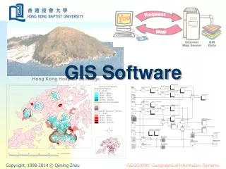
GIS Software & Hardware Overview
GIS Software & Hardware Overview. POEC 6383 GIS Implementation & Management Ronald Briggs University of Texas at Dallas. Introduction. From the discussion of Fundamental GIS Concepts we noted: two types of data: spatial data (where) and attribute data (what)

GIS Software & Hardware Overview
E N D
Presentation Transcript
GIS Software & Hardware Overview POEC 6383 GIS Implementation & Management Ronald Briggs University of Texas at Dallas Ron Briggs UT-Dallas
Introduction • From the discussion of Fundamental GIS Concepts we noted: • two types of data: spatial data (where) and attribute data (what) • two models for data representation: raster model and vector model • two computing environments: traditional relational data base model and object-oriented model • as we search for software for our GIS project, ideally we seek implementations which: • handle both spatial and attribute data, and pay commensurate attention to each • support vector and raster formats, including • conversion between the two • analytic capabilities for both • utilize relational data base or object-oriented computing models • how do software vendors in the market place meet these needs? Ron Briggs UT-Dallas
Software Categorization • Professional/industrial • capable of supporting on-going operational processes and management needs of the enterprise • permits programming of business processes and geospatial applications • Desktop/Presentation • support the analytical needs of professionals processing geospatial data • Business and other Niche Applications: targeted toward specific subsets of applications • to business for site selection and market area analysis • to specific industries e.g. transportation, telecomm, oil & gas exploration, • to specific applications e.g. rectification, thematic mapping • Mass Market • general public & personal productivity applications Ron Briggs UT-Dallas
Mass Market Software for GIS: Mass Market differences (based on Thrall and Thrall, 1998) Least Complex Most Users • Digital atlas • e.g Rand McNally New Millenium, MS Encarta, National Geographic Picture Atlas • Interactive street display & route planning • e.g. De Lorme, MS Streets98, AAA • Internet Mapping: geocoding and routing • urban yellow pages • Spreadsheet and Database Mapping • Lotus Ver. 5 (Atlas Mapmaker) • Excel for Windows 95/97 (Mapinfo) • Clip Art and ready-made maps • Thematic Mapping • Desktop GIS & Business/Niche Applications • Prof./Industrial: Geographically-enabled programming Least Users Most Complex
support for raster as well as vector data (and perhaps also images) user-selected (rather than proprietary) spatial data input digital format (shape files, TIGER files, etc) geographic format (datum, projection) variety of standard attribute data input formats (spreedsheets, comma delimited text, dBase, etc.) external data base access/connectivity via SQL, ODBC, etc. internal data customization and query (e.g calculating new variables and querying all) selective overlay of input spatial data comprehensive support for spatial query and logic polygon joins and overlay point in polygon intersection of lines and polygons buffering around points, lines and polygons batch geocoding with variety of user-selectable options topological editing of input (or new) spatial data customization of maps and graphics for display and hardcopy variety of digital data output formats for graphic (e.g. gif, tif, jpeg) and non-graphic data macro, scripting or programming capability Professional Desktop versus Mass MarketThe capabilities of mass market (display, single-point geocoding, thematic mapping) plus
ARC/INFO (ESRI, Inc., Redlands, CA) privately owned by Jack Dangermond, a legend in the field and former Harvard prof. originated commercial GIS still clear market leader with about a third of the market Intergraph (Huntsville, AL) origins in proprietary CAD hardware/software strong in design and FM (facilities mapping), and running hard to match ESRI in GIS its UNIX-based MGE (Modular GIS Environment) product evolved from its older CAD products after split with Bentley, courageously committed to NT and object technology in 1995 and first released “new generation” GeoMedia product in March 1997 Bentley Systems (Exton, PA) Bentley brothers (Barry & Ray) originally developed the PC-based Micro-Station product under contract with Intergraph, but split in 1995 have very successfully continued to develop and sell MicroStation GeoGraphics since then. Software for GIS: professional/industrialThe Industry Leaders Ron Briggs UT-Dallas
Smallworld Systems (Englewood, CO) origins in Oxford, England emphasis on FM & utilities The first to use OO (in early 1990s) but can it now compete as established vendors do the same? Autodesk’s AutoCAD Map dominant CAD supplier and world’s 4th largest software company fully topological AutoCAD Map introduced in 1996 (but no raster) illustrates convergence of CAD/GIS. possible industry leader since many places already use standard AutoCad for mapping GDS (Graphic Data Systems, Englewood CO) originated as McDonnel Douglas in-house system owned now by Convergent Group and EDS closure in 1997 left its customers in the lurch (e.g. City of Irving) ERDAS/Imagine, ER MAPPER, PCI, Envi, Genasys II, origins in remote sensing thus raster oriented but now include vector support ERDAS long established leader ER MAPPER very agressive newcomer originating in Australia Envi, another relative newcomer PCI long-term Canadian player Genasys II older and fading US player new satellite data products enhance their attractiveness GRASS (Rutgers Univ.) raster oriented, but some vector routines originally developed by US Army Construction Engineering Research Lab(CERL) in Champaign, IL; army ended dev. & support in 1996 but assumed by Baylor University. Software for GIS: professional/industrialThe Also-Rans and Wannabes Ron Briggs UT-Dallas
Software for GIS: Desktop/Presentation • ARCVIEW from ESRI • stand-alone GIS, or user front-end to ARC/INFO • strong customization (via AVENUE language) • Mapinfo (Troy, NY) • very aggressive and successful newcomer • Atlas/GIS (from Strategic Mapping, Santa Clara, CA) • one of the originators of PC-based mapping • purchased by ESRI in 1996 • Other Commercial Entrants • Maptitude (Caliper Corp, Newton, MA): cheap--one of the best deals around • WinGIS (Progis Corp, Austria): European entry • SAS/GIS (at last, SAS tries to catch up) • IDRSI (Clark Univ) • one of the pioneering, university developed packages, but limited commercial penetration altho trying hard • raster orientation with some vector capabilities Ron Briggs UT-Dallas
Software for GIS: Business & Niche • BusinessMAP (from ESRI): $99 choropleth and pin mapping (originally Maplinx) • Tactician:specialist product for market analysis, site selection, etc. • NDS (National Decision Systems): marketingdata supplier released I-Mark software in 1999, combining older Infomark Express (reporting) and I-Map (maps) products • GeoQuery (Naperville, IL): a mapping product based on Intergraph GeoMedia • Surfer (Golden Software):contour creation & spatial interpolation • Map Viewer (Golden Software):thematic map creation • Blue Marble Geographic Calculator: projections, conversions, etc. • EDX, Planet (from MSI), Cell CAD II: wireless telephony planning
Software for GIS: Leading Vendor’s Products Autodesk World Autodesk MapGuide AutoCAD Map ArcView (AV) Arc/Info AV Business Analyst AV Internet Map Server BusinessMap Pro GeoMedia Geomedia Pro Geomedia Web Map Geomedia Network MapInfo Pro Mapinfo MapXtreme MapXtreme Java MapInfoData Target Pro Desktop GIS Web-based GIS CAD mapping Desktop GIS Prof./Indus. GIS Business GIS Web GIS Entry business maps Desktop GIS Prof./Indus. GIS Web-based GIS Networking modules Desktop GIS GIS apps. Server Web-based Server GIS for marketing $1,995 $9,990 $4,250 $1,195 $10,000 $11,995 $10,500 $149 $1,500 $7,500 $10,000 $2,000 $1,295 $24,495 $24,495 $695 • Autodesk www.autodesk.com • ESRI www.esri.com • Intergraph www.intergraph.com • MapInfo www.mapinfo.com Source: PC Week 1/4/99
GIS Market Share (%) **GIS World, July ‘97, p. 12 quoting Daratech Ron Briggs UT-Dallas
Price ($) you generally pay for capability, but do you need it? cost doesn’t always equate to capability, but there’s usually some catch Learning curve simplicity of use for limited function products consistency of interface for multi-function products Market share will it be around in the future? experienced workers available third party services: add-ons, training, consultants, etc. Future needs analytic capabilities data types conversion expensive retraining data conversion application conversion Organizational needs consistent software info sharing lower support & training costs lower costs via mass licenses targeted software lower train/support via simpler interface lower cost via targeted function best of both via add-ins or object orientation. Software Selection: Considerations and Trade-offs Ron Briggs UT-Dallas
ESRI Product Line-up (main products) • ArcView (multiple operating systems: PC, UNIX, VMS, MAC) • desktop GIS for end-user visualization, analysis and query • GUI driven, with extensive customization capability via AVENUE scripting • generally presumes inputted data developed elsewhere e.g with ARC/Info (Data Automation Kit released 1996; essentially a subset of PC/ARCINFO) • ARC/INFO (workstation operating systems: UNIX, NT) • comprehensive tool kit for geographic data input, analysis and management • A/I Version 8 Workstation same as A/I v. 7 & earlier: command driven, with GUI dev. capability via AML (ARC Macro Language); both NT and UNIX • A/I Version 8 Desktop is complete re-write with GUI interface using MS COM objects: only runs on NT, not available under UNIX • PC ARC/INFO is a DOS/Windows subsetof workstation ARC/INFO (dieing) • MapObjects (PC only) • set of OLE automation objects for mapping and GIS to incorporate into OO application development environments such as VB, Powerbuilder and Composer • SDE (Spatial Database Engine) • extensions to ORACLE (and other) to support spatial data and geographical analysis • ArcCAD (PC operating system only) • bridges CAD and GIS, thus useful for integrating data between the two Ron Briggs UT-Dallas
ArcInfo Version 8 • With Version 8, now have two flavors: Workstation: • classic, command-line ArcInfo • same as version 7 and earlier, with minor enhancements • the only option for UNIX, but also on NT Desktop: • Largest Microsoft COM/ActiveX application to date • Full GUI interface • Customization via Visual Basic for Applications (altho’ must have ArcInfo to run custom apps) • New data base concepts: Geodatabase • Available on NT only; no UNIX version Ron Briggs UT-Dallas
ArcInfo Desktop ArcCatalog (schema editor, with VISIO generation) • The base application for ArcInfo Desk • Windows Explorer-like interface • for organizing access to data and metadata • For launching other Desktop apps: MAP and TOOLBOX ArcMap (object editor) • Powerful GUI for spatial data editing and map viewing • ArcPlot/ArcEdit & ArcView View/Layout combined • Map projections on the fly (not via conversion as in AV) ArcToolbox • GUI interface to GIS tools via wizards • Classic ArcInfo runs underneath • Supports execution on remote machines • v. 8.0 does not support Geodatabases, ImageCats, Map librarian, or GRID data Ron Briggs UT-Dallas
ARC/INFO Workstation Line-up: Base Components • ARC • entry point to ARC/INFO, and ARCEDIT and ARCPLOT in particular • geographic data maintenance and processing • INFO • the relational data base system (RDBMS) foundation for ARC/INFO • ARCEDIT • foreditinggeographic data • supports input from wide variety of sources including keyboard, mouse, digitizer, other GIS databases • ARCPLOT • graphic subsystem for database display and map production Ron Briggs UT-Dallas
ARC/EDIT/PLOT Extensions COGO(Coordinate Geometry) supports surveying data, plat preparation, etc. for suveyors and civil engineers TIN (Triangulated Irregular Network) vector-based surface modelling NETWORK network analysis, such as shortest route ArcScan raster to vector conversion ArcExpress (optional product) graphic display optimization Semi & Independent Modules GRID analysis of raster data includes vector/raster & raster/vector conversion ArcPress enhances printing on raster devices ArcStorm(storage management) geog. data manager for large data systems ARC/INFO Workstation Line-up: Other Components Ron Briggs UT-Dallas
Where is my bus? DART service manager. Want application to display real time location of buses on touch-screen terminal to passengers waiting at Richardson Transit Center use MAP Objects incorporated into Visual Basic app. Council, get off my back! Planner for Plano. Need faster, easier, jazzier way of answering council member queries. use ArcView, since city has extensive ArcInfo coverages; write Avenue scripts to automate most common queries Keep the water flowing. Manager for North Texas Municipal Water Supply District. Swamped by growth. Needs help to manage his infrastructure. select Arc/Info 8 Keep the Taxes Coming In. Director of IS for Big City. Must tie all my data together--land ownership, tax rolls, utility lines, roads, 911 calls etc. Needs enterprise solution. SDE with ORACLE data base, accessed with ArcExplorer (free), ArcView, and ArcInfo 8 Choices, Choices, Choices!!
Hardware and Platforms for GIS • CPU (Pentium or RISC): powerful with lots of memory (128MB min for AI8) • Disk storage: lots--especially for images • Input devices: Digitizer, Scanner, CD-ROM/DVD, network/Internet • Output devices: • Large, high-res. display (relatively expensive) • Wide-bed color plotter (now usually inkjet, and affordable) • Operating System: • NT is eclipsing UNIX on the Desktop • MAC and UNIX supported by fewer and fewer vendors • Platforms: • PC or RISC Workstation • Mainframe--gone • Minicomputer—now also gone • Networks and Distributed Systems now the norm Ron Briggs UT-Dallas
The Religious Tenets of GIS • ArcInfo is the only true GIS • Intergraph is the only used GIS • MAPINFO is the only useable GIS Ron Briggs UT-Dallas
The GIS Market In 1992, according to Dataquest, GIS growth rate estimated at 35% per year • GIS related hardware $0.5 Billion • GIS related software $1.1 Billion • GIS Consulting services $2.4 Billion The big money is in consulting, not software or hardware (although much consulting is software related). Ron Briggs UT-Dallas