Download
1 / 17
180 likes | 562 Vues
Exercise 5. Spatial analysis and geoprocessing in ArcGIS September 18-19, 2008. Today. Spatial analysis Geoprocessing: Functions to work with layers (Overlay, proximity, summarization) Vector spatial analysis Hand out exercise 5 Lab reminders:

E N D
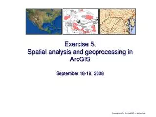
Exercise 5.Spatial analysis and geoprocessing in ArcGISSeptember 18-19, 2008
Today • Spatial analysis • Geoprocessing: Functions to work with layers (Overlay, proximity, summarization) • Vector spatial analysis • Hand out exercise 5 • Lab reminders: • Don’t forget to download two data files for use in today’s lab • If working at home: ArcToolbox requires patch for the student edition software to be installed (otherwise you may see errors) • See class website “Links” page link to student edition installation instructions for more info on installing patches • Next week: Mid term exam is given in your assigned lab section (should have prior arrangements if you have to miss the exam, do not come to wrong lab time)
ArcToolbox • Geoprocessing: Process steps in ArcGIS that create new spatial datasets • Proximity analysis (Buffer) • Overlay/extract (Clip, Intersect, Union) • Other summarizations (Spatial join, summarize) • ArcToolbox: • Many functions for geoprocessing and other manipulation of GIS datasets
Working with ArcToolbox: Hints • Must have current software patches installed • Problems with Vista otherwise • Problem with Internet Explorer 7 otherwise • Must have projections defined for your datasets
ArcToolbox • Tools are organized by function • Index tab • Search tab
Using tools in ArcGIS (clip) Input layer Clipping layer Output dataset (new) • See an error message? • Check projection(s) • Check software patches • Check file names Show help!!
Projections • Projections: Allow display of data from round earth on flat map • Saved with your datasets (if defined) • Prj file • Must be defined by data set creator
Defining a dataset’s projection • Use Define Projection tool in ArcToolbox • Select Projection from list: • Geographic coordinate systems (lat/long, DD) • Projected coordinate systems (UTM, others)
Overlay function: Intersect • Intersect combines features (and attributes) from two or more different layers Intersect • Points, lines, or polygons • Combines attributes • Limited extent
Extract data function: Clip • Clip extracts data from one layer by features of a 2nd layer Statewide Soils Clip by Cheat River basin (selected) Soils clipped to Cheat River basin
Updating geometry • After a clip or intersect, feature geometry may be incorrectly listed in table (area, length, perimeter) • To update geometry: • Right-click on field name • Use Calculate Geometry menu choice
Summarizing a table • You can summarize any table by unique values in a field • Summarize includes: • New table of summary info • Count of features for each unique value • Any other summary statistics for other fields (sum, mean, min, etc.)
Spatial join • Join: Cross-referencing two different datasets • Table join: based on common data in 2 tables (last week) • Spatial join: based on location of features (this week) • Options include finding nearest feature (and distance) Springs joined with County Springs
Proximity analysis: Buffering • Buffer tool in ArcToolbox • Many options for buffering: • Single buffer • Multiple buffers • Dissolve buffers (or not) • Creates a new polygon dataset
Exercise 5 overview • Open blank map, add data • Download landslides layer (from National Atlas) • Open ArcToolbox • Define projection for landslides shapefile • Overlay analysis with landslide data: Clip, intersect • Table analysis: Update geometry, summarize table • Spatial join • Proximity analysis: Buffer tool
Reminders • Part A due before end of lab today • Part B due at start of lab in 2 weeks (test next week) • You can do Part B GIS questions today if you have time • Print out final map to hand in with Part B • Read instructions carefully
Questions? • Demo: • Spatial join • Summarize