Download
1 / 26
260 likes | 393 Vues
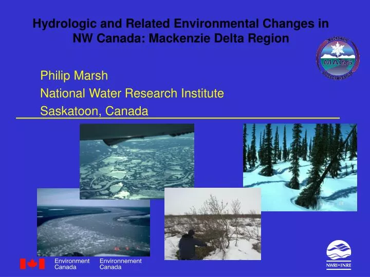
Hydrologic and Related Environmental Changes in NW Canada: Mackenzie Delta Region. Philip Marsh National Water Research Institute Saskatoon, Canada. Mackenzie Delta Region. hydrology influenced by a complex suite of processes including:

E N D
Hydrologic and Related Environmental Changes in NW Canada: Mackenzie Delta Region Philip Marsh National Water Research Institute Saskatoon, Canada
Mackenzie Delta Region • hydrology influenced by a complex suite of processes including: • local climate, including temperature, snow, rain, radiation and wind for example. • runoff of the entire MRB; • Beaufort Sea; • changes in vegetation, with vegetation controlled in a complex manor by climate, fire, and possibly the grazing patterns of caribou and reindeer; treeline Alaska Beaufort Sea Mackenzie R. basin Arctic Environmental Atlas
Objectives • Provide a few, brief examples of past changes in climate, vegetation and hydrology in the Mackenzie Delta region over the past 40 years. • In conjunction with observations of environmental change in this region, we have been carrying out detailed process and model validation studies to improve our understanding of the observed changes. This work has included a number of collaborators, including the Mackenzie GEWEX Study (MAGS) and the Climate Change Action Fund (CCAF).
Trail Valley Creek May 13, 1999 Havikpak Creek April 30, 1999
Climate and hydrology during the last 40 years:Ice Breakup in the Mackenzie Delta and Discharge of the Mackenzie River
Canadian Mean Temperature Trends (1950-98) Winter Spring Summer Autumn B. Bonsal et al., NWRI
45 35 25 15 5 -5 -15 -25 -35 Precipitation Change (1950-1998) % Change Winter Spring Summer Autumn Barrie Bonsal et al., NWRI
Annual and Seasonal Mackenzie River Discharge Observed reconstructed Discharge(mm) M. Mackay 1960 1970 1980 1990
Mackenzie River East Channel at Inuvik Date of Peak Water levels Elevation of peak water level
Date of peak discharge and peak water level is generally simultaneous between Mackenzie River at Arctic Red River and East Channel at Inuvik
Climate and hydrology during the last 40 years:Vegetation, snow and runoff in uplands to the east of the Mackenzie Delta
Increased shrub growth in the Mackenzie Delta Region • J.R. Mackay presents numerous examples of increased shrub growth the areas north of Inuvik. • For example, Mackay (1999) reported rapid increase in vegetation in drained lake bottoms since 1980. • Similar increases observed at sites without drained lakes • Coincided with an increase in winter temperatures and total snowfall • However, there have few, if any, systematic studies of changes in vegetation in the Mackenzie Delta region over the last 40 years
Aug 28, 1976 Aug 13, 1993 18 years 0.0 J.R. Mackay, 1995 Active layer thickness – 1968 to 1993 depressions hummocks 1.4
Late winter snow cover Estimation of the start of spring melt
Climate and hydrology of the Mackenzie Delta Region:Process Studies
Trail Valley Creek: Shrub and Tundra Study Sites Shrub site Tundra site
Shortwave radiation (daily average) Snow removed from shrub by end of May and at the shrub site during first week of June Mid-May 2003 Mid-April 2003
Snow surface radiation Longwave (daily average) Net Allwave (daily average)
Climate and hydrology of the Mackenzie Delta Region:Modelling
D S (-26 mm) P-E (225 mm) Qsfc (132 mm) Qtot (247 mm) CRCM est. of Annual basin water balance (P - E) - S - Qtot = error (225) - (-26) -247 = 5 mm P = 496 mm E = 271 mm Mackay et al. - MSC
Mackenzie River 1998/99 Basin area = 1.8 million sq km. measured: 2.68 x10¹¹ m3 WATROUTE: 2.70 x10¹¹ m3 WATFLOOD: 2.65 x10¹¹ m3 Measured = 149 mm WATROUTE = 150 mm WATFLOOD = 147mm
Conclusion • Hydrologic and other environmental changes have occurred in the MD over the last 40 years • These changes including warmer annual and spring air temperatures, changes in precipitation and snow cover. • These have contributed to dramatic changes in the timing of spring freshet and breakup, and in some areas increased shrub growth. • The links between climate, fire, vegetation and hydrology not well understood • Ongoing process and modelling studies are making progress in allowing us to better understand some of these past changes, and our ability to consider likely future changes