IGS Overview
IGS Overview. Ruth Neilan IGS Central Bureau at JPL Pasadena, California USA. Content. Mission & History Organization of the IGS Key Components Working Groups Pilot Projects Applications Resources, IGS CB Information System. In Support of Science.

IGS Overview
E N D
Presentation Transcript
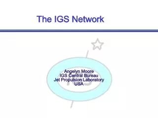
IGS Overview Ruth Neilan IGS Central Bureau at JPL Pasadena, California USA
Content • Mission & History • Organization of the IGS • Key Components • Working Groups • Pilot Projects • Applications • Resources, IGS CB Information System
In Support of Science • The accuracies of the IGS data and products are to be sufficient to support scientific requirements • Access to and continued improvement of the ITRF (International Terrestrial Reference Frame) • Station position and velocities • Monitoring Earth rotation parameters • Monitoring deformation of the solid Earth and hydrosphere variations • Precise time transfer • Scientific satellite orbit determination, LEO’s • Ionospheric monitoring and research • Atmospheric applications - ground and space based for climate research, eventually weather forecasting
Historical Perspective Key factors in formation of IGS • All geodynamics and geodetic organizations realized the potential of GPS by early 90’s • Motivating goal: Millimeter positioning in support of science anywhere in the world • Not one agency can nor should assume the capital investment & recurring operations costs for the entire infrastructure • Join with key international partners to form federation, define cooperation, set standards, science quality driven • IGS History documented in Annual Report Series (1994)
ORGANIZATION OF THE INTERNATIONAL GPS SERVICE INTERNATIONAL GOVERNING BOARD NAVSTAR GPS Satellites Global Data Centers Analysis Center Coordinator Operational & Regional Data Centers Analysis Centers INTERNET Global Network Associate Analysis Centers Telephone - Modem, Radio Links USERS Practical, Custom, Commercial, Governments,... Regional Network Associate Analysis Centers IGS Projects and Working Groups SATELLITE LINK Reference Frame Densification Precise Time Transfer Low Earth Orbiters Ionosphere Atmosphere Sea Level GLONASS Pilot Service Project Central Bureau Management, Network Coordinator, Central Bureau Information System GPS Stations
Organization of the IGS • The IGS accomplishes its mission through the following components: • Network of tracking stations • Data Centers • Analysis Centers and Associate Analysis Centers • Analysis Center Coordinator • Reference Frame Coordinator • Working Groups and Pilot Projects • Central Bureau • Governing Board
Data Centers of the IGS Data Centers have three categories (see IGS Data Center Presentation) • Operational Centers have direct contact with the stations • Regional Centers store all data from a geographic region, some for a special application • Global Data Centers (GDC) are the main interface with Analysis Centers and Users, store all data used by Analysis Centers and all IGS products • Crustal Dynamics Data Information System • Institut Geographique National • Scripps Institution of Oceanography
Analysis Centers of the IGS • Analysis Centers have two categories: • Analysis Centers produce daily products on a continuous basis • Associate Analysis Centers produce unique products such as station coordinates and velocities, tropospheric information; ionosphere information; they may facilitate distributed processing, analyze dense regional networks, combine network solutions, etc. • Global Network Associate Analysis Centers (GNAAC) • Regional Network Associate Analysis Centers (RNAAC) • Products and applications of the ACs, see IGS Product presentation.
IGS Analysis Centers • Analysis Centers • Astronomical Institute University of Bern, Switzerland - CODE • European Space Operations Center / European Space Agency, Germany - ESOC • FLINN Analysis Center, Jet Propulsion Laboratory, USA- JPL • GeoForschungsZentrum, Germany - GFZ • Geosciences Lab, National Geodetic Survey, USA- NGS • Natural Resources Canada, Canada- NRCAN (EMR) • Scripps Institution of Oceanography, USA – SIO • US Naval Observatory, USA - USNO • Analysis Coordinator: Tim Springer, University of Bern, formerly Jan Kouba, Natural Resources Canada
IGS Central Bureau • The Central Bureau is responsible for general management of the IGS and acts as the executive arm of the Governing Board. The CB is located at NASA’s Jet Propulsion Laboratory. • The primary functions of the CB are to: • Coordinate and manage IGS activities • IGS Network Coordination responsibilities formalized in 1998 • Establish and promote compliance to IGS network standards • Monitor network operations and quality assurance of data • Develop and operate the Central Bureau Information System (CBIS) website • Act as day-to-day liaison with external agencies worldwide
IGS Governing Board MEMBER INSTITUTION & COUNTRY FUNCTIONS TERM*(current: 4 years) • Christoph ReigberGeoForschungsZentrum, Germany Chair, Appointed (IGS) 1999-2002 • Gerhard Beutler University of Bern, Switzerland Appointed (IAG) --- • Mike Bevis University of Hawaii, USA Appointed (IGS) 1998-2001 • Geoff Blewitt University of Nevada, Reno Analysis Center Representative 1998-2001 • Claude Boucher Institut Geographique National, ITRF France IERS Representative --- • Carine Bruyninx Royal Observatory, Belgium IGS Representative to IERS 2000-2003 • John Dow European Operations Center, Germany Network Representative 2000-2003 • Bjorn Engen Norwegian Mapping Authority Network Representative 1998-2001 • Joachim Feltens European Operations Center, GermanyIonosphere Working Group Chair 1999-2000 • Remi Ferland Natural Resources Canada IGS Reference Frame Coordinator 1999-2000 • Gerd Gendt GeoForschungZentrum Potsdam, Germany Troposphere Working Group Chair 1999-2000 • Tom Herring Massachusetts Institute of Technology IAG Representative --- • John Manning Australian Survey and Land Information Group Appointed (IGS) 2000-2003 • Ruth Neilan IGSCB, Jet Propulsion Laboratory, USA Director of Central Bureau --- • Carey Noll Goddard Space Flight Center, USA Data Center Representative 1998-2001 • Paul Paquet Royal Observatory of Belgium FAGS Representative --- • Jim Ray U.S. Naval Observatory, USA Precise Time Transfer Project, Chair 1999-2000 • Markus Rothacher Technical University Munich, Germany Analysis Representative 2000-2003 • Robert Serafin Natl. Center for Atmospheric Research, USA Appointed (IGS) 1998-2001 • Jim Slater Natl. Imagery and Mapping Agency USA International GLONASS Pilot Project, Chair 2000-2002 • Tim Springer University of Bern, Switzerland Analysis Center Coordinator 1999-2002 • Michael Watkins Jet Propulsion Laboratory, USA Low Earth Orbiter Working Group Chair 1999-2000 • James Zumberge Jet Propulsion Laboratory, USA Analysis Center Representative 2000-2003 • Angelyn Moore IGSCB, Jet Propulsion Laboratory, USA Secretariat ---
Contributing Organizations & People • Over 80 Contributing Organizations • 108 Associate Members • More than 1200 Corresponding Members • See Resource Sheets (Pages 4 – 7) for details
FOMI FOMI Satellite Geodetic Observatory, Budapest, Hungary GSD Geodetic Survey Division, NRCan, Canada GFZ GeoForschungsZentrum, Potsdam, Germany GSI Geographical Survey Institute, Tsukuba, Japan GIUA Geophysical Institute, University of Alaska, Fairbanks, AK, USA GRDL Geosciences Research and Development Laboratory, NOAA, Silver Spring, MD, USA GSFC Goddard Space Flight Center / NASA, USA HRAO Hartebeesthoek Radio Astronomy Observatory, South Africa IRIS Incorporated Research Institutions for Seismology, USA ICC Institut Cartografic de Catalunya, Barcelona, Spain IGN Institut Geographique National, Paris, France IMVP Institute for Metrology of Time and Space, GP VNIIFTRI, Mendeleevo, Russia ISAS Institute for Space and Astronautic Science, Sagamihara, Japan ISRO Institute for Space Research Observatory, Graz, Austria IAA Institute of Applied Astronomy, St. Petersburg , Russia INASAN Institute of Astronomy, Russian Academy of Sciences, Moscow, Russia IESAS Institute of Earth Sciences, Academia Sinica, Taiwan IGGA-WUT Institute of Geodesy & Geodetical Astronomy, Warsaw University of Technology, Poland IGNS Institute of Geological and Nuclear Sciences, New Zealand IBGE Instituto Brasileiro de Geografia de Estatistica, Brazil INEGI Instituto Nacional de Estadistica Geografia e Informatica, Aguascaliente, Mexico INGEOMINAS Instituto Nacional de Invetigaciones Geologico Mineras (INGEOMINAS), Bogota, Colombia INPE Instituto Nacional de Pesquisas Espaciais, Brazil Contributing Organizations AWI Alfred Wegener Institute, Germany AIUB Astronomical Institute, University of Bern, Switzerland AUSLIG Australian Survey and Land Information Group, Australia BAKO Bako Surtanal, Indonesia BKG Bundesamt fuer Kartographie und Geodaesie, Germany BFL Bundesamt für Landestopographie (Federal Topography), Switzerland BIPM Bureau International des Poids et Mesures CSR Center for Space Research, University of Texas at Austin, USA CNES Centre National de Etudes, Toulouse, France CEE Centro de Estudios Espaciales, Chile CICESE Centro de Investigación Científica y de Educación Superior de Ensenada, Mexico CAS Chinese Academy of Sciences, China KAO-CAS Chinese Academy of Sciences, Kunming Astonomical Observatory, China CSB China Seismological Bureau CDDIS Crustal Dynamics Data Information System, GSFC/NASA, USA CMMACS CSIR Centre for Mathematical Modeling and Computer Simulation, Bangalore, India DUT Delft University of Technology, Netherlands DITTT Department of Land, Noumea, New Caledonia DLR/DFD Deutsche Forschungsanstalt für Luft-und Raumfahrt e.V., Neustrelitz, Germany ERI Earthquake Research Institute, University of Tokyo, Japan VS NIIFTRI East-Siberian Research Institute for Physicotechnical and Radiotechnical Measurements, Irkutsk, Russia IVTAN Electromagnetic Field Expedition (Bishkek, Kyrgyzstan) of the Institute of High Temperatures, RAS ESA European Space Agency, Germany ESOC European Space Operations Center, Germany FGI Finnish Geodetic Institute, Finland
IDA International Deployment of Accelerometers / IRIS, Scripps Institution of Oceanography, USA ASI Italian Space Agency, Matera, Italy JPL Jet Propulsion Laboratory, California Institute of Technology, Pasadena, CA, USA KAO Korean Astronomy Observatory, Taejon, Korea KMS Kort & Matrikelstyrelsen, National Survey and Cadastre, Denmark LINZ Land Information New Zealand, Wellington MAO Main Astronomical Observatory of the Ukrainian National Academy, Ukraine MO Manila Observatory, Philippines MIT Massachusetts Institute of Technology, Cambridge, MA, USA NASA National Aeronautics and Space Administration, USA NBSM National Bureau of Surveying and Mapping, China NCAR National Center for Atmospheric Research NGRI National Geophysical Research Institute, Hyderabad, India NIMA National Imagery and Mapping Agency, USA INGM National Institute in Geosciences, Mining and Chemistry (INGEOMINAS), Colombia NOAA National Oceanic and Atmospheric Administration, USA NSF National Science Foundation NRCan Natural Resources of Canada, Ottawa, Canada ROB Observatoire Royal de Belgium, Brussels, Belgium OUAT Olsztyn University of Agriculture and Technology, Poland OSO Onsala Space Observatory, Sweden GSC Pacific Geoscience Center, Geological Survey of Canada, NRCan, Canada IERS Paris Observatory, International Earth Rotation Service, Paris, France POL Proudman Oceanographic Laboratory, UK ROA Real Instituto y Observatorio de la Armada, Spain RIG Research Institute of Geodesy, Geodetic Observatory Pecny, Ondrejov, Czech Republic RGO Royal Greenwich Observatory, UK RJGC Royal Jordanian Geographic Center RAS Russian Academy of Sciences RDAAC Russian Data Archive and Analysis Center, Moscow, Russia SOEST School of Ocean and Earth Science and Technology, University of Hawaii,USA SIO Scripps Institution of Oceanography, San Diego, CA, USA SAO Shanghai Astronomical Observatory, China SCIGN Southern California Integrated GPS Network, USA SRC-PAS Space Research Center of the Astrogeodynamical Observatory, Poland SK Statens Kartverk, Norwegian Mapping Authority, Norway SOI Survey of Israel L+T Swiss Federal Office of Topography, Switzerland TUM Technical University Munich USNO U.S. Naval Observatory, USA UCAR University Consortium for Atmospheric Research UFPR University Federal de Parana, Brazil UNAVCO University Navstar Consortium, Boulder, CO, USA UB University of Bonn, Germany CU University of Colorado at Boulder, Boulder, CO, USA UNR University of Nevada, Reno, NV, USA NCL University of Newcastle on Tyne, United Kingdom UPAD University of Padova, Italy WING Western Pacific Integrated Network of GPS, Japan WTU Wuhan Technical University, China Contributing Organizations
Operations of the IGS • Operational Data Centers • Retrieve data from receivers • Validate data and monitor station status • Translate raw GPS data into RINEX (Receiver Independent Exchange) • Forwards appropriate files to Global Data Centers or Regional Data Centers • Global Data Centers organize the files on the basis of site and time, and provide Internet data access to users and analysts • IGS Analysis Centers pick up the data from the Global Data Centers, and estimate precise orbits, Earth Rotation parameters (ERP), clocks, etc • Analysis Center results are collected by the Analysis Coordinator and combined into the official IGS products
IGS Evolution Pilot Project IAG Approved Service --->
Estimated Quality of IGS Products June 1999
Network Densification • In 1993 the IGS realized that simultaneous processing of many stations was impractical • IGS groups began investigating the rigorous combination of solutions rather than raw data analysis • 1994 Workshop on Densification of the International Terrestrial Reference Frame initiated • SINEX - Solution Independent Exchange Format accepted in 1996 • Combination of global station solutions since late ‘96 • Polyhedron Solutions improving (see Annual Report Series) • IGS contribution to ITRF significant • Establish IGS Reference Frame Coordinator June ‘99 at Natural Resources of Canada, Remi Ferland
Densification Project Densified IGS network of ~200 - 250 globally well distributed sites -- goal that any user is within 1500 - 2000 km of a precise reference station • Regional analyses produced by Associate Analysis Centers called RNAACs (Regional Network Analysis Center) who • produce solutions for regional network using IGS products Solutions written into an ascii format call SINEX, Solution Independent Exchange format • Regional solution is made available to Global Network Analysis Centers (GNAACs) who • combine and compare solutions from all regional analysis centers • Result is a dense homogeneous network of stations in unique, consistent reference frame (ITRF)
IGS/BIPM Precise Time Transfer • Chaired by J. Ray, USNO (USA) & F. Arias, BIPM (France) Study accurate time and frequency comparisons • Develop operational strategies to exploit GPS measurements for improved accurate time and frequency comparisons world • Significant to maintaining UTC as new generation of frequency standards emerge • New/upgrade receivers at time labs • Data analysis • Key issue is calibration of instrumental delays to relate GPS clock estimates to external standards • Time transfer comparisons, simultaneously with independent techniques
Ionosphere Working Group • Chaired by J. Feltens, ESA-ESOC, Germany • Working group, active through increasing solar maximum • Calibration of Radio Signals (GPS and others) • Ionosphere Maps • Develop combined IGS global ION maps • Validation of maps, may lead to improved IGS ionosphere model • Assessing stochastic behavior of the Ionosphere • Supported high rate GPS data acquisition and analysis during August 11, 1999 solar eclipse • IONEX is the ascii file exchange format; these files can be accessed at the Global Data Centers
LEO (Low Earth Orbiters) • Working Group chaired by M. Watkins, JPL, USA • Determine role of IGS in future GPS LEO missions, POD +? • Oersted,Sunsat, SAC-C, CHAMP, GRACE, GLAS, … • Support of LEO occultation experiments for atmospheric profiling • IGS Network component, obvious infrastructure to support robust, high-rate, low latency data requirements • Other applications require timely availability of data (seconds to hourly) • Discussing LEO data as element of IGS • Analyze effects of inclusion in analysis, improve IGS Products? • Evaluate potential contribution of AC’s to LEO effort • Use early missions as case studies and analysis proof of concept
Troposphere Project • Chaired by G. Gendt, GFZ, Germany • Continuous well distributed measurements of water vapor are of great interest for numerical weather prediction, climate research and atmospheric studies • Collocation of precise meteorological instruments to convert Zenith Path Delay (ZPD) to Percipitable Water Vapor (PWV), need dry delay from barometric pressure, more meteorological instruments needed • Zenith Path Delay (ZPD) estimated by all IGS AC • ~100 sites, combined ZPD at 2 hour interval • Consistency of Combination among Acs at 4mm level • Comparison to Water Vapor Radiometer (WVR) at Potsdam agree to 1mm of Precipitable Water Vapor (PWV) • Official product available at GDC’s & CBIS
GLONASS Pilot Service • International GLONASS experiment IGEX, Investigated uses of GLONASS for geodetic and geophysical applications • October’98 - April’99, 61 GLONASS sites, 30 SLR stations • Interoperability of GPS/GLONASS • Precise Orbit determination and reference frame: PZ90 - ITRF96/97 • Time offsets between GPS and GLONASS systems and GLONASS systems to UTC • Orbits average throughout ~ 20- 30 cm between ACs • 1m level comparisons GPS-SLR solutions • Demonstrates the extensibility of IGS to accommodate other microwave systems, e.g. GALILEO, GNSS • Pilot Service charter approved by IGSCB, effort led by J. Slater, NIMA USA
Sea Level Monitoring • GPS for monitoring tide gauge benchmarks (TGBM) and altimeter calibration • Decouple crustal deformation effects at tide gauge benchmarks from ‘true’ long term sea level trends • IGS/PSMSL (Permanent Service for Mean Sea Level) -- Cross discipline, joint activity • Currently an seed initiative, not yet a full working group in IGS • Recommendations stemming from 1997 workshop, see IGS publications • Technical specifications development led by M. Bevis, University of Hawaii, USA, member IGS GB, Chair of IAG Subcommission VIII • Recent list prepared of GPS at TGBM (IGSMail #2501)
IGS Web Site The Central Bureau Information System is a key resource for all users • One of the first websites in 1993, originally developed with W. Gurtner , AIUB • IGSMail, IGS Reports • IGS Directory, Calendar • On-line Publications • Links to IGS sites and other locations of interest • Rich FTP archives • Tracking station information, site logs, network information • FAQ
Summary • The economics of GPS make the measurement technology available to all IGS users • The organization and outreach of the IGS enables users to take advantage of data, systems, and products developed cooperatively with the top international GPS experts • Through the IGS standards are developed and adopted worldwide, contributing to robust, homogenous reference frame and implementing common processes • IGS is a supporting foundation for nearly all GPS projects and numerous applications
Conclusion • Tutorial development is our approach to promote extended and appropriate use of IGS products • Plan to continue developing tutorial • Many thanks to those involved in preparing the tutorial • Special thanks to Jan Kouba for coordinating this effort • It is the dedicated contribution of many people and organizations that make the IGS so successful!