Download
1 / 9
90 likes | 244 Vues
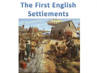
Locations of historical settlements First settlers Earliest settlers about 9,000 yrs ago were hunters, gatherers & fisherfolk…. Middle stone age Lived close to rivers & lakes… water supply.

E N D
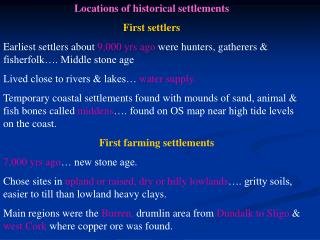
Locations of historical settlements First settlers Earliest settlers about 9,000 yrs ago were hunters, gatherers & fisherfolk…. Middle stone age Lived close to rivers & lakes… water supply. Temporary coastal settlements found with mounds of sand, animal & fish bones called middens…. found on OS map near high tide levels on the coast. First farming settlements 7,000 yrs ago… new stone age. Chose sites in upland or raised, dry or hilly lowlands…. gritty soils, easier to till than lowland heavy clays. Main regions were the Burren, drumlin area from Dundalk to Sligo & west Cork where copper ore was found.
Buried the dead in stone tombs called megaliths. Bronze age people around 4,000 yrs ago. Evidence of stone circles, cairns, cist graves, fulacht fiadh indicate their sites. Celtic Settlements Iron age.. 650BC to 250AD… Celts with a structured society of royals, druids, judges, freemen & farmers. Introduced iron working into Irl Lived throughout farming lowlands in a dispersed pattern. Divided the country into tuaths. Built ring forts, crannógs, hill forts & promonotory forts on cliffs on elevated sites. Names like rath, dun & cashel identify Celtic settlements.
Small monastic settlements Early missionaries chose scattered, isolated sites. Remains found include stone churches & bee-hive huts. Settlements near a lake or river for food & water. Map evidence shows ch in red or place names with “cill”
Historic development of towns Large early Christian settlements. Monasteries built at route centres E.g. Clonmacnoise, Co Offaly. on fertile plains & river valleys E.g. Kells. Centres of religion & education. Monastery, church & round towers were central to the settlement all enclosed by circular stone wall. Identified on OS map by “cill” & “manistir” E.g Kilkenny. Towns grew around these and other functions like trade & metal work developed. These became a focus for route ways, creating a radial pattern.
Viking settlements Built at defensive sites on river estuaries. Acted as trading bases, providing safe anchorage for longboats. Examples… Dundalk, Limerick, Waterford. Norman settlements Came in 1169… built castle for protection & took over best farmland Built motte & bailey on defensive sites like bridging points, elevated sites. E.g. Cahir castle. As functions grew towns dev. around the castles, with high defensive walls & gateways. Abbeys & friaries built outside town walls… monastic land called granges. Centres of education, accommodation, hospitals & alms. Towns dev. into market centres & milling & tanning ind. dev. here… towns thrived & survived. Found on OS map in red… motte, castle, friary, grange.
Planned plantation towns Built as part of plantations of Laois/Offaly, Munster & Ulster (1609) plantations. Purpose: defend settlers, create business by having a market, intro. Protestant faith. Have parallel or evenly wide streets with centrally placed protestant churches. Central diamond or square for markets & fairs & a market house. Later planned towns had wider streets (18th & 19thC) Birr & Durrow. Tall multi-storey buildings. Estate or demesne on edge of town surrounded by stone wall, for local landlord, with a manor.
Coastal Towns Defensive site controlling deep harbours. The meeting point of inland & coastal routeways….linear pattern Viking, Norman or plantation towns serving as ports & markets. Provided services & functions like milling, brewing, manufacturing & admin. centres. E.g. Limerick, Sligo, Galway. Canal Towns Rivers like the Barrow, Shannon & Liffey were deepened & widened & connected by canals in C18th & C19th. Allowed for movt. of goods & people & for trade to dev. Towns dev. along the canals such as Athy, Mullingar & Tullamore. Grain & timber was carried along the canals & mills flourished.
Railway towns Railways built in C19th… brought increased trade in goods + passengers - hotels & markets dev. E.g.. Thurles, Mallow, Athlone. Trains faster & cheaper than canals so new towns dev. & canal towns into decline. Trains safer, faster & easier than sitting in traffic jams. Seaside towns Dev. as railways were built. Join towns to nearby cities… E.g. Bray & Tramore. Hotels & services dev. to cater for tourists. Wealthy people built holiday homes in these towns.
Expansion of large towns & cities C18th & C19th dev. during Georgian period. Suburbs with wide streets, squares & parks. Four storey red brick terraced mansions…. Many now changed into flats & business premises. E.g.. Merrion Sq & Stephen’s Green, Dublin. New Towns Shannon….. Meet the needs of pop working in industrial estates & airport. Tallaght…. Cater for surge in pop of Dublin as an overspill town.