Download
1 / 26
260 likes | 516 Vues
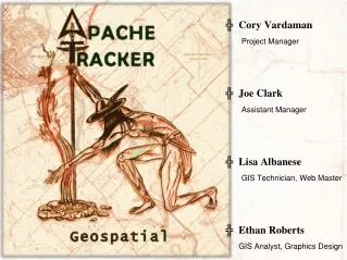
Cory Vardaman Project Manager Joe Clark Assistant Manager Lisa Albanese GIS Technician, Web Master Ethan Roberts GIS Analyst, Graphics Design. Warrant Visualization and Mapping : Improved Criminal Information Management Using GIS. Prepared for the New Braunfels Police Department in

E N D
Cory Vardaman Project Manager Joe Clark Assistant Manager Lisa Albanese GIS Technician, Web Master Ethan Roberts GIS Analyst, Graphics Design
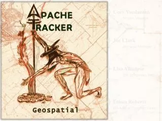
Warrant Visualization and Mapping:Improved Criminal Information Management Using GIS • Prepared for the New Braunfels Police Department in • response to the Request for Proposal
Summary • The Problem: Un-served warrants • Offenders “getting away with it” • Increased administrative backlog” • Uncollected revenue • The Answer: • GIS can manage and visualize information • Provides a useful tool to enhance law enforcement altogether
Purpose • What will Apache Tracker Geospatial do for the NBPD? • Design a tool to map active warrants • Graphically display warrants • Increase efficiency
Scope: New Braunfels ETJ • Why? …The ETJ is the only area NBPD can serve warrants
Methodology • Phase I: Data Preparation/ File Conversion • Phase II: Basic Warrant Tool Development • Phase III: Advanced Tool Construction • Phase IV: Tool Proofing and Refinement
Phase I: Data Preparation Municipal Court Multiple Warrant Data CRIMES Database
Phase I: Data Preparation / File Conversion • Task: Obtain and prepare warrant attributes for geocoding • How: Active Warrant File (AWC) Conversion • Goal: Create reference data Batching For ease of data conversion, a sample of active warrants and its attributes will be extracted from the CRIMES warrants database in a tabular spreadsheet .xls. This data will be used as reference data in the geocoding model.
Phase II: Basic Warrant Tool Development Task: Match warrant address field to geographic address. How: Geocode Reference Data + Address layers = Address Locator Address Locator Style Primary Layer – Point Address Data Secondary Layer – Street Data to catch unmatched addresses. Goal: Create warrant file (point file) address locator as a resource.
Phase III: Advanced Tool Construction Task: Geocoded warrant file implemented with additional map layers to create: File geodatabase Map document Reference map design How: The selected map layers and the geocoded warrant file will be inputted into a file geodatabase that can be employed into the NBPD server along with the reference ready map document. Goal: Complete tool
Phase IV: Tool Proofing and Refinement Tasks: Implementation, testing, troubleshooting Additional project considerations (optional) How: Test run with at Texas State. Test run at Police Department. Warrant model will be installed within the NBPD server through Mike Parma, GIS Coordinator for New Braunfels. He requests the geoprocessing tool output in geodatabase format configurable to their ESRI servers. Goal: Satisfactory results in testing and troubleshooting.
Additional Tools If time permits, the group has the option to work on additional tools: • Analysis Purposes • Dispatchers and Administrative support expressed interest in using the model for analysis purposes such as mapping hot spots or high density locations. Querying Hot Spot Management • Officers expressed interest in the ability to query warrant data to optimize their search based on criteria they feel is important. Mr. Parmer indicated web mapping applications, such as querying, is task he may have to build into the model in the future.
Implications Supporting the New Braunfels Police Department in effectively serving outstanding warrants by: • providing a tool that dispatchers will use to produce maps • providing officers a graphic visualization of outstanding warrants • offering other important updated data including… • the number of warrant(s) • fine amount • age of warrant(s) • and any other information contained in the CRIMES warrant records
February • Phase I: Data Preparation/Collection • .XML warrant file extraction and cleaning • CRIMES Dispatch system “batching” • Testing of converted files • Data collection 1 2 March Timeline • Phase II: Basic Warrant Development Tool • Address locator referencing (standardized address) • Warrant file geocoding • Additional refinement 3 4 5 6 April • Phase III: Advanced Tool Construction • Geocoded warrant file implementation • Creation of file geodatabaseand map document • Model streamlining • Reference map design 7 8 9 10 11 • Phase IV: Tool Proofing and Refinement • Model enhancement with data recycling • Warrant model installed and tested on NBPD server • Troubleshooting • Additional project considerations May
February • Phase I: Data Preparation/Collection • .XML warrant file extraction and cleaning • CRIMES Dispatch system “batching” • Testing of converted files • Data collection 1 2 March Timeline • Phase II: Basic Warrant Development Tool • Address locator referencing (standardized address) • Warrant file geocoding • Additional refinement 3 4 5 6 April • Phase III: Advanced Tool Construction • Geocoded warrant file implementation • Creation of file geodatabaseand map document • Model streamlining • Reference map design 7 8 9 10 11 • Phase IV: Tool Proofing and Refinement • Model enhancement with data recycling • Warrant model installed and tested on NBPD server • Troubleshooting • Additional project considerations May
February • Phase I: Data Preperation/Collection • .XML warrant file extraction and cleaning • CRIMES Dispatch system “batching” • Testing of converted files • Data collection 1 2 March Timeline • Phase II: Basic Warrant Development Tool • Address locator referencing (standardized address) • Warrant file geocoding • Additional refinement 3 4 5 6 April • Phase III: Advanced Tool Construction • Geocoded warrant file implementation • Creation of file geodatabaseand map document • Model streamlining • Reference map design 7 8 9 10 11 • Phase IV: Tool Proofing and Refinement • Model enhancement with data recycling • Warrant model installed and tested on NBPD server • Troubleshooting • Additional project considerations May
February • Phase I: Data Preperation/Collection • .XML warrant file extraction and cleaning • CRIMES Dispatch system “batching” • Testing of converted files • Data collection 1 2 March Timeline • Phase II: Basic Warrant Development Tool • Address locator referencing (standardized address) • Warrant file geocoding • Additional refinement 3 4 5 6 April • Phase III: Advanced Tool Construction • Geocoded warrant file implementation • Creation of file geodatabaseand map document • Model streamlining • Reference map design 7 8 9 10 11 • Phase IV: Tool Proofing and Refinement • Model enhancement with data recycling • Warrant model installed and tested on NBPD server • Troubleshooting • Additional project considerations May
February • Phase I: Data Preperation/Collection • .XML warrant file extraction and cleaning • CRIMES Dispatch system “batching” • Testing of converted files • Data collection 1 2 March Timeline • Phase II: Basic Warrant Development Tool • Address locator referencing (standardized address) • Warrant file geocoding • Additional refinement 3 4 5 6 April • Phase III: Advanced Tool Construction • Geocoded warrant file implementation • Creation of file geodatabaseand map document • Model streamlining • Reference map design 7 8 9 10 11 • Phase IV: Tool Proofing and Refinement • Model enhancement with data recycling • Warrant model installed and tested on NBPD server • Troubleshooting • Additional project considerations May
Final Deliverables Warrant Tool and Geodatabase* Final Report (Hard Copy) Display Poster Electronic Data Copy (CD Format) Additional Shapefiles Metadata Final Report Power Point Presentation Manuals Readme File Note: All electronic deliverables will undergo format compatibility
Conclusions • Will be a user friendly tool that can be easily updated • Assist with “in the field time management” • Enhance planning operations • Help provide a foundation for further GIS integration
Questions… • Point of Contact: Ethan Roberts…………..…ethanroberts@txstate.edu