Understanding Arizona's Floodplain Management: Insights and Challenges from the 2008 NFDA Meeting
200 likes | 307 Vues
This document summarizes the key discussions from the 2008 NFDA Annual Meeting regarding floodplain management in Arizona. It highlights the importance of the National Flood Insurance Program (NFIP) and the role of local communities in managing flood risk. With over 100 participating communities and nearly 100% participation in the NFIP, the application of floodplain management ordinances is crucial. The document also addresses challenges related to map modernization, public outreach, and the importance of informing residents about flood risks and insurance options.

Understanding Arizona's Floodplain Management: Insights and Challenges from the 2008 NFDA Meeting
E N D
Presentation Transcript
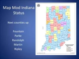
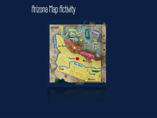
Map Mod in Arizona Maureen Towne, CFM NFDA Annual Meeting March 31, 2008
NFIP in AZ • Over 100 participating communities • Almost 100% participation • Application and Ordinance • Free
Floodplain Management in AZ • NFIP communities: • Floodplain Management Ordinance • Agree to regulate and enforce development in mapped floodplains • Mapped floodplains on the FIRMs
Effective Maps in Arizona • 2005: One county • 2006: Maps delayed • 2007: Five counties • 2008: Six counties • 2009: Three counties
Map Mod Challenges in AZ • Who • What • Where • Why • When
Public Outreach & New Maps • Community Officials • How to Notify Affected Residents? • Is My House In or Out? • How Can I Get Out? • How Much Will Insurance Cost Me? • Timing is Critical • Grandfathered Insurance • Public Meetings
Levees – Levees - Levees • FEMA’s definition • PM 34: levees must be certified • PM 43: Provisionally Accredited Levees • Highways, railroad and canal embankments
Typical Levee protected_area
Contact Information Maureen Towne, CFM AZ Map Mod Coordinator - ADWR (602) 771-8662 mctowne@azwater.gov Brian Cosson, CFM NFIP State Coordinator – ADWR (602) 771-8657 btcosson@azwater.gov