Download
1 / 16
160 likes | 178 Vues
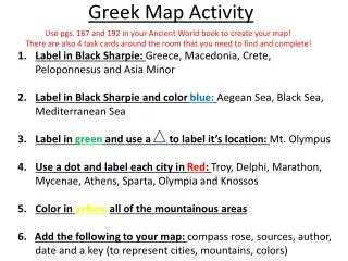
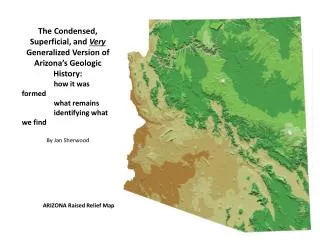
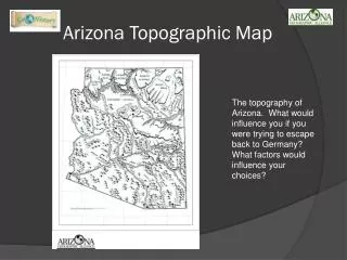
Follow along on your blank map to put 22 cities, rivers, lakes, and geographic features in and around the state of Arizona. Use the drawing tools to complete each step. Start here!

E N D
Follow along on your blank map to put 22 cities, rivers, lakes, and geographic features in and around the state…
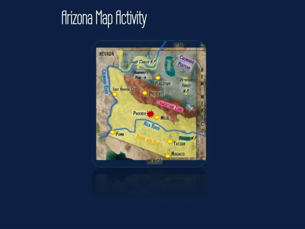
Start here! This will be the satellite image where you will work and the image you will share with Mrs. Watson. Use the drawing tools to complete each of the steps. Part of the steps have already been started to show you what it should look like. You will need to use the internet, an atlas, and your textbook to find the locations.
What Region?? Step 1: Shade in the state of Arizona, labeling and shading three distinct geographic regions with different colors. What Region ?? Desert Region
NEVADA Step 2: Draw in the borders and label all of the states and countries surrounding Arizona. Hint – there are 5 states and 1 country. NEW MEXICO
Step 3: Trace and label the Colorado River NEW MEXICO CALIFORNIA
NEVADA Step 4: Trace and label the Gila River Gila River
NEVADA Step 5: Outline Grand Canyon National Park and shade it in with the color of your choice and label. NEW MEXICO CALIFORNIA Gila River
NEVADA Step 6: Outline the Painted Forest and shade it in with the color of your choice and label. Grand Canyon N.P. NEW MEXICO Colorado River CALIFORNIA Gila River
NEVADA Step 7: Outline Petrified Forest National Park and shade it in with the color of your choice and label. Grand Canyon N.P. Painted Forest NEW MEXICO CALIFORNIA Colorado River Gila River
UTAH CO NEVADA Step 8: Outline Saguaro N.P. National Park and shade it in with the color of your choice and label. Grand Canyon N.P. Painted Forest NEW MEXICO Petrified Forest N.P. Colorado River CALIFORNIA Gila River MEXICO
UTAH CO NEVADA Step 9: Draw a triangle and label Humphrey’s Peak, the highest point in the state of Arizona. Bonus ** Label the elevation Grand Canyon N.P. Painted Forest NEW MEXICO Petrified Forest N.P. Colorado River CALIFORNIA Gila River Saguaro N.P. MEXICO
UTAH CO NEVADA Step 10: Draw stars and label a few cities in Northern Arizona Grand Canyon N.P. Painted Forest NEW MEXICO Humphrey’s Peak Petrified Forest N.P. Colorado River CALIFORNIA Gila River Saguaro N.P. MEXICO
UTAH CO NEVADA Step 11: Draw stars and label a few cities in Southern Arizona Grand Canyon N.P. Painted Forest NEW MEXICO Humphrey’s Peak Petrified Forest N.P. Flagstaff CALIFORNIA Lake Havasu City Prescott Colorado River Gila River Saguaro N.P. MEXICO
UTAH CO NEVADA Step 12: Draw a larger star and label Phoenix, the capital city of Arizona Draw a smiley face and label Wittmann, Arizona Grand Canyon N.P. Painted Forest NEW MEXICO Humphrey’s Peak Petrified Forest N.P. Flagstaff CALIFORNIA Lake Havasu City Prescott Colorado River Gila River Saguaro N.P. MEXICO
Are you finished? Review your map to make sure you have completed all steps. Share it electronically with a classmate for review and feedback. When you are satisfied with your finished project, email the completed map to Mrs. Watson and Mrs. Walker. mwatson@nadaburgsd.org fwakler@nadaburgsd.org