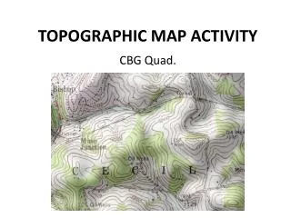
Topographic Map Activity
Topographic Map Activity. Typo Lake Charles Hendrickson. Topographic Maps . Topographic maps are maps that provide extensive close up detail about a place. You can learn a lot from topographic maps, you just need to know how to understand them. Topographic Maps cont.

Topographic Map Activity
E N D
Presentation Transcript
Topographic Map Activity Typo Lake Charles Hendrickson
Topographic Maps • Topographic maps are maps that provide extensive close up detail about a place. • You can learn a lot from topographic maps, you just need to know how to understand them.
Topographic Maps cont. • Inside each topographic map there are Townships. • Each Township is a 6 mile square.
Townships • Each Township is divided into sections. • Sections are 1 mile squares. • Therefore there are 36 sections in a Township. • There are 640 acres in a section
Sections • Each section was then broke up and sold in different size lots. • This is one section that has been divided up. • The NW1/4,Sw1/4, is a legal description and means that this particular piece of land is in the North west quarter of the south west quarter of the section.
Uses • Topographic maps have many uses, such as; • Hiking • Orienteering • Architecture • Mining • And many other activities where it is beneficial to know the lay of the land.
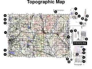
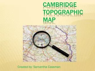
The Typo Lake quadrangle Typo Lake is in the very South East corner of Isanti county. It is called a quadrangle because there are four townships that meet inside the parameters of the map.
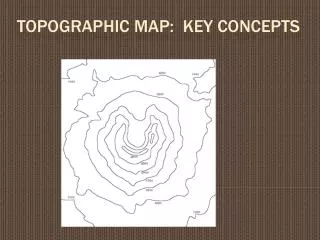
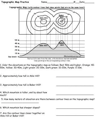
Some Terms • Contour line- lines that connect equal points of elevation above sea level. • Contour interval- the amount of change in elevation between each contour line. • Interpolation- guessing between two known points to find an unknown point. • Scale- the ratio of the number of units between the map and the real world.
Contour lines • Can never cross • “V” points uphill at a stream or valley • “V” points downhill at a ridge.
Contour lines cont. • Circles that get smaller represent hills. • Circles with little hash marks pointing inward represent a depression.
Contour lines cont. • Lines closer together mean that the land is steep. • Lines that are farther apart mean that the land is flatter.
Symbols • Swamps/Wetlands • Lake • Woodland • River
Lakes • The public access would be right here, because it is a unimproved road that goes right up to the lake and stops.
Roads and Related Features • Secondary Highway • Light duty road • Intersection
Roads cont. • Unspecified light duty road • Unimproved road
Railroads • Standard guage, single track (you can usually tell if it is a railroad because it is as strait as an arrow)
Land surveys • Township and Range line • Township and Range labels
Aviation • Unpaved landing strip • Airport taxi or apron
Church • Church • Cemetery
References • http://egsc.usgs.gov/isb/pubs/booklets/symbols/topomapsymbols.pdf • http://www.google.com/imghp?hl=en&tab=wi • http://www.geo-site.net/physical/Isanti_County_Topographic_Maps.html