Updating topographic map G100V
190 likes | 423 Vues
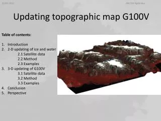
Updating topographic map G100V. Table of contents: Introduction 2-D updating of ice and water 2.1 Satellite data 2.2 Method 2.3 Examples 3-D updating of G100V 3.1 Satellite data 3.2 Method 3.3 Examples Conclusion Perspective. 1. Introduction. Project title:

Updating topographic map G100V
E N D
Presentation Transcript
INUTEK Nytårskur Updating topographic map G100V • Table of contents: • Introduction • 2-D updating of ice and water • 2.1 Satellite data • 2.2 Method • 2.3 Examples • 3-D updating of G100V • 3.1 Satellite data • 3.2 Method • 3.3 Examples • Conclusion • Perspective
INUTEK Nytårskur 1. Introduction Project title: Development of capacity and methods for a test production of new accurate and adequate G100V maps in Greenland Project funded by: Dancea (Danish Cooperation for Environment in the Arctic) The aim of the project: A test production of new topographic vector maps in scale 1:100.000 based on raw vectors from aerial photos produced by KMS (Danish Cadastre) in the period 1978-1987 Update of the ice margin and proglacial lakes by remote sensing due to the changes in glacier size . Cooperation: Asiaq, KMS, DTU Space, GRAS A/S DK
INUTEK Nytårskur 1. Introduction Project Area ca. 13’000 km² 2 different glacier types Ice shield with calving glaciers, relatively smooth topology Ice caps with valley glaciers in alpine terrain (Nuussuaq Halvø)
INUTEK Nytårskur 2. 2-D updating of ice and water 2.1 Satellite data: LANDSAT 7 Benefits: Free of charge, fine resolution (30m), full coverage of project area, 16-days Earth coverage cycle (end of March – beginning of October) Optimal images: At the end of melting season, before new snow falls, free of lake ice and clouds 12-08-2009 11-07-2009
INUTEK Nytårskur 2. 2-D updating of ice and water 2.2 Method: Decision Tree classification All image pixels are classified by the use of an automatic workflow called “Decision Tree” Input data: Tasseled Cap Brightness index Tasseled Cap Wetness index NDVI LANDSAT DN Band 4 LANDSAT DN Band 5 LANDSAT Temp Band 6 SPIRIT DEM (ASTER GDEM) SPIRIT slope (ASTER slope) Algorithms inspired by GLIMS (Global Land Ice Measurements from Space) www.glims.org
INUTEK Nytårskur 2. 2-D updating of ice and water 2.2 Method: Decision Tree classification Post classification Vectorizing GIS analysis Verification analysis Manual correction Attribute creation Data fusion 3-D updating ice water sea land bare soil
INUTEK Nytårskur 2. 2-D updating of ice and water 2.2 Examples: Map detail of Nuussuaq Halvø Mapping lakes: 2 km buffer around the ice ca. 600 m retreat KMS glacier 1985 Light blue: glacier 2009 Dark blue: lakes 2009 ca. 20 km
INUTEK Nytårskur 2. 2-D updating of ice and water 2.2 Examples: Map detail of JakobshavnBræ 20 km 1–2 km KMS glacier 1985 Light blue: glacier 2009 Dark blue: lakes 2009
INUTEK Nytårskur 3. 3-D updating of G100V 3.1 Satellite data: SPIRIT DEM (SPOT 5 HRS sensor) 2 telescopes, pointing 20° toward the rear, respectively 20° toward the front relative to nadir Images with a swath of 120 km along a segment up to 600 km are acquired within 180 seconds Spatial resolution: 10m (5m along track) Acquisition mode: panchromatic (0.48 µm – 0.71 µm) Vertical accuracy: 90% < 10m on surface slopes < 20% Absolute location: RMS < 30m
INUTEK Nytårskur 3. 3-D updating of G100V 3.1 Satellite data: ERS-2: synthetical aperture radar (SAR) Data delivered from DTU Space, DK InSAR (Interferomtric Aperture Radar) Radar uses electromagnetic radiation with microwave frequencies meaning observations are not prevented by cloud cover or day light. InSAR uses two or more SAR images to generate digital elevation, using differences in the phase of the waves returning to the satellite
INUTEK Nytårskur 3. 3-D updating of G100V 3.1 Satellite data: ERS-2 synthetic aperture radar (SAR) 24 images between March 12th – June 28th 2011 Images cover the SE part of the project area Spatial resolution: 60m Vertical accuracy: < 21m Results: large errors due to poor interferometric coherence on steep slopes and in areas with high glacier velocity The predicted height measurement error standard deviation shows discontinuities Data not suitable for this project
INUTEK Nytårskur 3. 3-D updating of G100V 3.2 Method: New contour generation within updated glacier outline, including a 2 km buffer zone
INUTEK Nytårskur 3. 3-D updating of G100V 3.2 Method: • Updating within a 50 X 50 Km index using FME (Feature Manipulating Engine) • Clipping and merging DEMs • Raster to vector (points) transformation • Breaklines: coastline, rivers, river beds, • calving glacier front • Additional point data within KMS • DEM: Spot heights • Contour generation • Smoothing • Attributes
INUTEK Nytårskur 3. 3-D updating of G100V 3.3 Examples: SPIRIT KMS ca. 5 km
INUTEK Nytårskur 3. 3-D updating of G100V 1325 m 1300 m 1150 m 1125 m 2009 1985 15 Km 15 Km Map detail: N of Saqqaq, Nuussuaq Peninsula
INUTEK Nytårskur 4. Conclusion 2-D updating of ice and water: • Landsat 7 data are suitable to classify glacier and lakes for topographic maps 1:100.000. • Minimum area: 0.001 km2 • Optimal image properties achieves after snow melt season, before new snow falls, without • lake ice, and without clouds; i.e. mid-August in project area. • A semi-automatic classification method was developed and tested successfully. Main • challenges remain in areas with heavily debris-covered ice, on steep northern flanks due • to cast shadow, and on ice covered lakes. Those areas require manual interference, and • classification is time- consuming.
INUTEK Nytårskur 5. Conclusion 3-D updating of G100V • 3-D updating of G100V requires a high resolution, coherent DEM, with an explicit • acquisition date. • SAR data are not suitable to extract height information in area with rough terrain, or in • areas with high glacier velocity. Both is the case in the project area. • SPIRIT data proved to be successful for extracting contour lines with equidistance of 25m • and 100m. The result is very satisfying, but the data are expensive. • Challenges remain in areas with high glacier velocity, especially in case of using two • independent satellite sensors to update topographic maps, as it is the case in this • project.
INUTEK Nytårskur 5. Perspective • During this Dancea Project, an appropriate method has been developed to update G100V maps in Greenland by remote sensing. • Adding place names • Upgrading outwash plain/ bare soil (“Sandområder”) • To benefit of adequate and updated maps, this project should expend over the entire coastal • area of Greenland. Continue work will require further foundation to co-finance DEM data, as • well as working time. • Continue cooperation with KMS, DTU Space, Gras A/S
INUTEK Nytårskur Thankyou