
Uploaded by
mannix-rogers
2 SLIDES
112 VUES
20LIKES
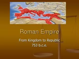
Identifying Roman Empire Locations Activity
DESCRIPTION
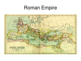
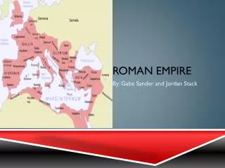
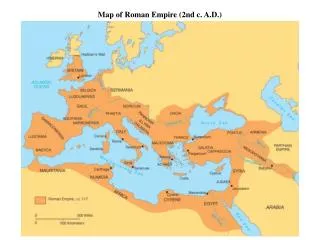
Engage students in understanding the Roman Empire by mapping key locations like Rome, Britain, Spain, and Carthage. Follow Mr. Hawthorne's guidance from the 'Western Civilization' textbook (pp. 156 & 165) to recognize historical sites such as Hadrian's Wall in Britain, Gaul in France, Greece, Syria, Palestine, and Sicily. This interactive and informative activity will deepen students' knowledge of the Roman Empire's vast reach and its impact on various regions.
Download
1 / 2
Télécharger la présentation 
Identifying Roman Empire Locations Activity
An Image/Link below is provided (as is) to download presentation
Download Policy: Content on the Website is provided to you AS IS for your information and personal use and may not be sold / licensed / shared on other websites without getting consent from its author.
Content is provided to you AS IS for your information and personal use only.
Download presentation by click this link.
While downloading, if for some reason you are not able to download a presentation, the publisher may have deleted the file from their server.
During download, if you can't get a presentation, the file might be deleted by the publisher.
E N D
Presentation Transcript
Roman Empire Map Activity Mr. Hawthorne Western Civilization
Identify the Following Locations (Using pp. 156 &165): • Rome • Britain • Hadrian’s Wall • Gaul • Spain • Greece • Syria • Palestine • Carthage • Sicily


More Related
Audio
Live Player