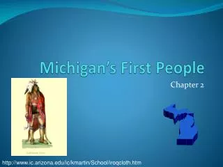
Michigan’s First People
160 likes | 286 Vues
Discover the rich history of Michigan's first peoples, including the Paleo-Indians who migrated over 11,000 years ago and the Anishinabeg tribes such as the Ojibwa, Ottawa, and Potawatomi, known as the Three Fires Confederacy. Learn about their lives, cultures, and how geography influenced their migration and settlement patterns. The chapter highlights the Huron Indians and Iroquois, exploring their relationships and conflicts, as well as burial practices and artifacts left behind. Dive into the world of ancient Native American tribes in Michigan.

Michigan’s First People
E N D
Presentation Transcript
Michigan’s First People Chapter 2 http://www.ic.arizona.edu/ic/kmartin/School/iroqcloth.htm
Early Native Americans • Paleo-Indians (old/early Indians) • Hunters from Asia-crossing a land bridge • 11,000 years ago after the glaciers • Archaeologists
Early Native Americans • Hopewell Indians • Came from what is now Indiana & Ohio • 2,000 years ago • What is left today: Norton Mounds near Grand Rapids • Mound Builders: bury their dead A burial mound at Norton Mounds, near Grand Rapids Source: http://www.michigan.gov/hal/0,1607,7-160-17449_18638_20846-54607--,00.html
The Anishinabeg Indians • Migrated from Atlantic Coast to Michigan about 1,000 years ago to what is now Sault Ste. Marie Sault St. Marie Pembroke School http://www.michigan-map.org/detailed.htm
The Anishinabeg Indians • 3 groups: • Ojibwa(or Chippewa) – “older brother” • Ottawa – “middle brother” • Potawatomi – “younger brother” • Known as the Three Fires Confederacy (family) • This is Chief Pontiac, the most famous Ottawa chief. Did you know that Pontiac, Michigan, and Pontiac cars are named after him? Hmmm … what’s in his hand? http://www.ohiohistorycentral.org/entry.php?rec=1857
Moodle Reflection • Look at a relief map from NASA, based on photos taken from space! • Relief maps show high and low areas of land • Blue areas = water • Green areas = low areas of land • Yellow areas = higher land areas • So … the more yellow the area, the higher up the land is (like mountains) • The greener the area, the lower it is.
Moodle Reflection • Compare the map on the next slide with the map in your book on page 51. • Explain where the Anishinabeg Indians came from and why they settled in different areas of Michigan. • Think about what they needed from their environment to survive. • How did geography affect their path?
Pembroke School Photo from NASA’s Jet Propulsion Lab: http://photojournal.jpl.nasa.gov/catalog/PIA03377
The Huron Indians • Huron: Named by French traders • Wendat: (people of the peninsula) • Lots of things in Michiganare named after the Hurons: • Huron Street in Ann Arbor • Huron River in Ann Arbor • One of our Great Lakes is Lake Huron • The Eastern Michigan University teams used to be called the Hurons Dolls from the Huron Tribe Image: http://www.learner.org/amerpass/unit01/authors-8.html
Iroquois beadwork. From http://www.bigorrin.org/iroquois_kids.htm The Iroquois Indians • Iroquois: New York • Forced the Huron to southeastern Michigan • Bitter enemies with the Huron Indians • Spoke same language and were related • They fought over land in the Upper Peninsula • Arrived about 350 years ago
Vocabulary Words • artifacts: objects made or used by people in the past • culture: similar art, beliefs, & customs of people • migrate: move from one place to another • Confederacy: a group united for a common purpose • wigwam: dome-shaped homes of bark and trees • bands: small groups of people • clans: groups of families with common ancestors • stockade: high fences • longhouses: large houses 25 x 200 feet long • kinship: family relationships
Group Work • Big Question: How did the first Michigan People adapt to their environment? Think about: • Clothing, food, shelter, natural resources, climate, weather, & travel. • Create a project about your Indian group. • Use any technology that you have learned so far. • Photo Story • Create a wiki page • Power Point • Inspiration • Audacity
Project Requirements • Keep the big question in mind as you work. • You need to research your tribe online. • Read from the Michigan book to get information. • Take notes in your own words to include all the information about: clothes, food, natural resources, weather, climate, travel, & shelter. • Include vocabulary words from the list that are appropriate to your tribe. • You may include other interesting facts you find. • Work together as a team.
Online Resources • http://www.native-languages.org/kids.htm • http://www.bigorrin.org/chippewa_kids.htm Ojibwa • http://www.bigorrin.org/ottawa_kids.htm Ottawa • http://www.bigorrin.org/potawatomi_kids.htm Potawatomi • http://www.bigorrin.org/wyandot_kids.htm Huron • http://www.bigorrin.org/iroquois_kids.htmIroquois • http://www.nativetech.org/clothing/regions/regions.html Clothing of Native Americans • http://www.nativetech.org/clothing/index.html clothes etc. • http://www.ipl.org/div/natam/ The Internet Public Library • http://nativeamericans.mrdonn.org/northeast/iroquois.html • http://nativeamericans.mrdonn.org/northeast/ojibwa/index.html • http://www.cdc.noaa.gov/USclimate/ Climate • http://www.ic.arizona.edu/ic/kmartin/School/index.htmIroquois
Free Online Clipart for Project • http://www.phillipmartin.info/clipart/homepage.htm free clipart • http://www.pppst.com/clipart.html free clipart
Compare & Contrast Tribes • Complete the compare and contrast chart while you listen to other groups present their information. • You will need to write small to fit details into the chart. If you miss details, you will find them on the wiki. • Please type your final copy after the presentations. You can go to the wiki to help you complete the chart. Tribes.doc