Download
1 / 27
270 likes | 283 Vues
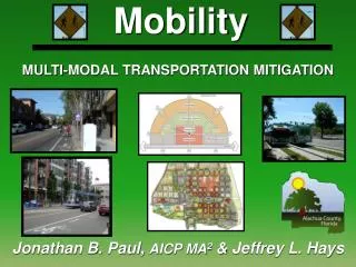
Transit Oriented Development in the city region; a dream?. Reindert Augustijn Team manager traffic and transport Stadsregio Arnhem Nijmegen. City region. From: Nota Ruimte - Ministry of Housing and Spatial Planning, 2004. TOD at what level?

E N D
Transit Oriented Developmentin the city region;a dream? Reindert Augustijn Team manager traffic and transport Stadsregio Arnhem Nijmegen
City region From: Nota Ruimte - Ministry of Housing and Spatial Planning, 2004
TOD at what level? What should be the size of a TOD region?
the City Region Arnhem Nijmegen • 20 municipalities • 720.000 inhabitants • 2 large cities (Nijmegen 160.000 and Arnhem 145.000) • 18 smaller towns and villages (from 8.000 to 45.000 inhabitants) • 1.000 square km surface • within the province: Urban Network with specific problems & challenges
the City Region 1950 the City Region 2010 From: Hybrid Landscapes - Must, 2004
Objectives of regional cooperation • TRAFFIC AND TRANSPORT • provision od public transport (legal task),infrastructure, trafficmanagement • HOUSING • coordination in quantities and differentiation in price and quality • ECONOMICS • coordination industrial & office sites, regional branding, labour market • SPATIAL PLANNING • coordination of the Regional Plan (not a legal task)
Facts and figures • Inhabitants 720.000 • Cars 320.000 • Bicycle >720.000 • Modal split public transport about 18% (trips) 20% (km’s) • Modal spit bicycles about 30% (trips) 5% (km’s) • About 100.000 train trips daily • Railwaystations 20 (2 intercity stations) • 115.000 bus trips daily • Busstops 1.750 (85 with DPIS) • Bushours 800.000 yearly • Revenues bus about € 38,5 million • Subsidy bus about € 33,5 million
formal cooperation (institutions) • regional board: with 6 political members from different city/town boards and a chairman • regional council: from every city/town one or more city council members • regional council: decisions by majority • meetings of aldermen on specific topics: frequently • regional civil service (40) working daily with local civil service
Integrated approach on spatial and transport planning Integration between: spatial/urban development; • 2010-2020 26.000 new dwellings (appartments and houses) • focus on Vinexlocations (new residential areas) in central area of region • usage of industrial areas and office sites • developments around (public) transport nodes (no specific TOD policy but development around ‘the S (rail) line’) transport sollutions; • tarmac agenda • cycle highways • traffic and mobility management • development public transport infrastructure • public transport concessions
Transport and traffic planning approach: 1. integrated spatial and transport planning; 2. pricing (chipcard and fees); 3. mobility management (behaviour); 4. improvement of public transport and cycling paths; 5. (dynamic) traffic management; 6. improvement of infrastructure; 7. construction of infrastructure.
Too much ambition? What kind of TOD is suitable? Is TOD possible when there is a surplus of office sites? Is TOD possible when the impact on property value is difficult to measure? Is there enough space to develop in built-up areas?
Public transport tender 2013 • One of the largest concessions in Holland • € 1,0 billion • Duration 10 years • Three modalities (bus, bus+ and train) • Development of transport nodes • Coordination with housing • Coordination with industrial sites • Development of infrastructure • Agreements with municipalities (PPA’s) • Interaction with other companies and knowledge centres
Openbaar vervoer 2013-2022 • Breng Direct • Breng Buurt OV concessie
The dream of an integrated concession died..1. Financial crisis and other/not familiar business cases 2. Risks considerd to be too large3. Too much ambitionlong live the dream........1. More vision on development of Public Transport nodes2. Working on public-public agreements (but still weak)3. Public available PT/SD model
Transport nodes! Accessibility and spatial development at public transport nodes
Public-Public Agreement • Municipality: Development of housing industrial area and local infrastructure • City region: Development of railway station and train and bus services and P+R and parking for bikes • Together looking for solutions (network/consensus approach instead of top down approach like ABC principles) • Possibilities not yet utilised Node Zevenaar Oost
Lessons learned • Be careful with raising expection • But give space to dreams, ambitions and innovative ideas in the early stage of the process • Check technical and financial possibilities and impact on other processes with the relevant authorities • Scope at the right time and arrange delivery management with clear responsibilities • Work with reliable govenance structures and feasable finance models • Involve knowledge institutes in all phases
Challenges • Get more understanding on financial and development possibilities of region, state en private parties • Divide risks on basis of knowledge of each others business cases • Create shortage of office sites and housing areas and enough development space around transport nodes • Synchronise and integrate spatial and transport planning cycles • Adjust governance and finance models for further integration of transport and spatial planning