Download
1 / 17
200 likes | 363 Vues
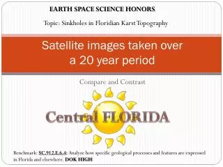
EARTH SPACE SCIENCE HONORS. Topic: Sinkholes in Floridian Karst Topography. Satellite images taken over a 20 year period. Compare and Contrast. Central FLORIDA.

E N D
EARTH SPACE SCIENCE HONORS Topic: Sinkholes in Floridian Karst Topography Satellite images taken over a 20 year period Compare and Contrast Central FLORIDA Benchmark: SC.912.E.6.4: Analyze how specific geological processes and features are expressed in Florida and elsewhere. DOK HIGH
Learning Goal: We will learn to Analyze satellite imagery of the greater Orlando, Florida area. • LEVEL 4 = I can…. • Analyze satellite imagery of the Orlando, Florida area. Predict the future appearance of the land over time. • I can also do levels 3-2. • LEVEL 3 = I can…. • Compare and contrast satellite image taken over a 20 year period. I can also do level 2. • LEVEL 2 = I can…. • Determine the cause and effect of water’s impact on Karst topography. • LEVEL 1 = I can…. • With some assistance/help, I can do some of level 2, otherwise, I am confused and need more time. • LEVEL 0 = I am totally lost and confused. I really need help.
Background • Karst topography is described as being any kind of landscape typified by porous sedimentary rockthat is easily dissolved awayresulting in unique land features, such as caves and sinkholes. • There are many examples of Karst topography around the continental United States, but perhaps the most striking example would be that of Florida. The state of Florida sits upon layers and layers of soft limestone and sand. Florida also has very little topographical relief when compared to the other 49 states.
Background • Because Florida juts out into the Atlantic to the east and the Gulf of Mexico to the west there are lots of low-lying areas that allow for the aquifer(which is less dense than the salt water underneath) to be at the surface or directly below the topsoil. This water, slightly acidic, will dissolve the limestone bedrockinto a complex network of caverns. • When a void is formed through the dissolution of the rock, the water left behind can exert enough pressure on the overhanging rock to keep it in place.
Background • However, if the aquifer lowers, as in the case of drought or over-harvesting of water, the pressure supporting the cavern ceiling drops and air takes its place. • This air-filled void cannot always support the tons of rock overhead. If the surface rock is overburdened with cars, buildings, pavement, or pools of water, the integrity of the rock may fail, resulting in a collapse of the cavern ceiling. A deep and usually circular hole is the result often swallowing or severely damaging the buildings built above them. This is called a sinkhole.
Background • Over time, if left to nature, these sinkholes will fill with water to form yet another of the thousands of circular lakes scattered throughout the Karst topography landscape. • Sinkholes can often be detected prior to their eventual collapse. In a building, for instance, if one notices cracks forming along the foundation or doors or windows suddenly close improperly, a sinkhole may be to blame. • A survey crew can use sophisticated instruments, such as sonar, to map the bedrock lying directly underneath the structure. If a sinkhole is indeed discovered, support struts may be able to anchor the building directly to the bedrock surrounding the void. Also, cement is often pumped in underneath the structure to fill the void and allow the building a firm and rigid surface on which to stand.
A. Orlando, FL 1973 (Circled: Disney’s Magic Kingdom) Prepared Photos
B. Orlando, FL 1986 (Circled: Disney’s Magic Kingdom and Epcot. Notice the lake that was previously absent) Prepared Photos
C. Orlando, FL 1992 (Circled: Disney’s Magic Kingdom, Epcot, and MGM Studios) Prepared Photos
D. Orlando, FL 2000 (Circled: Disney’s Magic Kingdom, Epcot, MGM Studios, and Animal Kingdom) Prepared Photos
Learning Goal: We will learn to Analyze satellite imagery of the greater Orlando, Florida area. • LEVEL 4 = I can…. • Analyze satellite imagery of the Orlando, Florida area. Predict the future appearance of the land over time. • I can also do levels 3-2. • LEVEL 3 = I can…. • Compare and contrast satellite image taken over a 20 year period. I can also do level 2. • LEVEL 2 = I can…. • Determine the cause and effect of water’s impact on Karst topography. • LEVEL 1 = I can…. • With some assistance/help, I can do some of level 2, otherwise, I am confused and need more time. • LEVEL 0 = I am totally lost and confused. I really need help.
A. Orlando, FL 1973 Enhanced Photos
B. Orlando, FL 1986 Enhanced Photos
C. Orlando, FL 1992 Enhanced Photos
D. Orlando, FL 2000 Enhanced Photos
Learning Goal: We will learn to Analyze satellite imagery of the greater Orlando, Florida area. • LEVEL 4 = I can…. • Analyze satellite imagery of the Orlando, Florida area. Predict the future appearance of the land over time. • I can also do levels 3-2. • LEVEL 3 = I can…. • Compare and contrast satellite image taken over a 20 year period. I can also do level 2. • LEVEL 2 = I can…. • Determine the cause and effect of water’s impact on Karst topography. • LEVEL 1 = I can…. • With some assistance/help, I can do some of level 2, otherwise, I am confused and need more time. • LEVEL 0 = I am totally lost and confused. I really need help.