Dr. David Liu
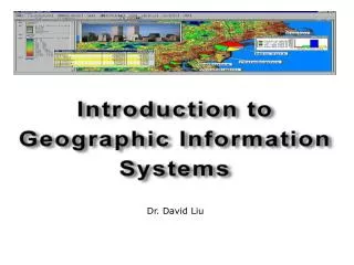
Dr. David Liu. Objectives. Understand what a GIS is Understand how a GIS functions Spatial data representation GIS application. What is an Information System?. In the digital environment we use software to create complex information systems. Database. Management. What is a GIS?.


Dr. David Liu
E N D
Presentation Transcript
Objectives • Understand what a GIS is • Understand how a GIS functions • Spatial data representation • GIS application
What is an Information System? In the digital environment we use software to create complex information systems. Database Management
What is a GIS? Information System • A means of storing, • retrieving, sorting, • and comparing • spatial data • to support some • analytic process. + Geographic Position
What is a GIS? GEOGRAPHIC Information System GIS links graphical features (entities) to tabular data (attributes)
GIS Definition • A GIS is a system (hardware + database engine) that is designed to efficiently, assemble, store, update, analyze, manipulate, and display geographically referenced information (data identified by their locations). • A GIS also includes the people operating the system and the data that go into the system.
Key Components of GIS Spatial Data Modeling Spatial Analysis & Spatial modeling Visualization Spatial Data & Attribute Data Database Management System
Spatial Data Modeling • RASTER • VECTOR • Real World
Representing Spatial Elements Raster Stores images as rows and columns of numbers with a Digital Value/Number (DN) for each cell. Units are usually represented as square grid cells that are uniform in size. Data is classified as “continuous” (such as in an image), or “thematic” (where each cell denotes a feature type. Numerous data formats (TIFF, GIF, ERDAS.img etc)
Representing Spatial Elements Vector Allows user to specify specific spatial locations and assumes that geographic space is continuous, not broken up into discrete grid squares We store features as sets of X,Y coordinate pairs.
Entity Representations We typically represent objects in space as three distinct spatial elements: Points - simplest element Lines (arcs) - set of connected points Polygons - set of connected lines We use these three spatial elements to represent real world features and attach locational information to them.
Attributes • In the raster data model, the cell value (Digital Number) is the attribute. Examples: brightness, landcover code, SST, etc. • For vector data, attribute records are linked to point, line & polygon features. Can store multiple attributes per feature. Vector features are linked to attributes by a unique feature number.
3 A-4 22061 Linking Spatial Entity with Attributes 1 (Universe polygon) Spatial data 2 3 3 (ARC functions) 4 5 COV# ZONE ZIP 1 0 2 C-19 22060 Attribute data 3 A-4 22061 4 C-22 22060 (INFO or TABLES functions) 5 A-5 22057
Raster vs. Vector Raster Advantages The most common data format Easy to perform mathematical and overlay operations Satellite information is easily incorporated Better represents “continuous”- type data Vector Advantages Accurate positional information that is best for storing discrete thematic features (e.g., roads, shorelines, sea-bed features. Compact data storage requirements Can associate unlimited numbers of attributes with specific features
Spatial Analysis/Modeling Spatial Operation • Buffering • Overlay Spatial Statistics Spatial Data Mining
Proximity Analysis Buffer: Delineation of a zone around the feature of interest within a given distance. For a point feature, it is simply a circle with its radius equal to the buffer distance.
Buffer Example • Rural district in N.E. Thailand • 51 study villages: • evaluate land use in the district relative to population change • Need to determine types & quantities of land use surrounding each village: • generate 3-km buffers around village centroids • overlay buffers on land-cover classification generated from satellite imagery • use buffers to “cut out” land near each village and summarize land uses within “cut out” area
Variable Distance Buffer Buffer zone can be made variable according to certain attributes. Suppose we have a point pollution source, such as a power plant. We certainly want to keep our residential area away a distance from it. However, this distance can be made variable according to the amount of pollution that a power plant produces. For small power plant, the distance can be short, while for large power plant that generate a lot of pollutant, we should keep a longer distance from it. As we is shown on the right.
Buffers for lines and Polygons Move circle of specified radius along lie (or lines forming polygon) Draw orthogonal from line to edge of circle Buffer line is tangent to circle where the orthogonal intersects it.
Lines and Polygons Buffer Example Buffer lines Buffer polygons
Spatial Analysis • Overlay function creates new “layers” to solve spatial problems
Spatial Operation with Multiple Vector Layers • Overlay analyses • Operate on spatial entities from two or more maps to determine spatial overlap, combination,containment, intersection…etc. • one of the most “fundamental” of GIS operations • formalized in 1960s by landscape architects who used acetate map overlays • now a basic part of the GIS toolbox • Vector overlays- • combine point, line, and polygon features • computationally complex • Raster overlays- • cell-by-cell comparison, combination, or operation • computationally less demanding
Spatial Operation with Multiple Vector Layers • Basic idea: • spatially combine/compare two data layers to: • (a) generate new output data layer, or • (b) assign attributes of one data layer to another • most cases: one of the data layers will contain polygon entities • Point-in-polygon overlay • increasing conceptual and computational complexity
Point-in-polygon vector overlay • Overlay point layer (A) with polygon layer (B) • in which B polygon are A points spatially located? • » assign polygon attributes from B to points in A A B Example: comparing soil mineral content at sample borehole locations (points) with landuse (polys)...
Line-in-polygon vector overlay • Overlay line layer (A) with polygon layer (B) • in which B polygons are A lines spatially located? • » assign polygon attributes from B to lines in A Example: assign landuse attributes (polys) to streams (lines)... A B
Polygon-polygon vector overlay • Overlay polygon layer (A) with polygon layer (B) • result: what are the spatial polygon combinations of A and B? • » generate new data layer with combined polygons • attributes from both polygon layers are included in output • How are polygons combined? • (i.e. what geometric rules are used for combination?) • UNION (Boolean OR) • INTERSECTION (Boolean AND) • IDENTITY • Polygon overlay will generally result in a significant increase in the number of spatial entities in the output • can result in output that is too complex too interpret
A A B B Boolean Operations Some of the fundamental overlay analysis for vector data are UNION, and INTERSECT corresponding to Boolean operations of OR, AND A B UNION OR A B INTERSECT AND
Polygon-polygon vector overlay (cont’d.) UNION overlay polygons and keep areas from both layers INTERSECTION overlay polygons and keep only areas in the input layer that fall within the intersection layer IDENTITY overlay polygons and keep areas from input layer
GIS software • ESRI products: ArcGIS, Arc/Info … • MapInfo • AutoDesk products: AutoCAD ------------------------------------- • Clark University: IDRISI • GRASS
Summary Spatial Data Modeling Spatial Analysis & Spatial modeling Visualization Spatial Data & Attribute Data Database Management System