Download
1 / 24
240 likes | 440 Vues
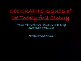
GEOGRAPHIC ISSUES of the Twenty-first Century. TWO THEORIES: Continental Drift and Plate Tectonics EARTHQUAKES. PANGEA About 300 million years ago the moving landmasses came together to form the SUPERCONTINENT of PANGEA (all land).

E N D
GEOGRAPHIC ISSUES of the Twenty-first Century • TWO THEORIES: Continental Drift and Plate Tectonics • EARTHQUAKES
PANGEAAbout 300 million years ago the moving landmasses came together to form the SUPERCONTINENT of PANGEA (all land). • How did the continents move from PANGEA to the places in which we know them today?
CONTINENTAL DRIFT&PLATE TECTONICS • Continental Drift Theory • Wegener c. 1915 • Theory stated that the continents drifted along the surface of the earth, • But had no real explanation of the FORCE that made the drift possible • Created the theory of PANGEA Visit page in the text page 83 (Figure 9-3) and find 4 points of evidence that Wegener used to defend his C.D. theory.
CONTINENTAL DRIFT&PLATE TECTONICS • Plate Tectonics • Built upon the C.D. Theory • Posed by Canadian scientist: J.Tuzo Wilson • Convection (heat driven) currents of inner earth fluid, (like slow-moving plastic in a lava lamp) provide: • Something on which the continents move & • The energy force needed to drive this process – (the force pushes the continents along)
The surface of the earth is always changing • The earth's crust is made up of "plates" (like pieces of a jigsaw puzzle – about 20 globally) • PLATES are usually made up of both a CONTINENT and an OCEAN • They are constantly moving relative to one another at speed's of about 2-10 cm/year (about how fast your fingernails grow). • The plates can either slide past one another, or they can collide, or they can diverge (or move apart). On average, how far apart would the plates move over the course of a millennium? (cm and metres)
Impact at Home… • The movement of the Earth’s crust has shaped Canada (& other places) in many ways: • Mountain chains on the east and west coast • Fossil fuels – oil, gas & coal were formed when Canada’s landmass was located in a warmer, tropical area
WHEN THEY DO… EARTHQUAKES!
Queen Charlotte Islands • Each year, seismologists record, and locate more than 1000 earthquakes in western Canada. • The Pacific Coast is the most earthquake-prone region of Canada. • In the offshore region (to the west of Vancouver Island), more than 100 earthquakes of magnitude 5 or greater have occurred during the past 70 years. The Queen Charlotte Islands Earthquake of August 22, 1949 Magnitude 8.1
Cascadia Subduction Zone • The zone is from West of Vancouver Island, from the north tip of the Island to northern California • The oceanic Juan de Fuca plate is moving towards North America at about 2-5 cm/year. • This region is called the Cascadia subduction zone. • Here, the much smaller Juan de Fuca plate is sliding (subducting) beneath the continent (it is about 45 km beneath Victoria, and about 70 km beneath Vancouver). • The ocean plate is not always moving though. Victoria Lion’s Gate Bridge Vancouver Vancouver
There is good evidence that the Juan de Fuca and North America plates are currently locked together • This is causing strain to build up in the earth's crust. • This squeezing of the crust causes the 300 or so small earthquakes each year in southwestern B.C. • It is also causing the less-frequent (once per decade, on average), damaging crustal earthquakes - with magnitude 7.3 or greater
At some time in the future, these plates will snap loose, generating a huge offshore "subduction" earthquake • This quake will be similar to the 1964 M=9.2 Alaska earthquake c. 1964 • Evidence also indicates that huge subduction earthquakes have struck this coast every 300-800 years. Photos from the Alaska Earthquake (c. 1964)
The Impact of Physical Geography on Humankind
Mount St. Helens BEFORE AFTER
Connections: Name 5 movies where the theme includes the idea “Geography has Great Impact on Humankind.”