Download
1 / 38
420 likes | 802 Vues
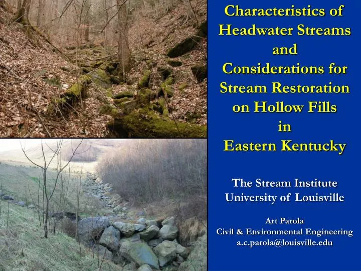
Characteristics of Headwater Streams and Considerations for Stream Restoration on Hollow Fills in Eastern Kentucky. The Stream Institute University of Louisville Art Parola Civil & Environmental Engineering a.c.parola@louisville.edu. Sponsors and Acknowledgement.

E N D
Characteristics of Headwater Streams and Considerations for Stream Restoration on Hollow Fills in Eastern Kentucky The Stream Institute University of Louisville Art Parola Civil & Environmental Engineering a.c.parola@louisville.edu
Sponsors and Acknowledgement • EPA 319 and Kentucky Division of Water • Regional Stream Assessment of Headwater Streams • Margi Jones – 319 Project Manager • EPA 401 Wetlands Grant and Kentucky Division of Water • Evaluation of Stream Restorations • John Dovak and Jennifer Garland, supervisors, Water Quality Certification Section, Kentucky Division of Water • Assistance also provided by Kentucky Department for Natural Resources • Jennifer Thompson and Mark Carew
AcknowledgementULSI Staff • Jeffery Jack, Ph.D. – Associate Professor, Biology Department, University of Louisville • Michael Croasdaile, Ph.D. - Research Associate • William S. Vesely, Research Project Engineer • Ben Mater – Graduate Student • Chandra Hansen – Technical Research Writer • Dana S K Jackman, M.S. - Program Coordinator
Headwater Streams and Hollow-Fill Study Sites Greenbo Lake SRP Martin County Laurel Frk. of Wolf Br. Yatesville WMA Pike County Mudlick Br. of Pond Cr. Narrows Br. of Pond Cr. Murphy Frk. of Narrows Br. Mudlick Br. of Blackberry Frk. UT of Narrows Br. Paintsville WMA Robinson Forest WMA Owsley County Rone Frk. Br. UT of Spivey Cr. Fishtrap Lake WMA Harlan County Arches Br. of Big Laurel Cr. Nick Br. of Big Laurel Cr. Letcher County Elkhorn Cr headwaters Little Elkhorn Cr Harlan County Sally Huff Br. of Cloverlick Cr. Bee Br. of Cloverlick Cr. Trace Frk. of Cloverlick Cr. Right Frk. of Cloverlick Cr. Lilley Cornett Woods
Some Characteristics of Headwater Streams in Eastern Kentucky • Headwater Valley and Stream Morphology • Extent of channel network • Channel head locations • Bed forms (boulder swales, step pools, plane bed, etc.) • Channel and valley evolution – landslide driven landscape • Headwater Valley Hydrology • Intermittent-ephemeral transition zones • Valley groundwater system • Structural features and land-use
Flow may rearrange colluvial material into bedforms (step-pools)
Susceptible to landslides Debris flow Numerous old landslides Landslide potential mapOuterbridge 1982
Landslides Channel has incised into hillslope at contact with landslide scar
HF 11 HF 5 Sediment Pond HF 10
Multiple fill types • Valley fills • Hollow fills and head-of-hollow fills • Side hill fills • Bench fills Characterized by • elevation in the hollow • location • geometric configuration • durability of rock
Side drains (Groin ditches) Terraces Underdrains
HF 11 HF 5 Sediment Pond HF 10
Mud Lick Headcuts may migrate around check dams
Landslides are part of the landscape and should be considered in channel design
Some Considerations for Design of Stream Restoration at Hollow Fills • Final constructed geometry of fill may change substantially from the initial permitted design • Fill is composed of porous material, affecting groundwater and surface water interaction and the location of the ephemeral/intermittent transition zone • Adjacent hillslope processes such as landslides will continue resulting in slope failure debris in channels and potential displacement of channels • Differential settlement of fill would cause somewhat unpredictable changes in channel slope in locations other than along fill sides • Downstream channel instability may propagate into fill channels or restored pond reaches
Kentucky DNRBetter pond restoration plans and improved channel design on fills • Directive 34: 01/17/01 Inspection Procedures for MSHA Impoundments • Directive 36: 08/07/02 Excess spoil fill, contemporaneous reclamation, backfilling & grading: Inspection/Enforcement procedures http://www.minepermits.ky.gov/statutesregs/RAMs.htm Reclamation Advisory Memorandums • RAM 138 08/15/05 KPDES Permits for Coal Mining Activities: New Antidegradation Requirements • RAM 137 04/14/04 New Regulations for Noncoal Minerals • RAM 136 11/21/03 KPDES Coal General Permit Reissued • RAM 135 09/10/02 Review of Durable Rock Fill Designs • RAM 134 10/25/01 Clarification of Permitting Procedures for Streams Between Fills and Ponds